October 7 and 8.
The photos will look better if you go to the blog by clicking on the blue title.
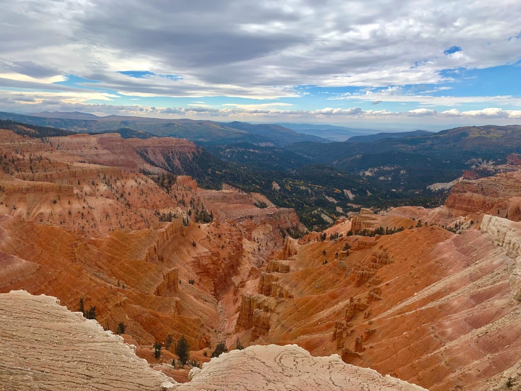
The first photos of Cedar Breaks National Monument are a continuation of October 7 day on Route 14 and then Route 148 to see several viewpoints of Cedar Breaks. This is a lesser known area and near the more well known Bryce Canyon. Cedar Breaks is at an elevation of over 11,000 feet and is the last visible out crop of the Colorado Plateau. The Colorado Plateau starts on the south at the Mogollon Rim in mid Arizona and includes the Grand Canyon, Arches, Canyonlands, Capital Reef, Grand Staircase Escalante, Bryce, Zion, and Cedar Breaks – actually 9 National Parks and 18 National Monuments. The rocks are mostly sandstone (with a lot of red from iron oxides -rust) with some volcanic rocks mixed in and aged 2 billion years old in the depths of the Grand Canyon to 700 million years old to 50-60 million years old in the upper layers. The sandstone was laid down in vast seas which covered the area.


PCC open October
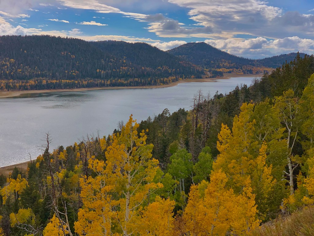
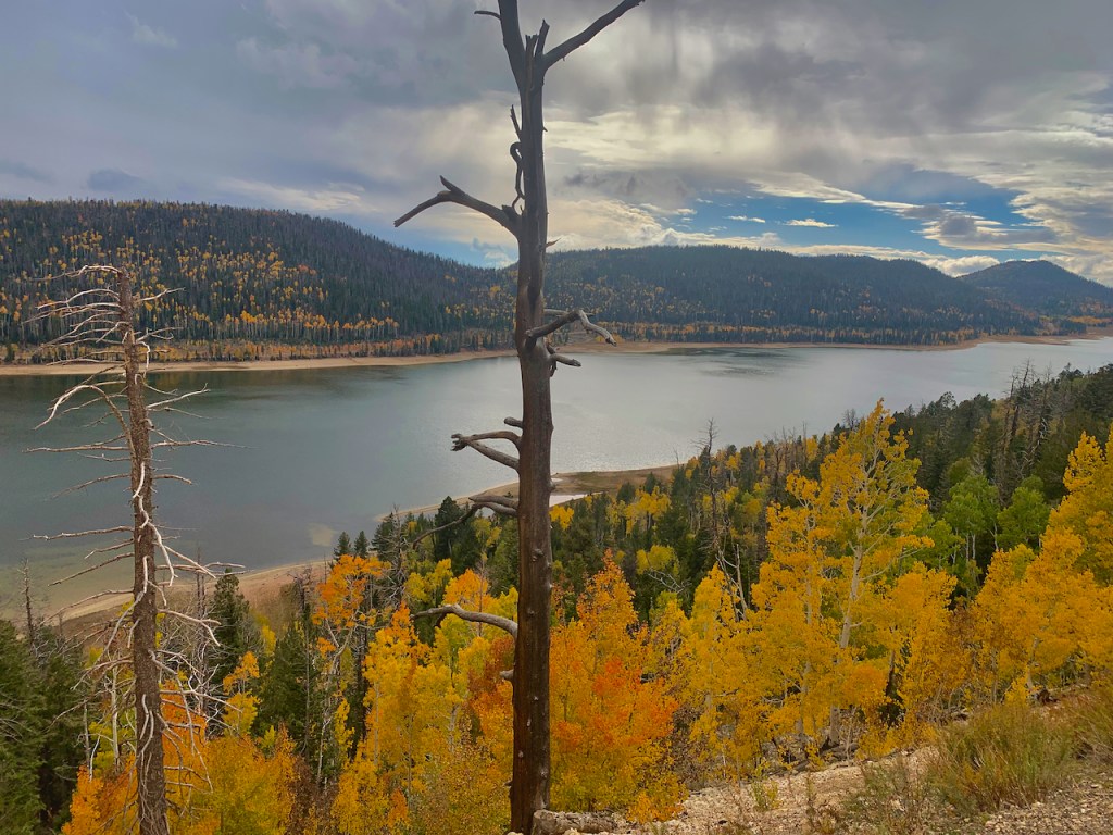
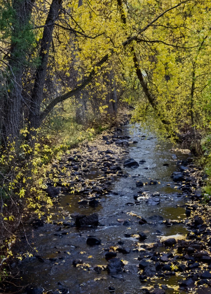
On the down slope of Rout 14 we came to Navajo Lake, a volcanic lake – first three photos and then a pond with good reflections.
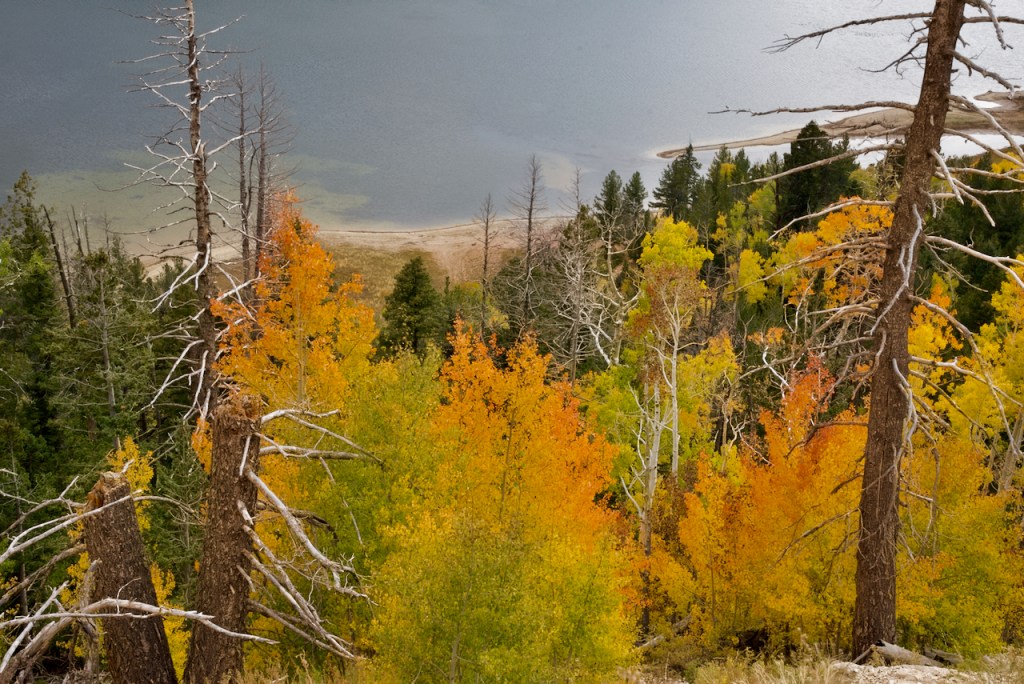


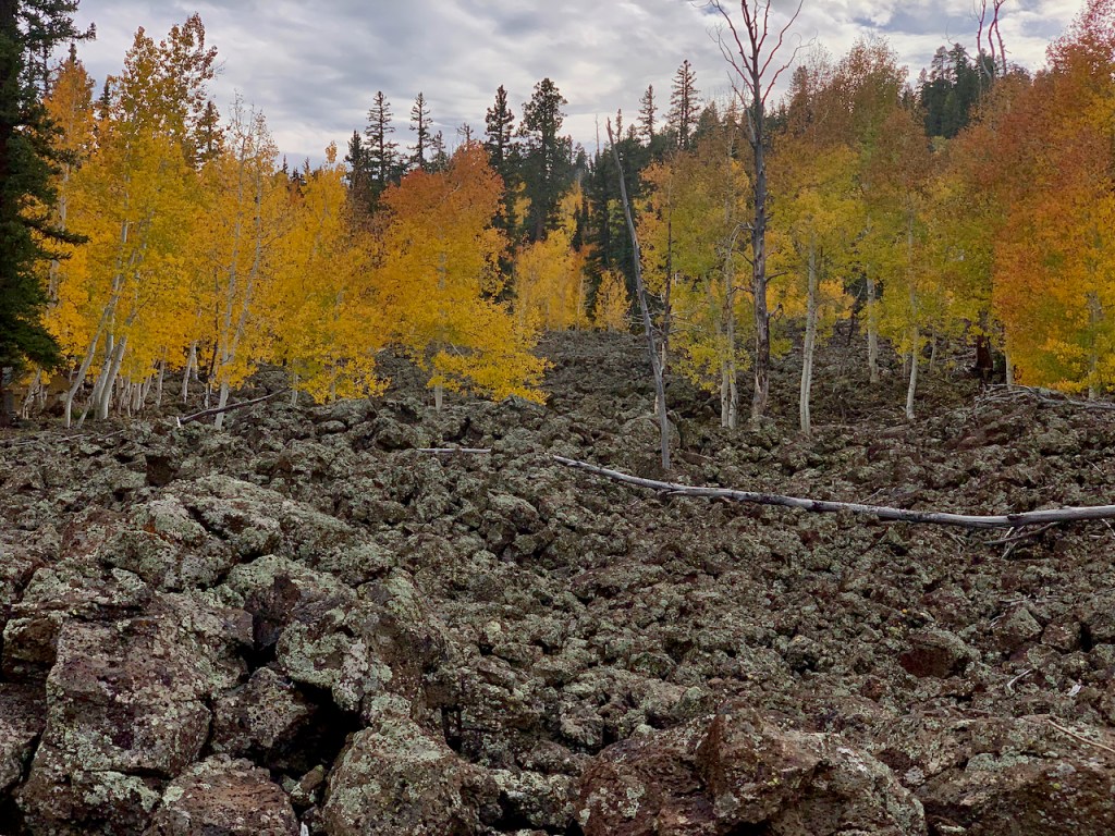
In this same area there were numerous places where the aspens were growing out of an ancient lava field. And finally a sunset at Panguitch RV park.


Oct. 8: This morning was cloudy with rain forecast all day, but the search for fall color must go on anyway. This time we headed back up to Cedar Breaks on Route 143. We drove all the way around Panguitch Lake and did not find much color, but a lot of fog


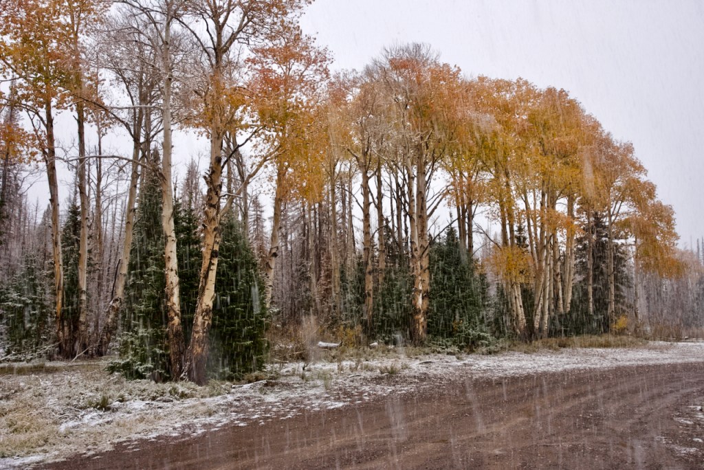
As we continued climbing the mountain, all of a sudden the the raindrops on the windshield turned to big and blotchy snowflakes. By this time we are at 10,000 feet or higher. So guess what, we were in the middle of a snowstorm with snow eventually 3-4 inches deep. In the second shot, I used a slow shutter speed to try to show the streaks of the snowflakes. We even saw a deer family with a couple of bucks in the snowstorm. This is as close to a white Christmas that we’ll get this year.


As we crested the mountain and started heading down at Brian Head Ski Resort the snow was already tapering off. I was surprised to see a 13% grade down the mountain toward I-15 and wonder how the ski people climb the road in the winter. I stopped for one shot of the aspens making a comeback in a burnout area.


After lunch we headed north a short ways on I-15 to Beaver. We started up Route 153 toward the Beaver ski area still with rain. In some ways the rain and wetness on the leaves gives some rich vibrant colors, but I have to keep checking the lens for raindrops as this will spoil photos.


The above are “teaser” shots of the color to come as we continue up the Beaver canyon. Please goto the blog to see the rest of the photos.
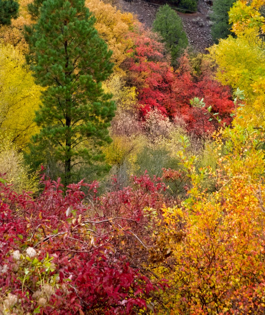
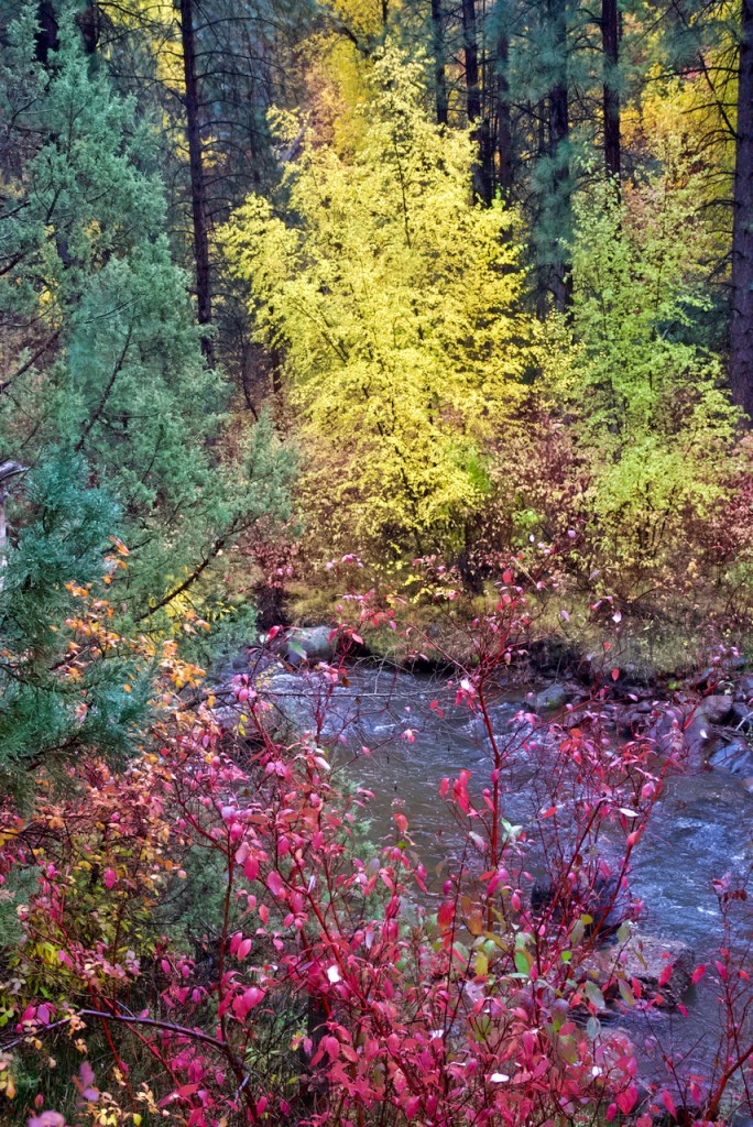
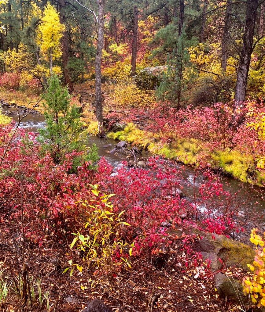
I was able to stop quite a bit in pull outs so that I could get some nice photos along the creek in the canyon. I don’t know the name of the shrubs, but they are brilliant red in contrast to the yellow aspens and other bushes.


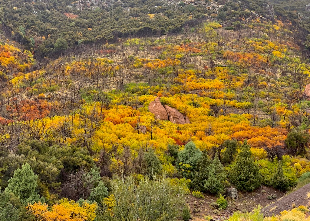
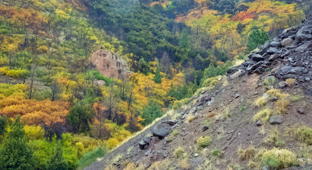
Finally I stopped at an overlook with a good view of a spectacular mountain side. After this area, the tree were mostly conifers and we turned around to head back to the RV park.


Gorgeous went to east Aurora monday. A lot of yellow lea ves!
Beautiful Pictures, we enjoyed seeing them.
Charles: You blew me away with your beautiful, interesting pictures. Your narration, as usual, was quite informative and greatly appreciated. The reflections pictures were spectacular. Jerry and I have been to Zion and Bryce. I would love to see some of the parks in the vicinity…maybe next year.
WOW, an array of seasons and their individual colors schemes. God’s beauty is breathtaking. I remember the individual beauty of each canyon. Such vivid colors.