May 9-19 The photos will show better if you go to the blog using the blue link in the email.
The last days of the trip were spent in Moab and Monument Valley. Since we had been to both places multiple times previously, I picked a couple places to visit that would not be too crowded. For the first time this year you need a “timed” entry permit to go into Arches National Park and still there are long lines to get in. So this was immediately crossed off the list.
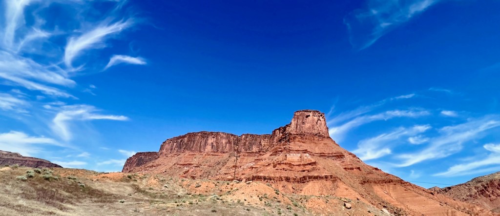
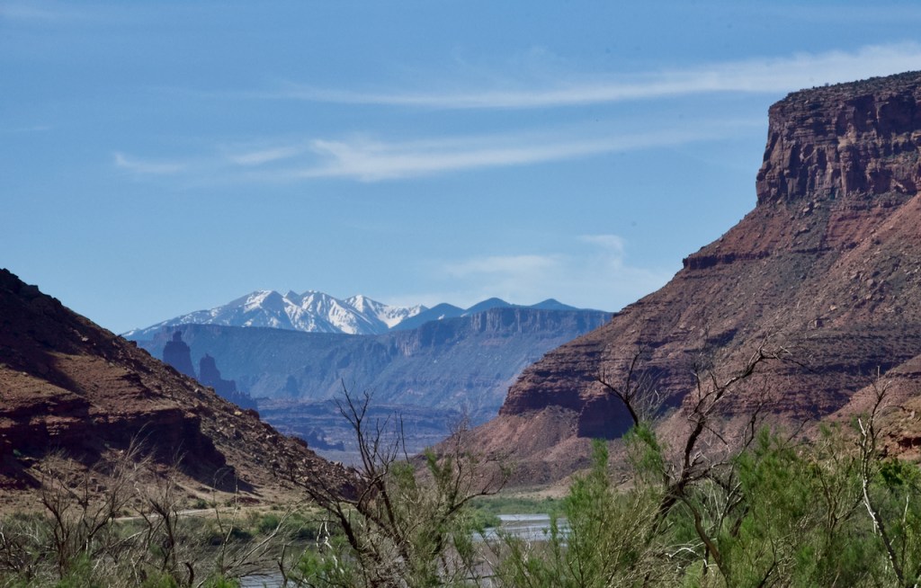
From Green River Utah, we went a little out of the way to take the Colorado River Scenic Byway (Rt 128) into Moab, which I had not been on previously. Most of the route had cliffs and red sandstone along the canyon to the river.


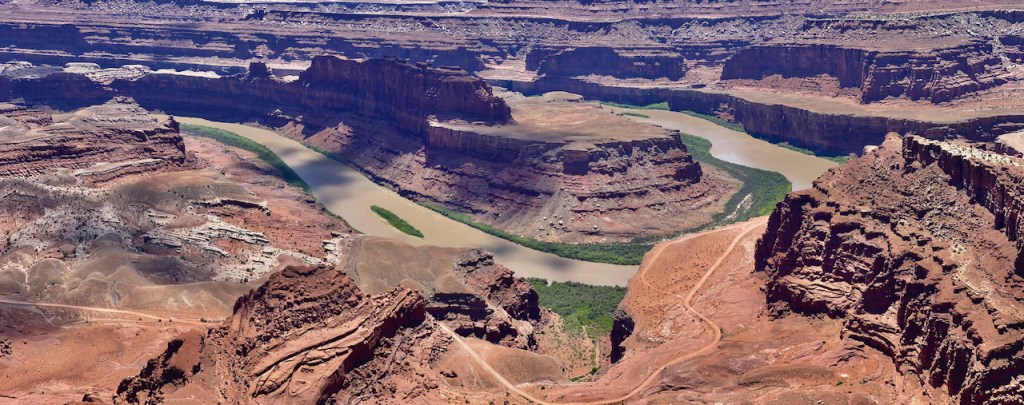
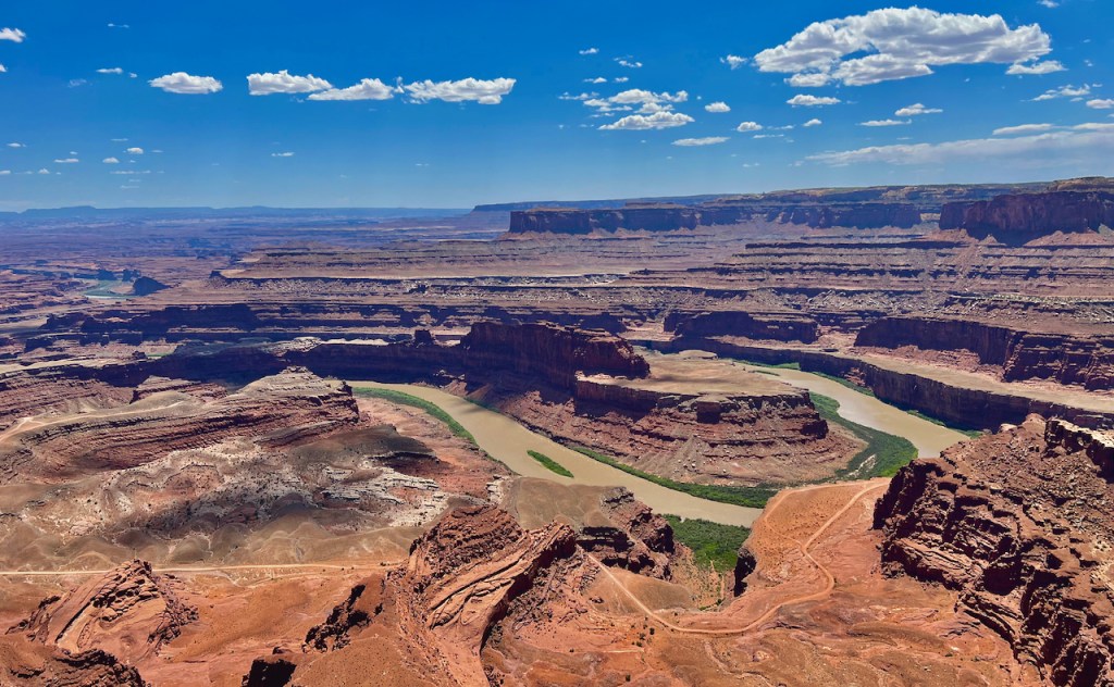
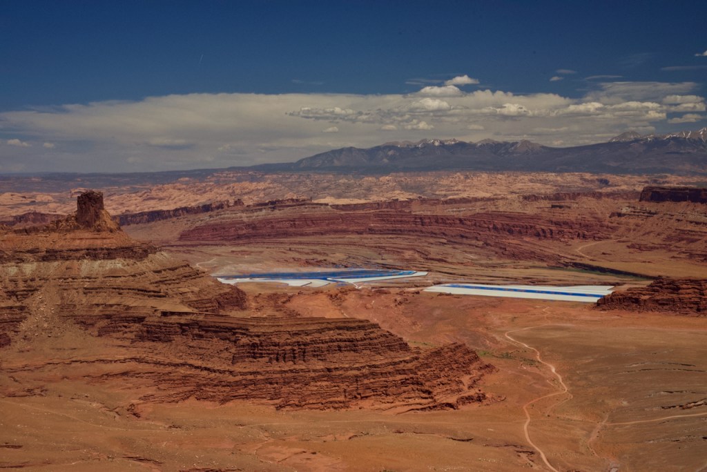
We stopped for lunch in Moab. This town has really grown since the last time we were here maybe 10 years ago. We traveled to Dead Horse Point State Park which has nice view point of bend in the river.
“The Legend of Dead Horse Point
Dead Horse Point is a peninsula of rock atop sheer sandstone cliffs. The peninsula is connected to the mesa by a narrow strip of land called the neck. There are many stories about how this high promontory of land received its name.
According to one legend, around the turn of the century, the point was used as a corral for wild mustangs roaming the mesa top. Cowboys rounded up these horses, herded them across the narrow neck of land and onto the point. The neck, which is only 30-yards-wide, was then fenced off with branches and brush. This created a natural corral surrounded by precipitous cliffs straight down on all sides, affording no escape. Cowboys then chose the horses they wanted and let the culls or broomtails go free. One time, for some unknown reason, horses were left corralled on the waterless point where they died of thirst within view of the Colorado River, 2,000 feet below.”
Do you see the ribbon of road below the cliff’s? This is part of the Shaffer Trail on which we drove 4-Wheel vehicles in a prior visit to this area.


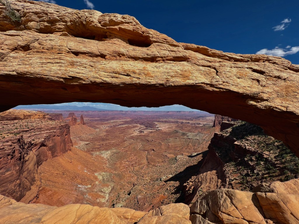
Next we reversed course and entered Canyonlands National Park. I hiked to Mesa Arch (hike was longer than I remembered it from years ago). The first photo is not mine, but is what about 50-100 photographers line up for early every morning to try to capture. Again, the site is famous and overrun by too many people, but you can see why they want this shot. The lighting is everything and you can see that my photos at mid afternoon are not that great in comparison, but I had a gap in people visiting and had it all to myself.


On the way south from Moab is Skyline Arch and worth one shot in my time frame.

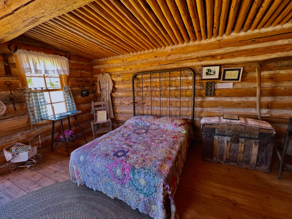
While heading south, I discovered a new pioneer museum in Bluff, UT. This is at the site of the Mormon Fort at the Bluff. There are replica cabins dedicated to the original families of settlers.
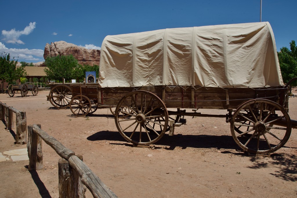
HOLE-IN-THE-ROCK TRAIL
“In 1879-80, Mormon pioneers built a wagon road between established communities in southwestern Utah and the Four Corners area. They were fulfilling an assignment from their church, The Church of Jesus Christ of Latter-day Saints, to establish a settlement in the area. Their journey turned into an ordeal of unparalleled difficulty as they blazed a route across some of the most broken and rugged terrain in North America.”
This route crosses the Grand Staircase Escalante National Monument and is still only accessible by 4-Wheel drive vehicles only.

As we continued south, I wanted to revisit Gooseneck State Park. Last time I had a cloudy day and thought the photos were pretty bland. I had a nice sunny day with clouds this time, but the photos were not much better as the rocks are just not that colorful. I did see some rafters far below in the San Juan River.

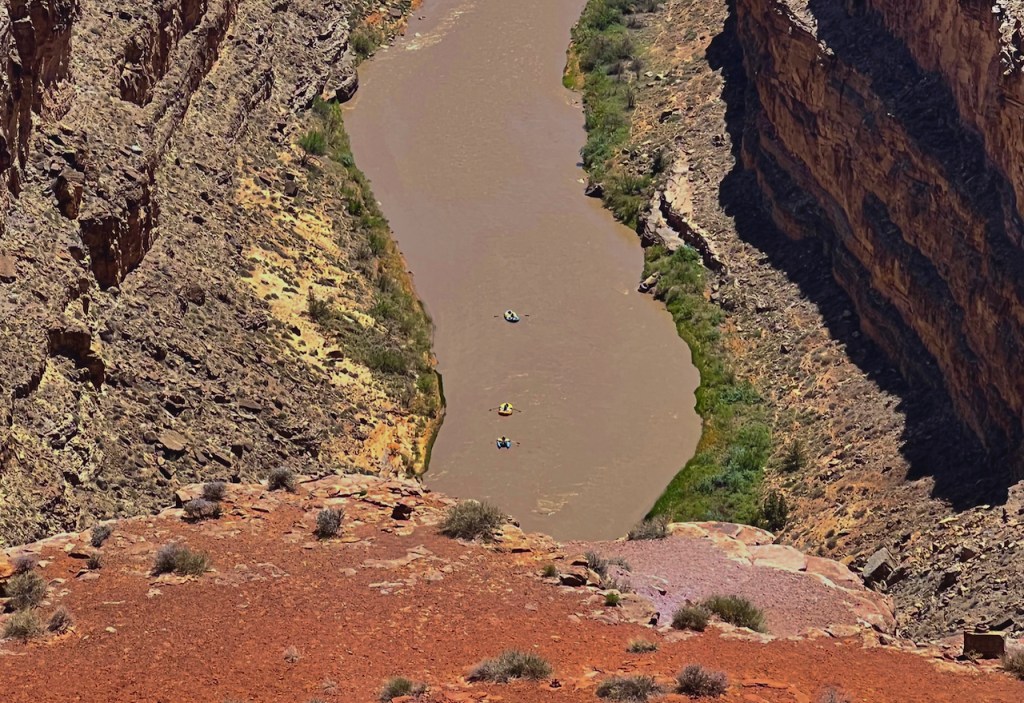

Near the town of Mexican Hat, UT this rock formation is just a little bit north of town and gives it the name.


Finally, we got to Monument Valley on the Utah/Arizona border. Again we have been here quite a few times before and was only worthy of a late afternoon view. There is a 17 mile gravel loop road that we have been on several times, which is not suitable for the RV van. Many tourists take truck tours offered by the Navajos. So I took the most iconic photos from the visitor center. You can see the left and right Mittens and the Sugar Bowl. We wanted to eat dinner there but it was open only to guests of the View Hotel. We ate at Gouldings across the street and near the RV park.


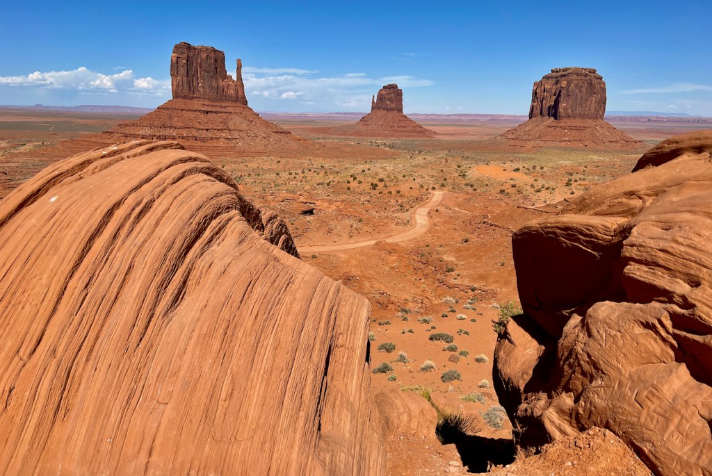


Love the blue skies with hint of clouds in the first three shots. I really like also the fourth from the last shot with the great depth of field. But you REALLY GOT me on number 30 (three with blossoms). GREAT depth of field, blue skies, bright flowers. To my eyes, a perfect composition. I really enjoy your photography.
These pictures are so wonderful and brought back many fond memories. We went to a good many of these places about four or five years ago. That year was super duper due to monsoon weather and we got some great shots with the clouds in them. When we visited Canyonlands, it was early in the day with hardly any people around. Jerry was unable to do any climbing and was using his four-wheeled walker so I found that I didn’t feel safe hiking down some of the trails since I would be alone. There was no cell phone reception there at the time. : ( Thank you always for your interesting narratives of the history behind all of your travels. It is so much appreciated.
Love to see the pictiures and your discretionsof them. Looking forward to your
Jouney.