June 4, 2021 Day 2
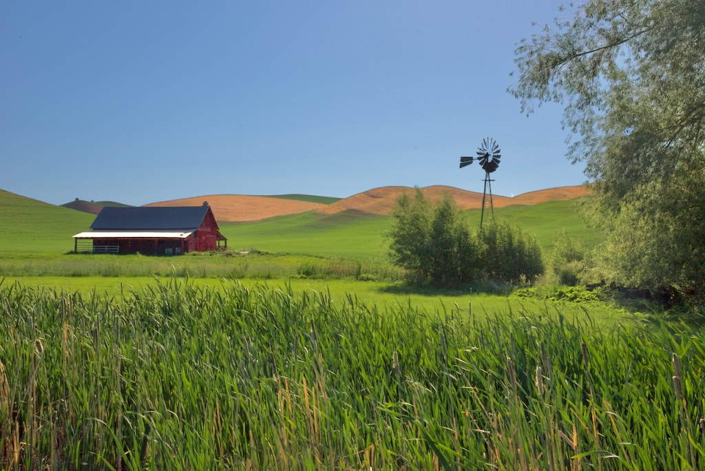
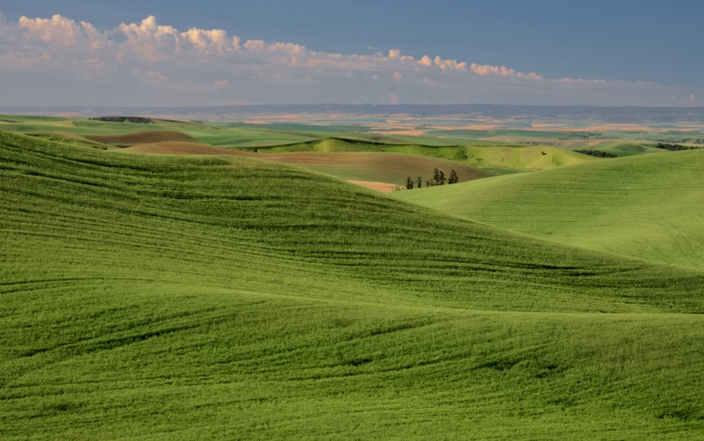
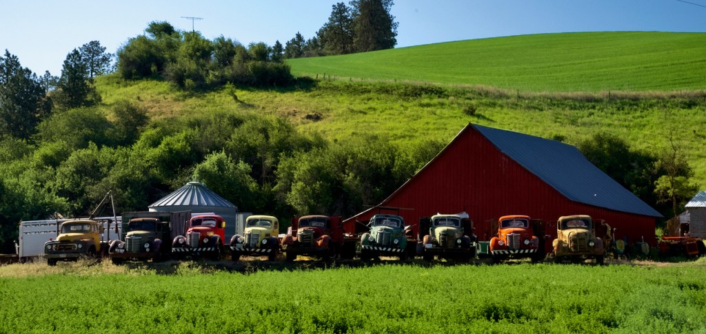
We stayed at a KOA on the Snake River at Almota. It was quite a steep drive on Route 194 in and out of the Snake River Canyon. This morning I continued north on Almota Road toward Diamond and Endicott. First up is a nice red barn with a windmill nearby. From a higher view point you can see the extent of the wheat fields in the rolling hillsides. The last photo is of a row of trucks on one farm. The woman farmer said I should get off the road and park in her farm yard, but be careful not to trample the alfalfa in front of the trucks. In the end I did not do that as I had already taken quite a few shots of the trucks and I was parked off the road and was walking on the edge.
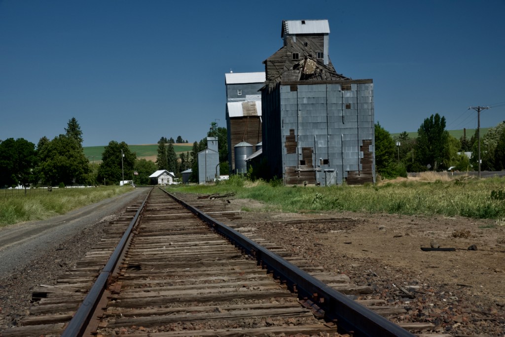
The next few photos are from Route 26 and then Endicott road. The granary is in Diamond. Every very small town had either old graneries or now has the steel bin type. When you see the amount of land devoted to growing wheat you need a lot of storage capacity. The railroads help to get the grain to various markets.


The above red barn was right across the road from the old granary. The town of St. John had the biggest granary complex that I saw. Look carefully at the second photo. A man with a safety harness is on top of the rail car. The tractor below it was used to move the rail car to a new place for the grain to fill in and the man on top can direct the pipe filling the car.


You don’t want to miss the rest of the photos on the blog as some are from Steptoe Butte view point. Click below.
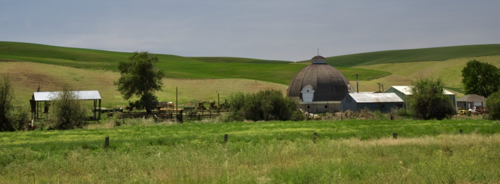
The next photos are from Route 23 both west and east of St. John. In particular take note of the round barn in the fifth photo down. Approximately 20 round barns were constructed between 1890 and 1920 and fourteen still stand. It is a 12 sided dodecagon and makes the maximum use of the space.


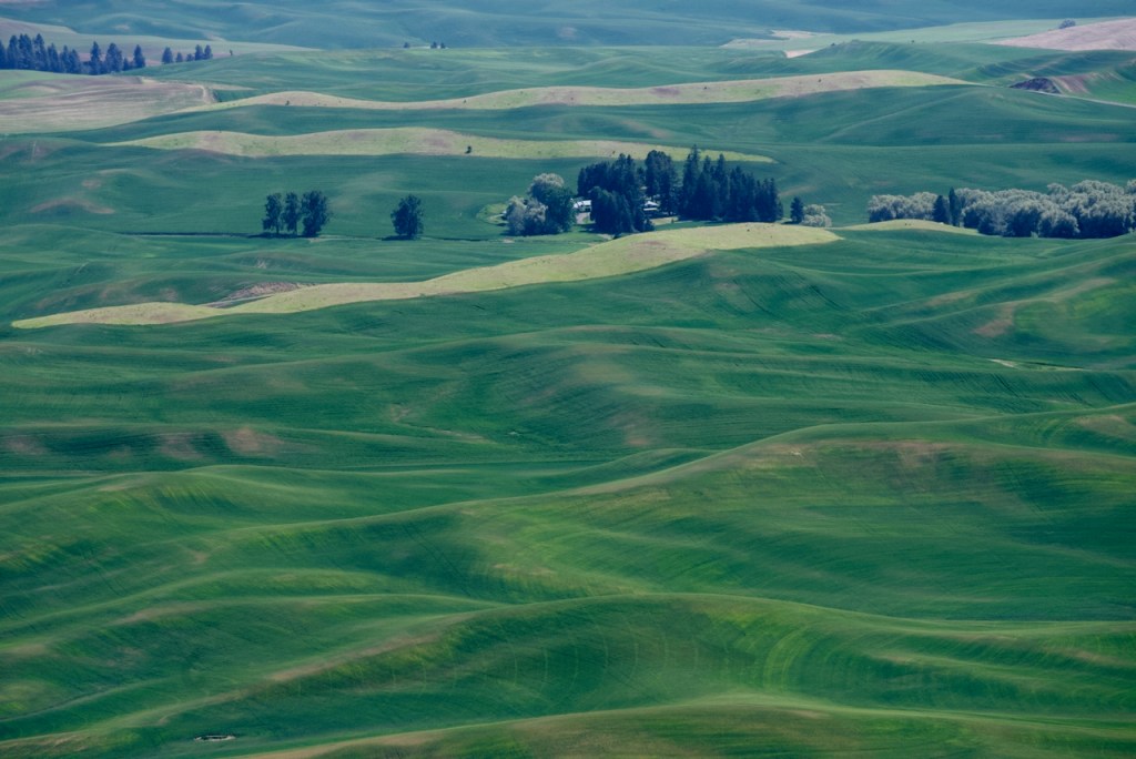
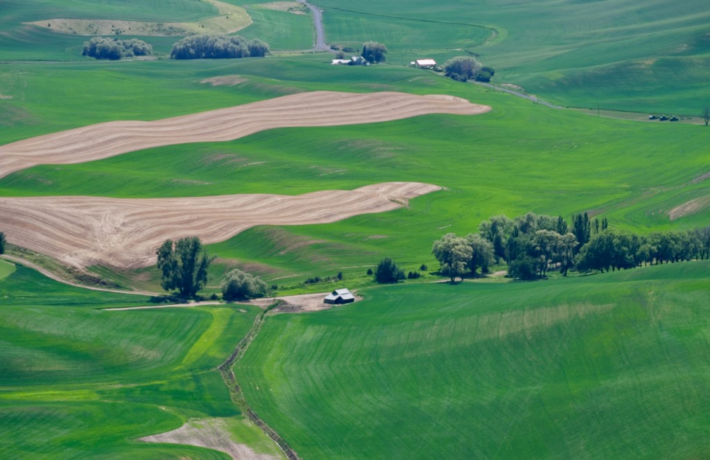
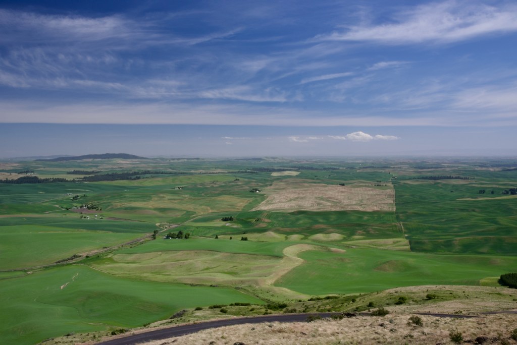
The next set of photos are from Steptoe Butte which is a rock formation of quartzite jutting up over 3600 feet above the plain. This gives a spectacular view point of the rolling hills and surrounding countryside. There were many view points along the spiraling road to the top.


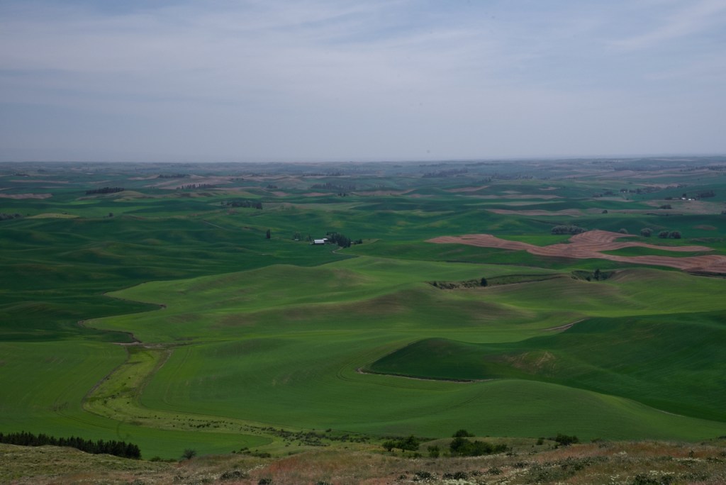

It was a beautiful view with wonderful shapes, curves, and shades of green.


You certainly got some fantastic pictures of Steptoe Butte, Charles!
Many people whom we know and who have lived here all their lives are amazed at how many places in WA we have visited. You have certainly visited many that we have never seen. Must make our way to Endicott and others on your travels!
Thank you for sharing them. I am amazed at how quickly you are working through them! Jean
Sent from my iPad
>
Beautiful shots, Charles. So you did get Steptoe Butte! Larry went up there last year. I finally paid my PCC dues!
Gary
Get Outlook for Android
________________________________
Charles, In the “Social” category in Gmail – infrequently look at it, I just found your Part 1 & 2 of your great posts on your visit to Palouse which I’ve heard of a number of times, but never visited. Your excellent photos filled in details of the area I never heard or saw.
Thanks for sharing!
Bill
Pretty cool, Charles! You never cease to disappoint us with your photography. Always beautiful and interesting. Somethings are so simple to photograph but you bring a special quality to each one of your pictures. Thank you for sharing.
Those photos of the loess around Steptoe Butte are spectacular! As a geographer, I knew about the agricultural productivity of the Palouse, but never imagined there were views like that. The rises and swales are very interesting!
Pingback: Photographer’s Dream: The Palouse in Washington | Ophardt Photos