July 14-22: Follow me on Instagram: charlesophardt_photo
For the first time all the photos are from iPhone 13 and 15.
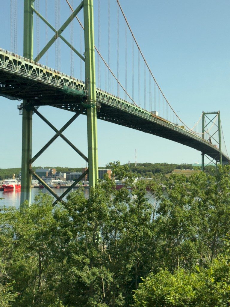
The trip started with a flight to Halifax and then a bus tour with a group from the Ahwatukee Recreation Center and Collette Tours. Halifax has a rich history as a British colony founded by Edward Cornwallis in 1749. He arrived with 13 transports with 1,200 settlers. This violated existing treaties with the French Acadian and Native Indian tribes called Mi’Kmaq and led to a period of warfare between the two.
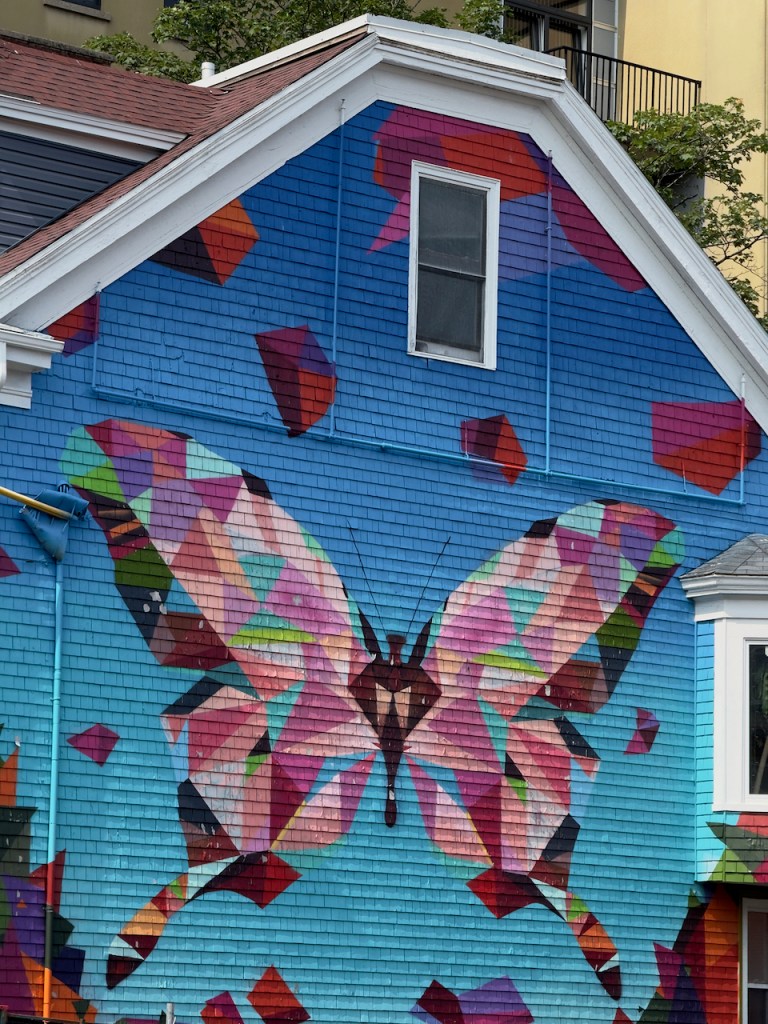
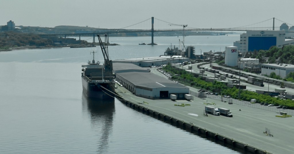
Halifax today is the capital city of the Nova Scotia Provence and its largest city.


The Citadel fortification was built during this period, but I did not go inside as it was a long walk back to the hotel. Here is one photo of a re-enactor portraying a 78th Highlander soldier guard.

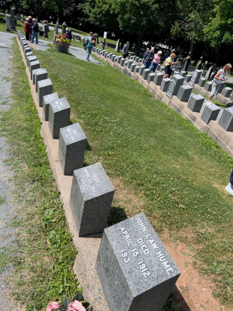
In Halifax there is a famous cemetery where many of the recovered dead bodies from the sunken Titanic ship are buried. It has a very methodical layout in the outline of a ship with each person given a number and later as they were identified the names were added. There was a special grave and stone for an unknown child which has since been identified.
In addition there was another part of the cemetery where the victims are buried from a tremendous explosion in the harbor that destroyed a very large section of the city. This occurred on December 6, 1917 when a munitions ship collided with another ship resulting in 1800 deaths, 9000 injuries, and 6000 homeless. This was the world’s largest explosion prior to the atomic bomb.

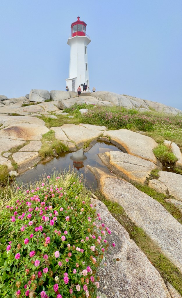
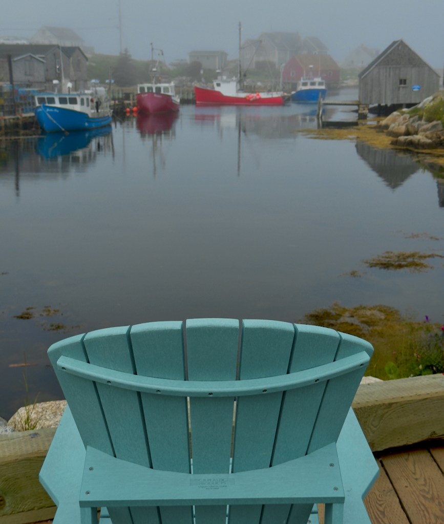
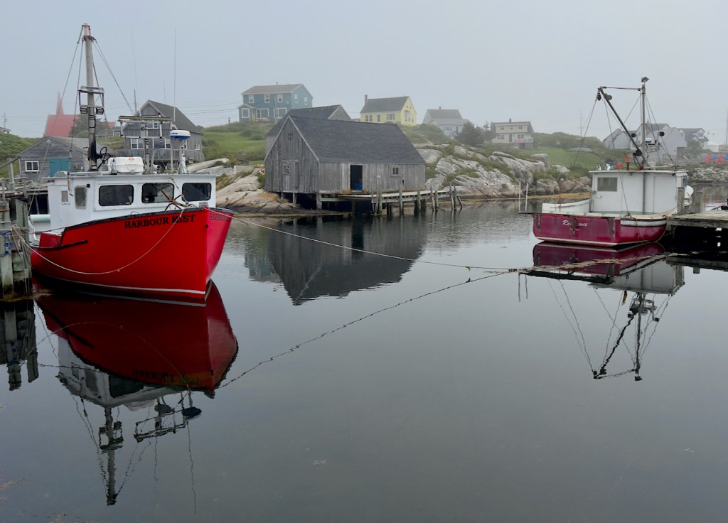
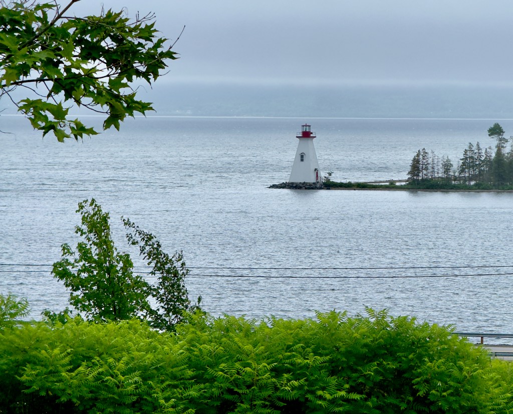
The first day we went to the famous Peggy’s Cove Lighthouse, quaint village and active fishing port. It was a foggy morning and many people walked out on the rocks to view the light house.


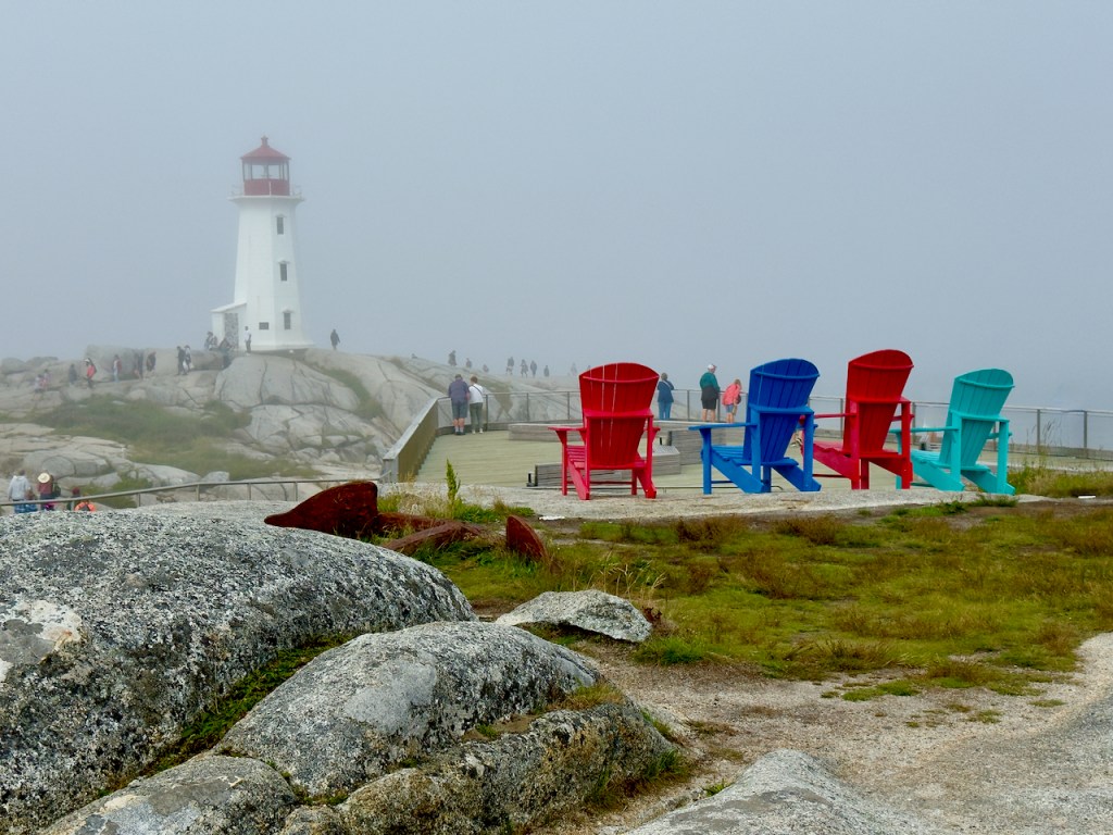
I always look for reflections and found several in the rocks near the lighthouse.


Above: Finally all the people had cleared out leaving the lone woman playing the accordion.
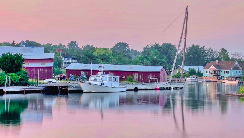
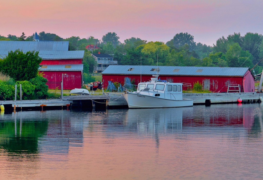
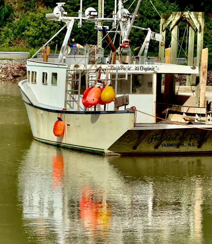
We walked through the town and I found many photographic compositions of the boats in the harbor.


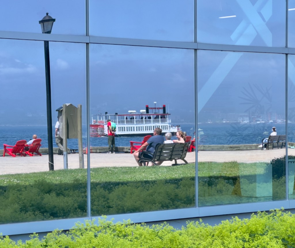
In the afternoon, we had free time so I went for a walk along the Halifax waterfront where there were many shops and restaurants. I did some people watching through the reflections in the windows. My lunch was an ice cream cone that I purchased from this woman in the colorful cart.


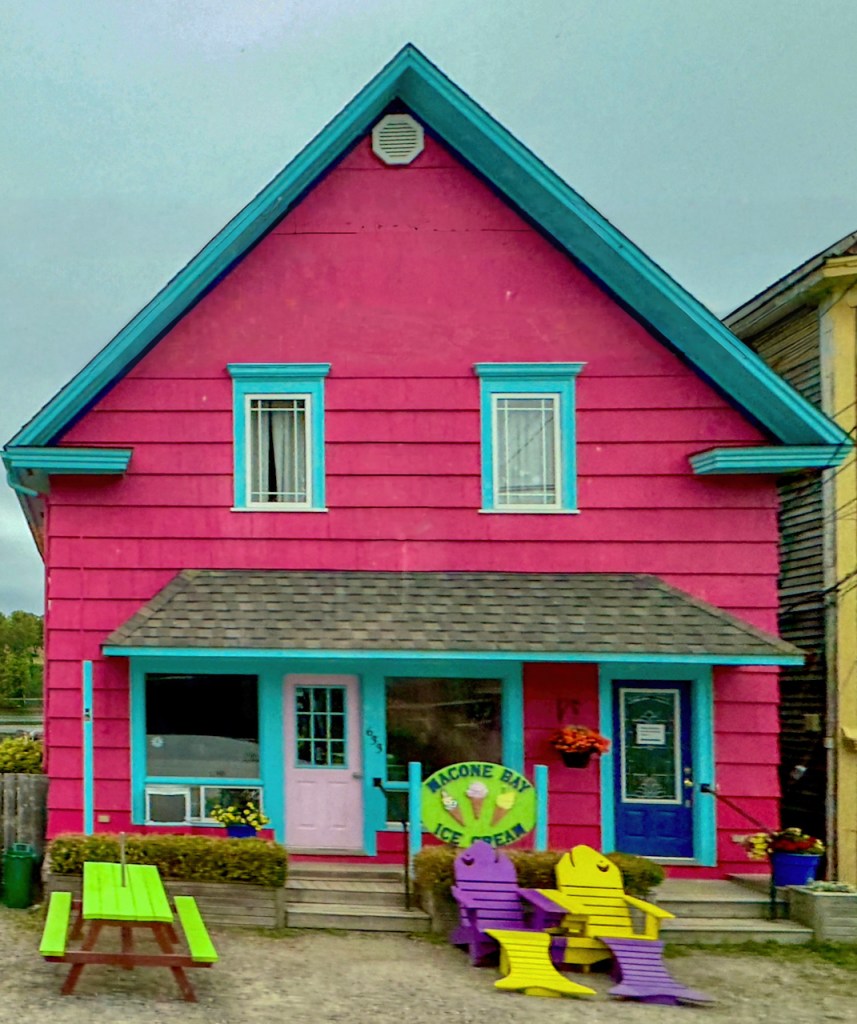
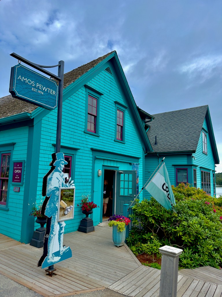
Day 2, we again went along the coast to the south and stopped first in Mahone Bay. The buildings were all very colorful and we had a tour of the Amos Pewter House shown in the last photo. We saw them giving a demonstration of casting the pewter.
Mahone Bay is famous for the three churches side by side. The first is St. James’ Anglican, the second is St. John’s Lutheran, and the third, with the squared off steeple is Trinity United Church.
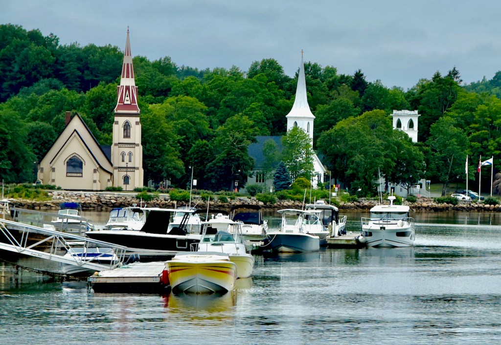
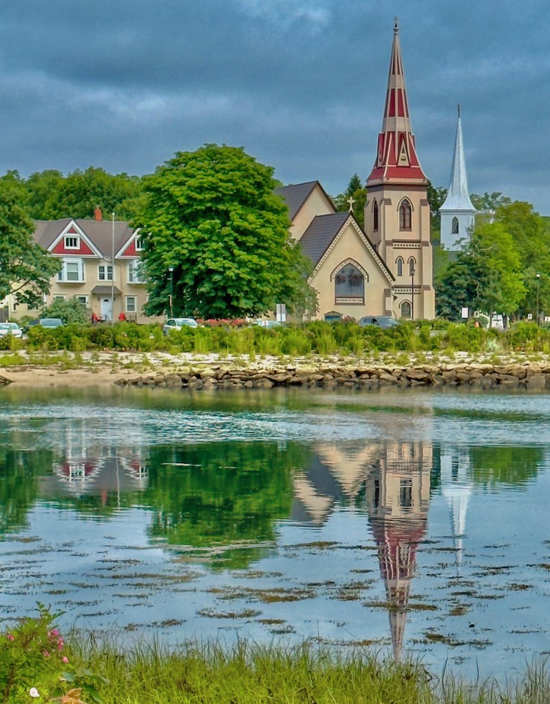
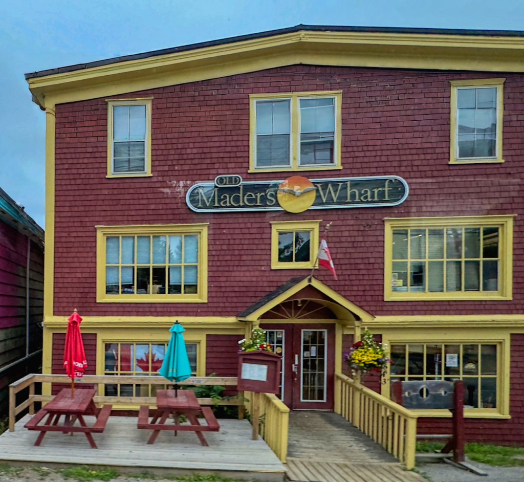
The next seaside town is famous Lunenburg, a Unesco World Heritage Site. The reason is that it is the best planned British colonial site including the layout and preserved wooden architecture. In 1753 the British recruited 1400 German Protestants to found the town and counter the influence of the French Catholics. The town eventually became heavily involved in various fisheries with cod as the chief fish through the 1800s and 1900s. The town is very picturesque with the red and other colorful buildings now protected and preserved.


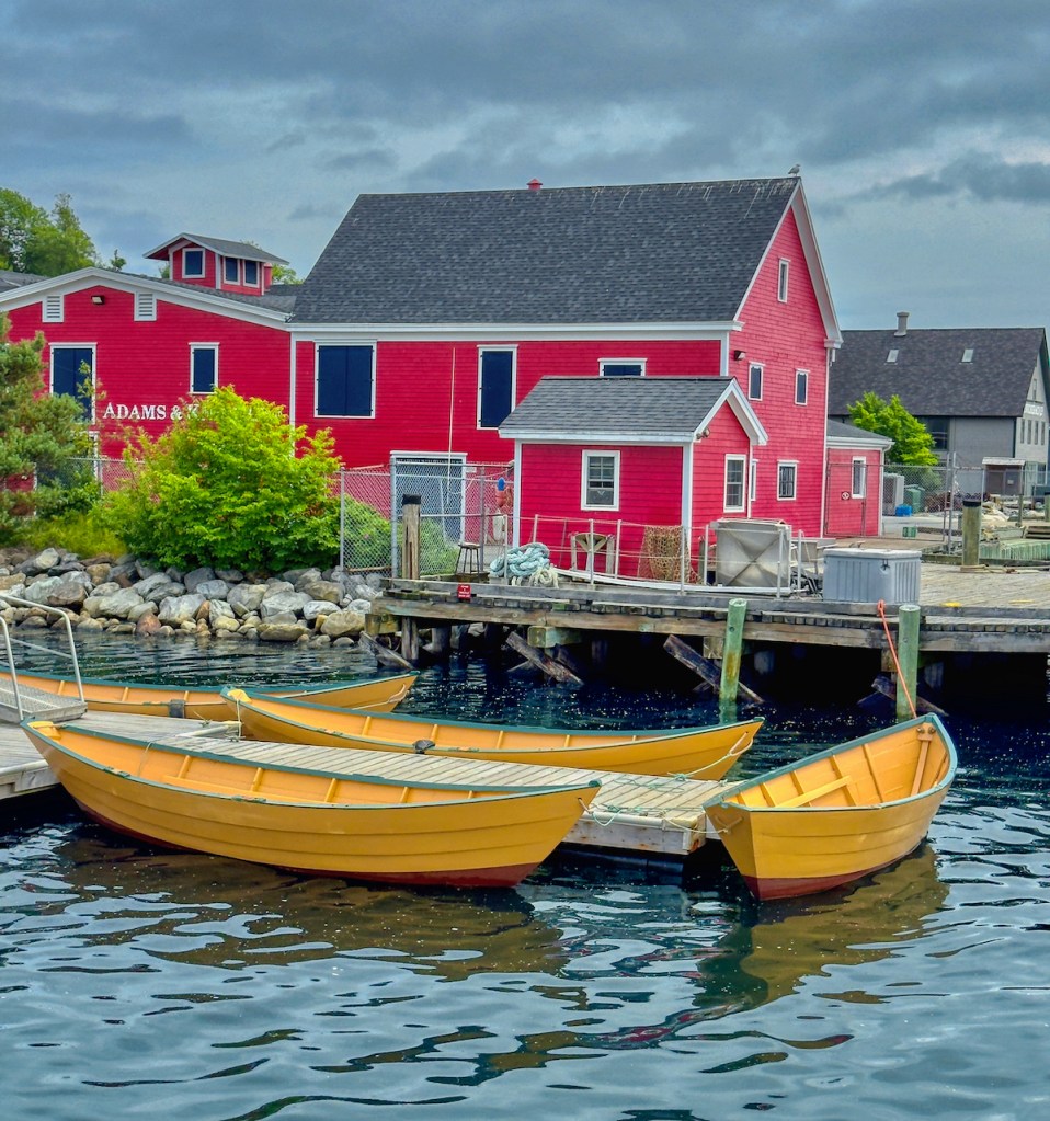

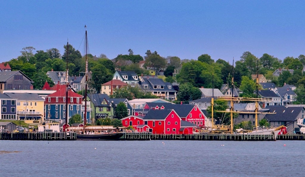
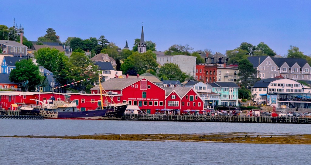
Lunenburg had a thriving wooden ship building industry. The Bluenose was built here in 1921, became a very famous undefeated racing ship, with the 16 knot speed record for a fishing schooner. The exact replica, Bluenose II, has sailed around the world. Its likeness represents Canada and is imprinted on the 10 cent coin.


Here’s a map of the Maritime Provences to help find some of the places that we visited.

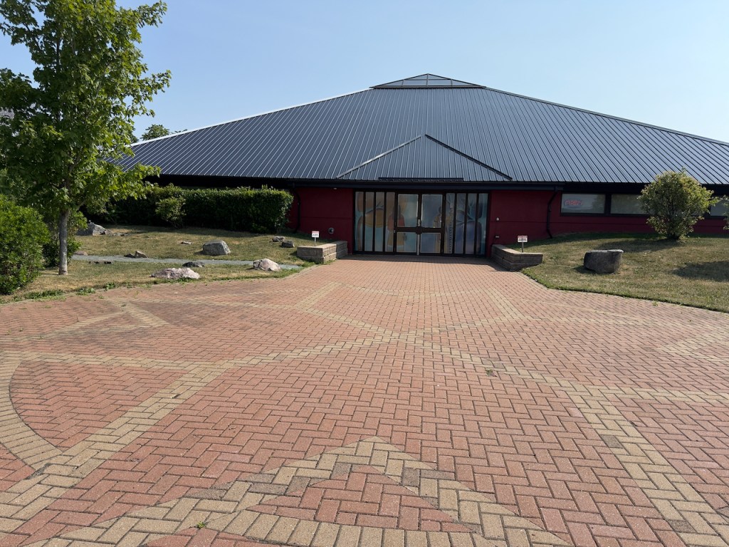
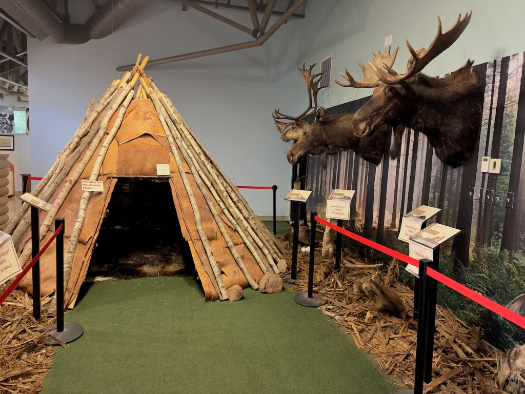
Day 3, we headed north unto left side of Cape Breton Island. On the way we stopped at the Millbrook Cultural Center in Millbrook, Nova Scotia to learn about the Mi’kmaq First Nation linage (pronounced “Mick Maw”). They were friends with the early French explorers and settlers called Acadians.
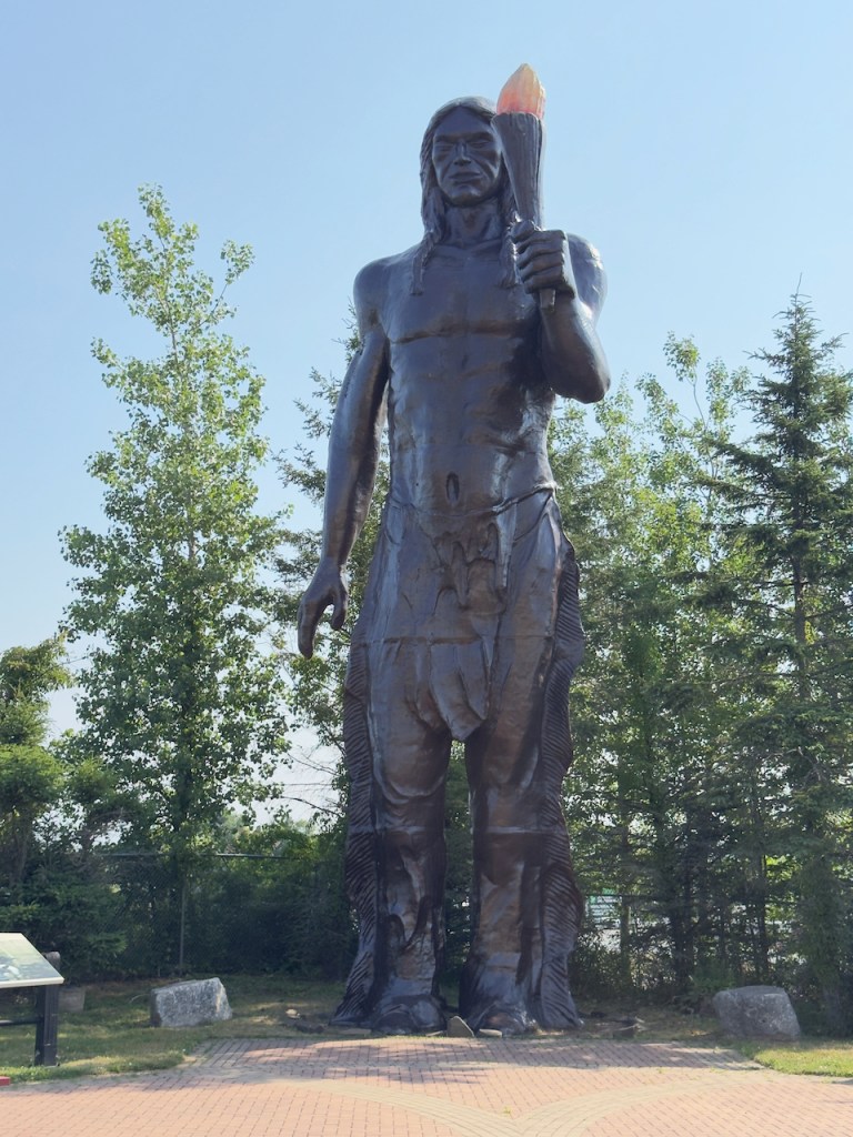
A 40 ft statue representing Glooscap is the hero of the MiKmaq creation stories, giving his people the canoe and fire (hence the torch held by the statue).
The next stop was at Gaelic College where they had various demonstrations including how to wear a kilt. This area was settled by the Scottish people and they are still trying to keep the Gaelic language alive.


We stayed for two nights at the Inverary Resort in Beddeck. We had a wonderful dinner the first night and it had a small harbor where I got some sunset photos.


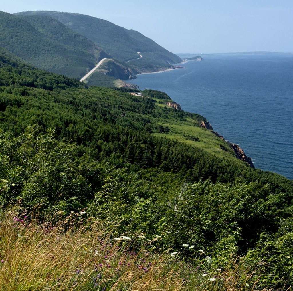
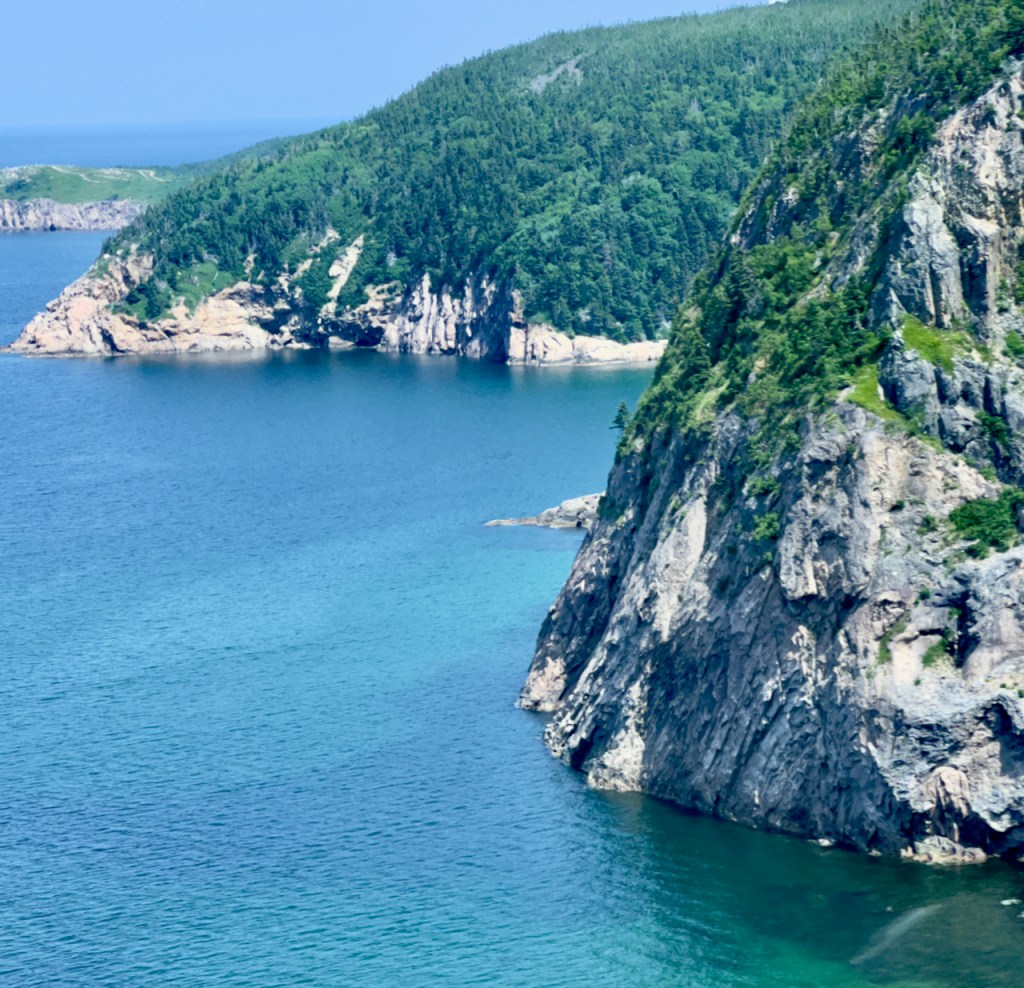
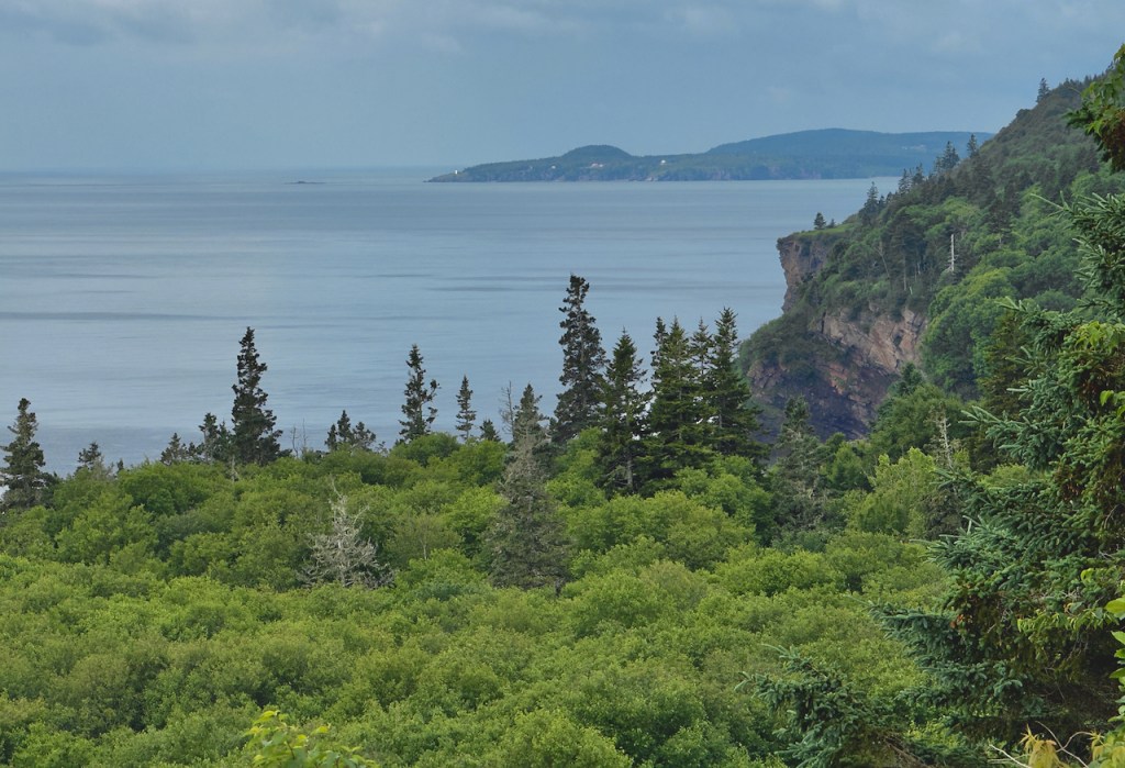
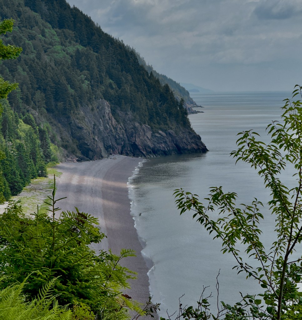
On Day 4 we traveled around Cape Breton Island on the Cabot trail with many views.


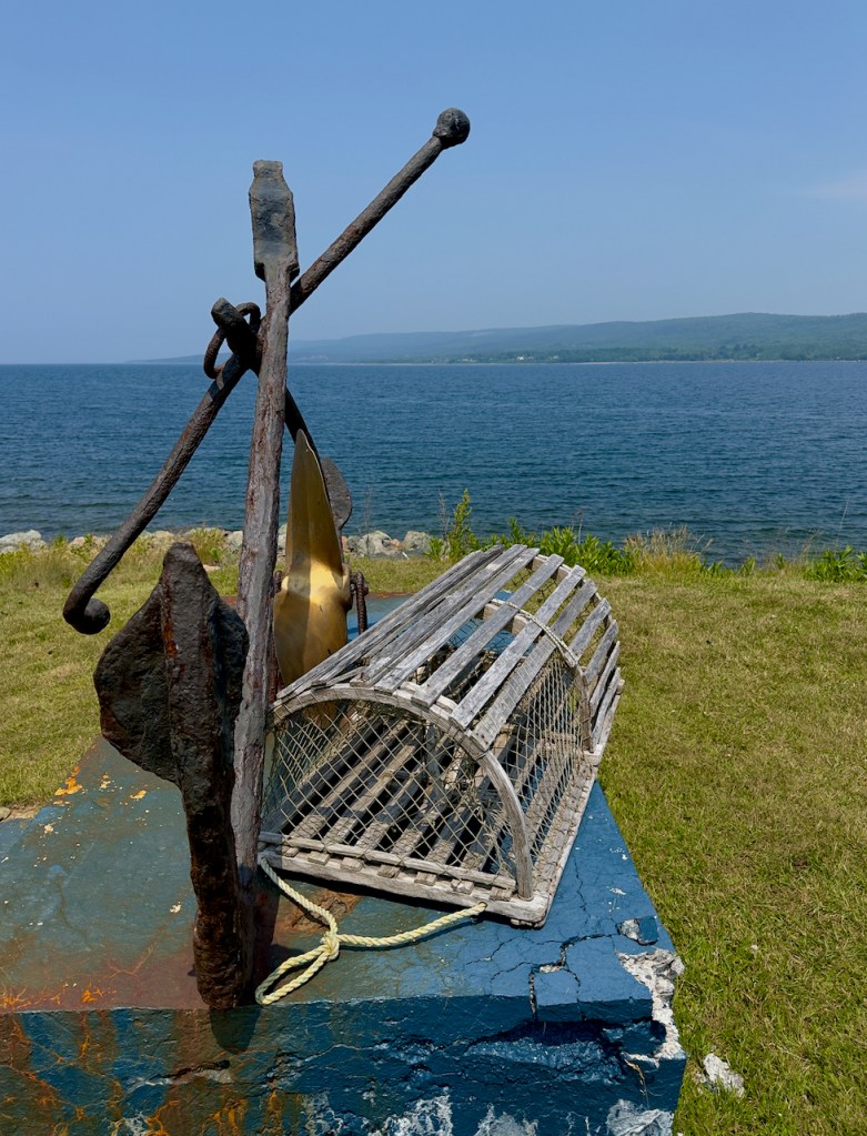
At Pleasant Bay we stopped for the view and a lobster trap demonstration. There is a funnel like opening that the lobster crawls through in search of the bait, but cannot get out. The second photo is an old style lobster trap.

In the first photo below they are loading crab traps onto the trailer.


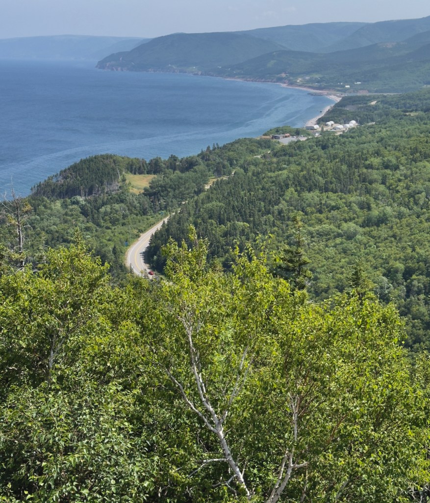
More views along the Cabot Trail.
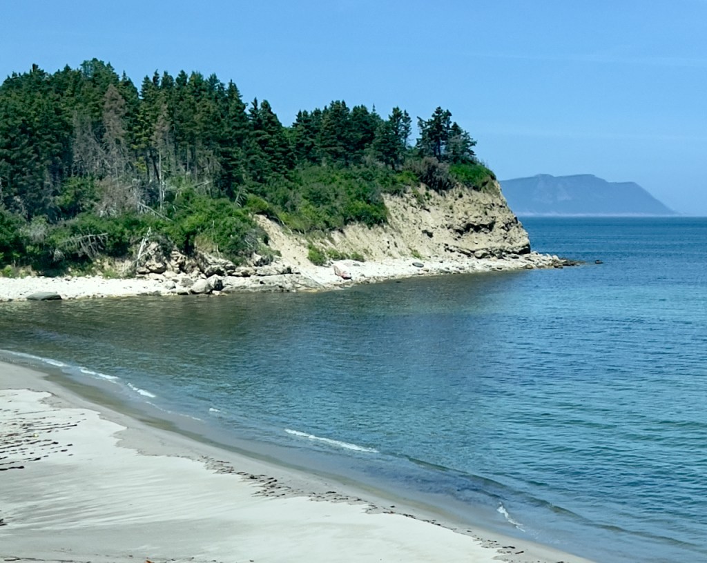
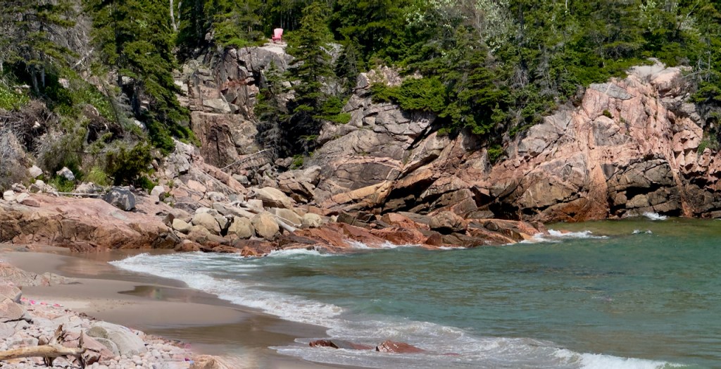
Neils Harbor and Black Brook Beach.


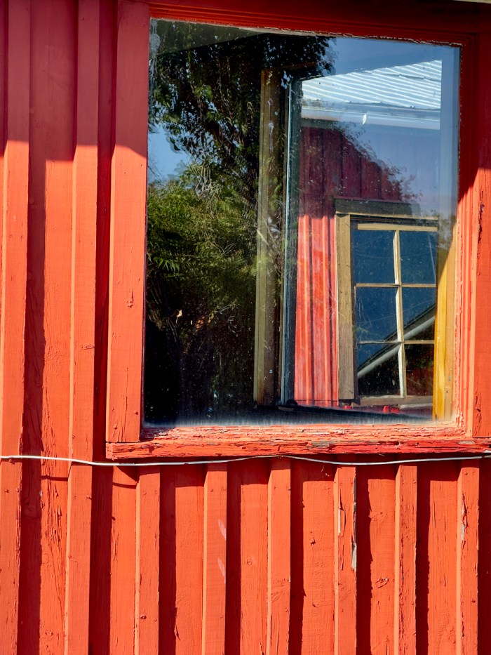
Here is an interesting composition at the Inverary Resort. It’s partly a reflection in the first window, but also a view through the corner of a second window to a third window in the next building.
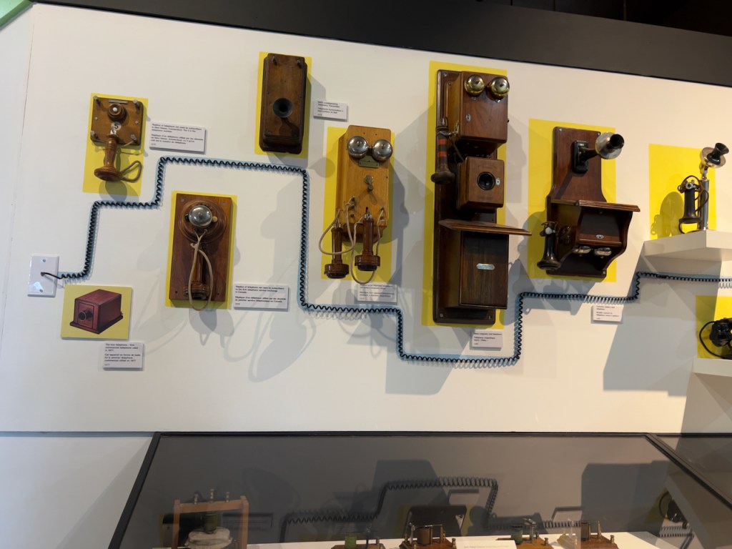
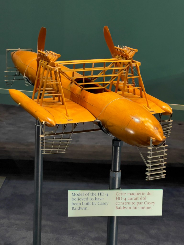
Day 5: Five minutes from the resort in Beddeck is the Alexander Bell Museum.

Alexander Bell had wide ranging interests in various inventions. Of course the telephone is the most well known. He also designed and tested a hydrofoil boat that held the 70 mph speed record on water for ten years. In addition he and friends were designing and building airplanes at the same time as the Wright Brothers. It was a very fascinating museum and I bought a book that really explained his inventions.
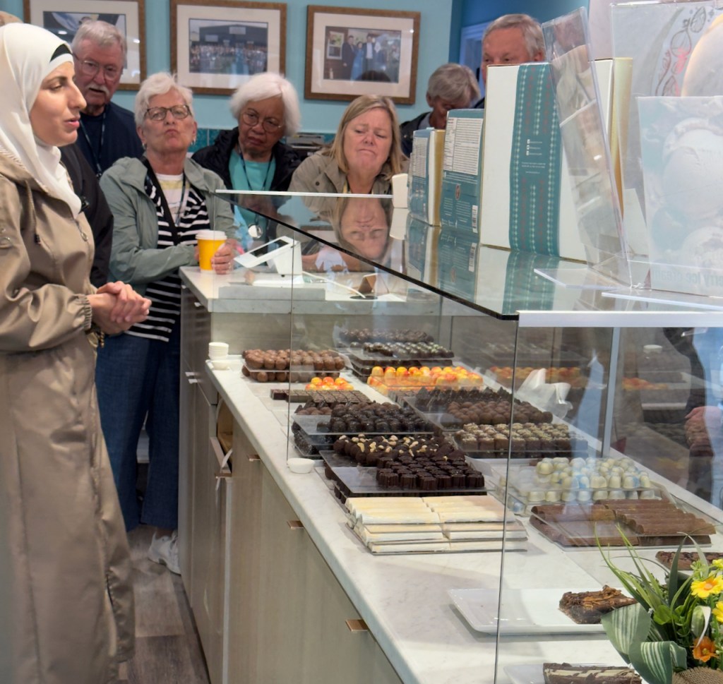
In the town of Antigonish we stopped at the Peace by Chocolate store run by a refuge Syrian family that lost the original factory in the Syrian war. They spent several years in refugee camps before finally emigrating to Canada.


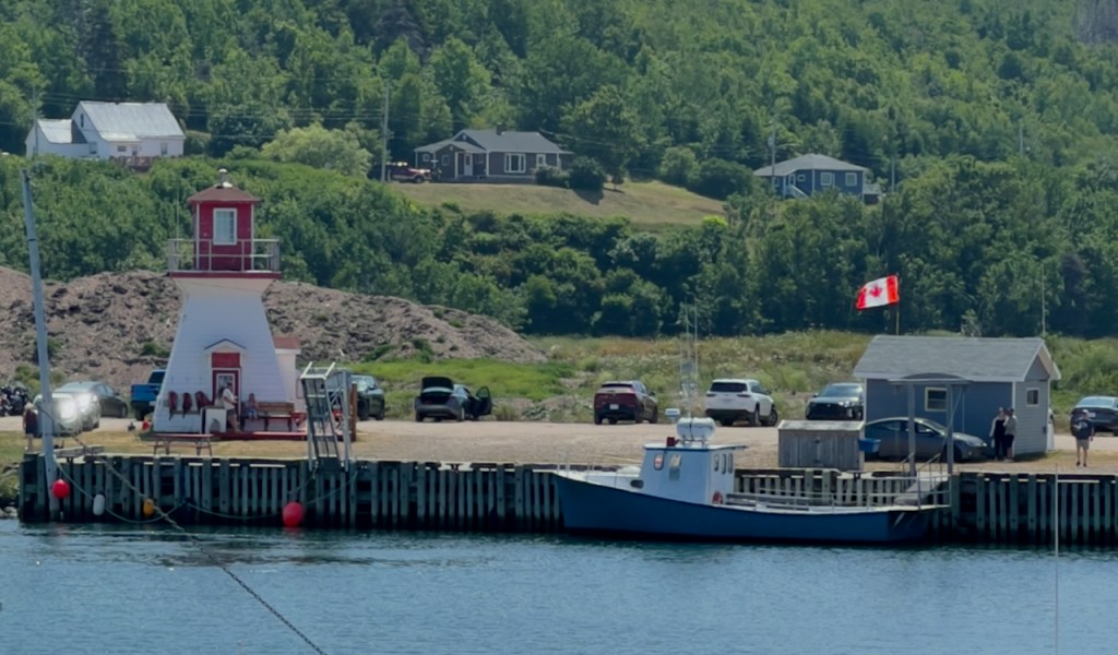
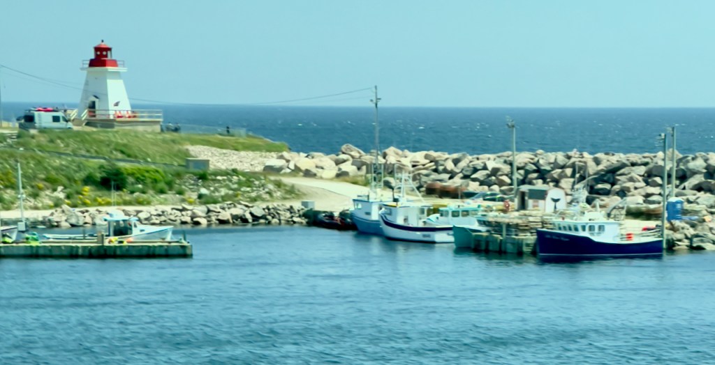
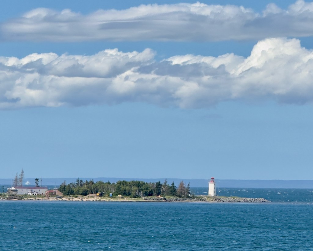
Next is the ferry terminal harbor at Caribou, where we had a short wait to board the ferry for Prince Edward Island. Notice my fishing boat, the Pierre Charles.


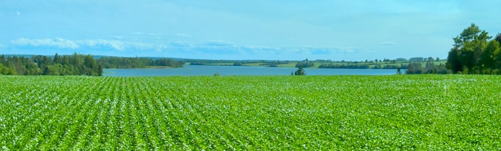
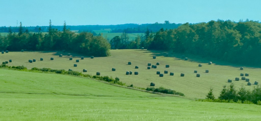
The countryside of Prince Edward Island is fairly flat as it was once a huge sand bar. We saw lots of farming activity including crops of potatoes, wheat, corn, soybeans, and hay. Most of the potatoes used in Canada come from PEI.


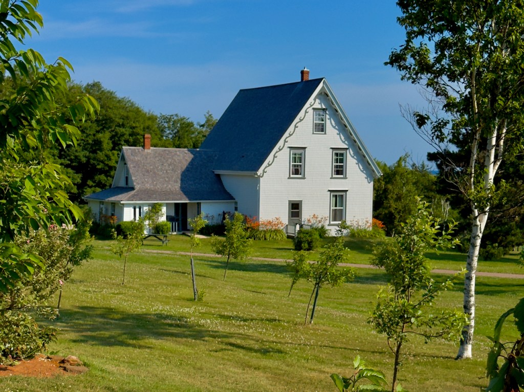
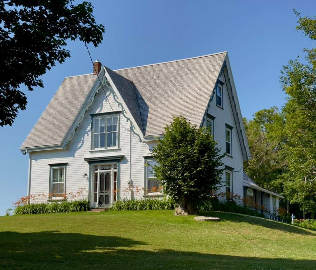
On Day 6, we first visited the house where the author, Lucy Maud Montgomery, lived and wrote the famous Anne of Green Gables first book in 1901. Eventually a total of 8 books that span the life of Anne into motherhood were written by Montgomery. Starting in 1985 three movies were made of the Anne of Green Gables series of books. Ancestors still run the complex and the tourist attraction. They also did a demonstration of how to plant potatoes.


We also stopped at a view point to see the fishing village on the French River.
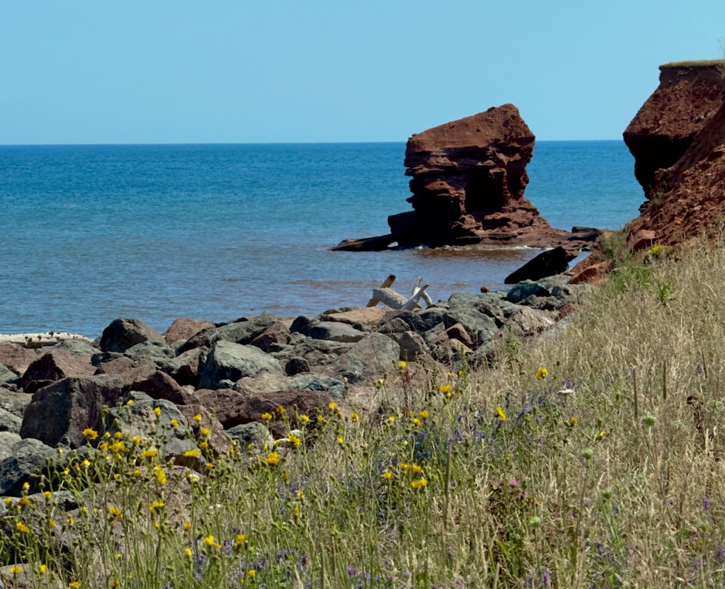
Nearby is Cavendish beach and a view point of a split rock off shore.


We had the trip’s Signature Lobster dinner at New Glasgow Lobster Suppers on Prince Edward Island.


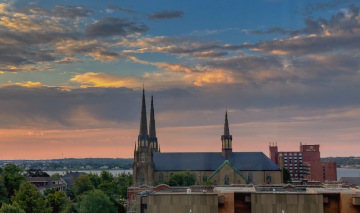
Day 7. Sunrise at Charlottetown, PEI.
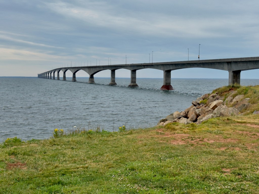
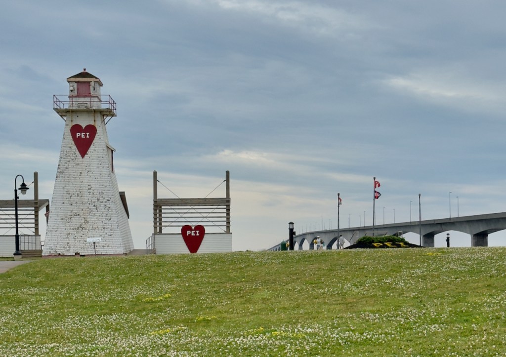
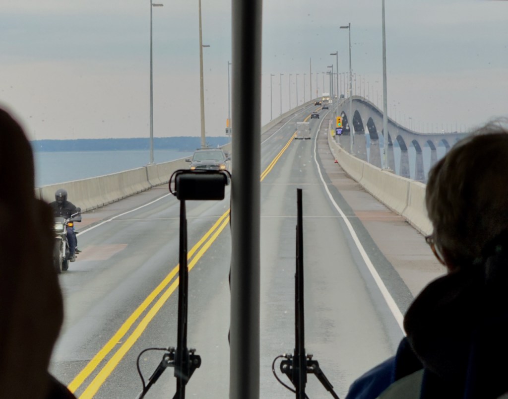
This morning we are leaving PEI via the curved 8 mile long Confederation Bridge, which is the longest over ice covered water in the winter. It bridges the North Cumberland Strait to New Brunswick and is part of the Trans Canadian Highway. If interested the above link details how it was constructed.

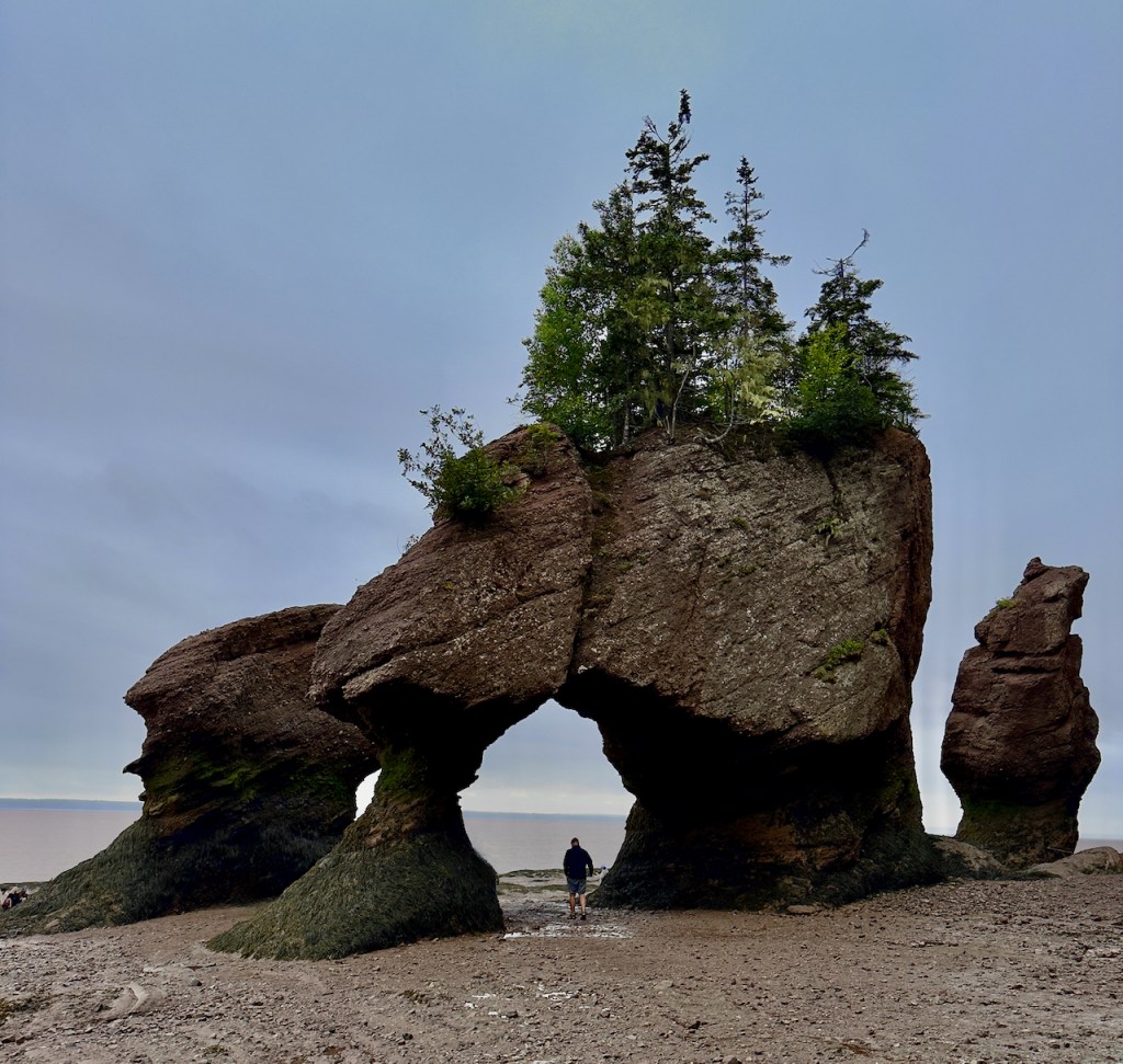
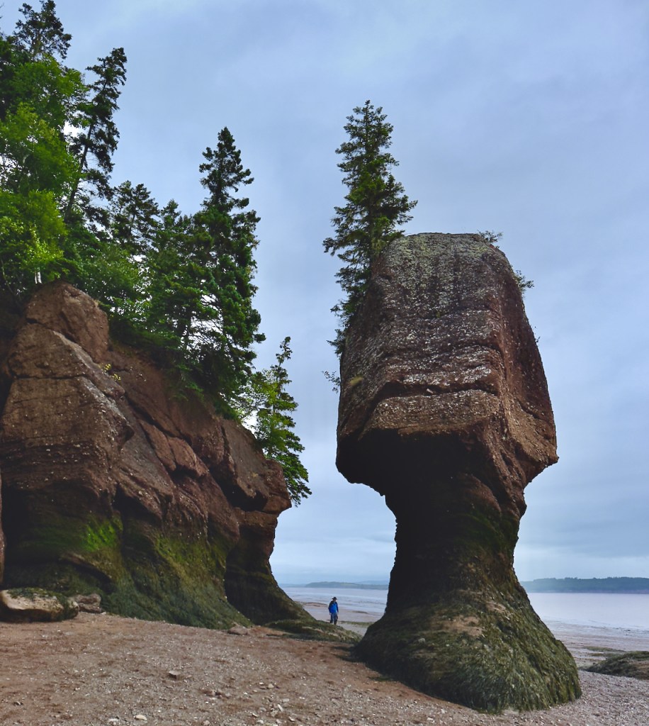
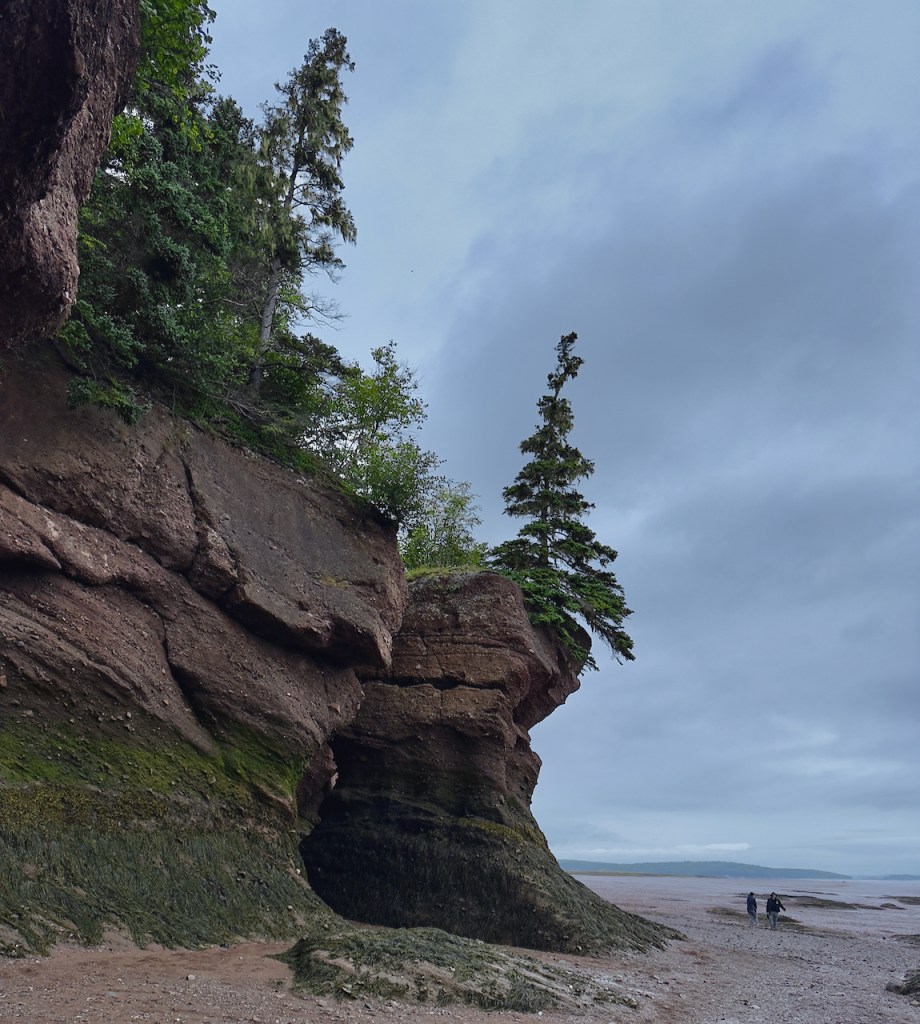
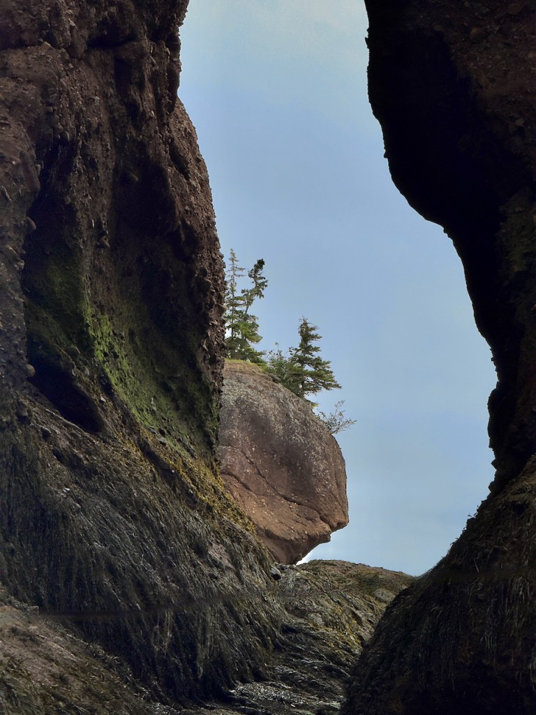
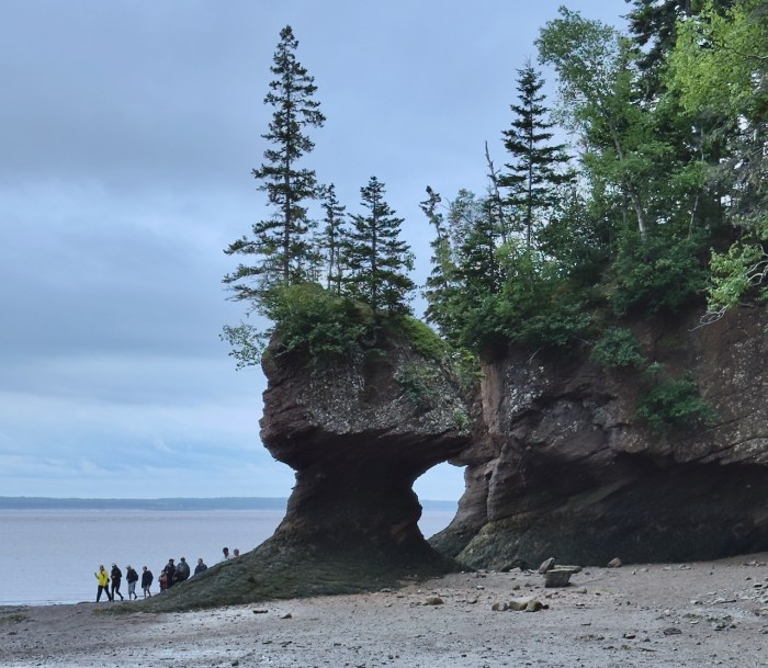
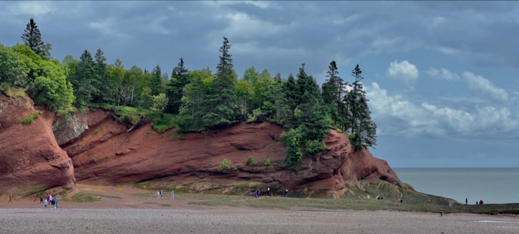
The first stop in New Brunswick was at Hopewell Rocks. This is on the Bay of Fundy where the highest tides in the world are found at 52 feet in some places. A full explanation can be found at the link above. The reason the tide is so high is that the deep water is funneled into an ever narrowing and shallow part of the bay. The first photos show the appearance as the tide is going out. At high tide the water would be covering the black portion of the rocks. These views are a before lunch and after lunch difference of about an hour and a half where a large portion of the ocean floor is exposed for people to walk on. It is gravel near the shore and super muddy further out.


The water erodes the rocks which are called flower pots. It is amazing to see the trees growing on them.


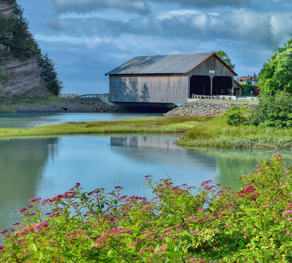
Day 8: Today we are going to see more of the Bay of Fundy with the first stop at the covered bridges at St. Martins. First some photos of the harbor. I did not take the fourth photo but wanted to show what it looks like at low tide where the boats need some supports so they do not tip over.
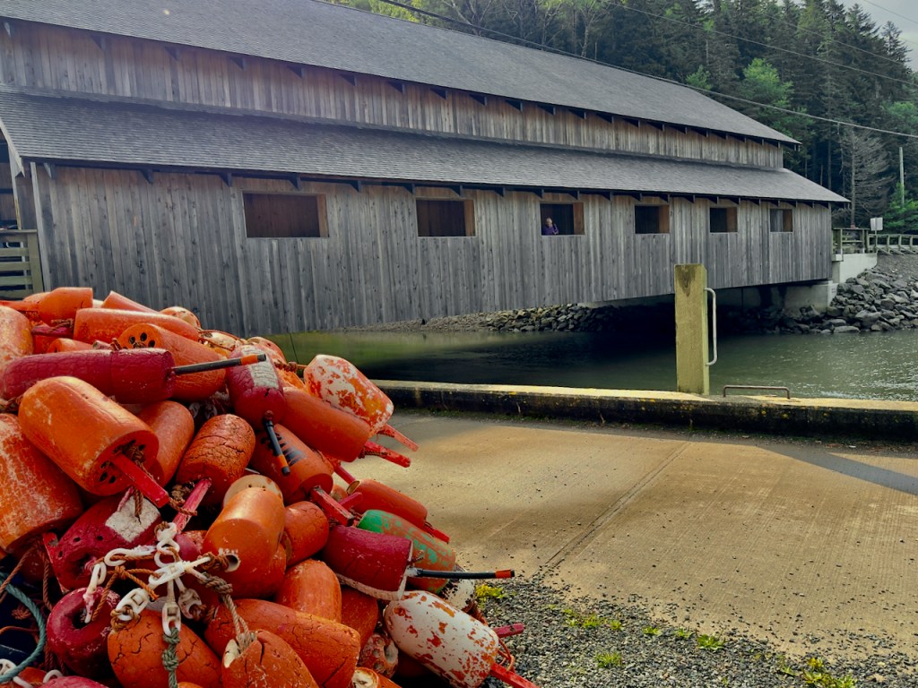


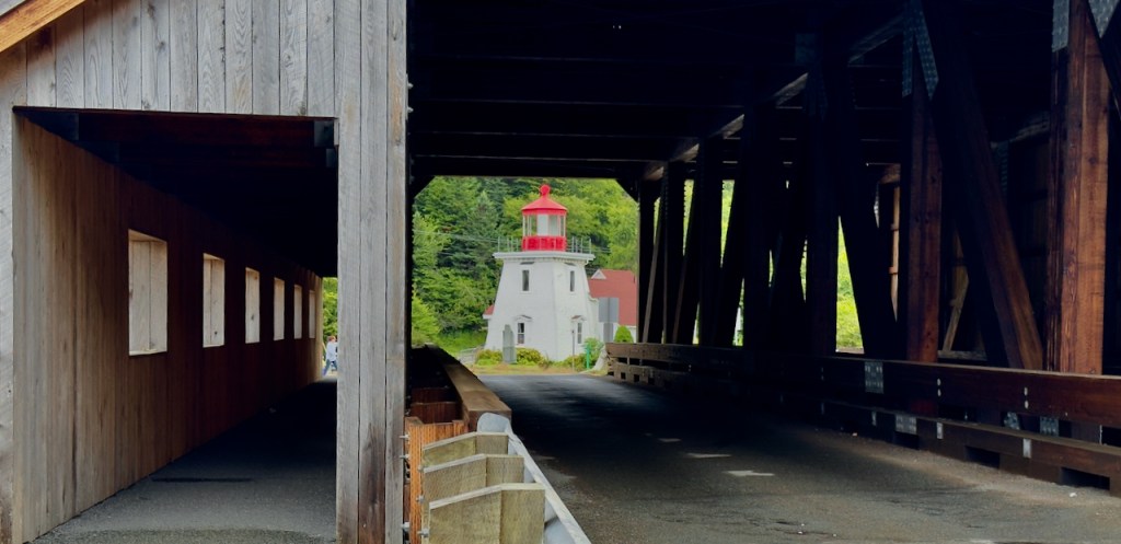
This was a wonderful place as I was able to get good reflection photos of both bridges. These photos beat anything I was able to get in Vermont and New Hampshire last fall!


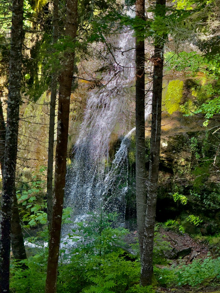
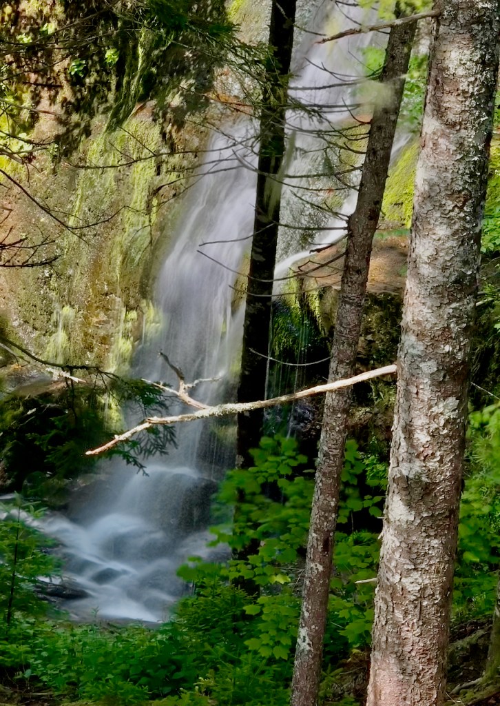
The Bay of Fundy Trail was interesting with periodic visits by a couple of re-enactors. The first stop was the Fox Rock viewpoint. The next stop was the Fuller waterfall with the steep steps that I did not go down, but found a couple view points through the trees.

We. stopped at the Cookhouse for samples of food and some more entertainment by the re-enactors. After that we went to the Caves for a lunch of chowder.

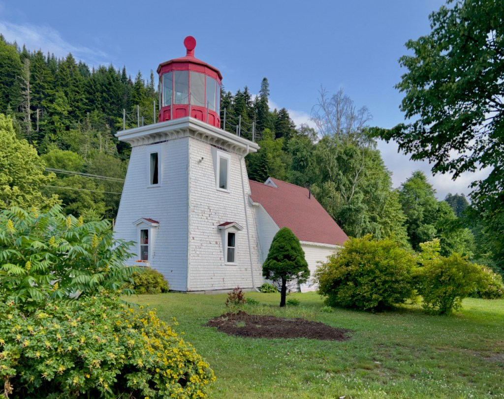
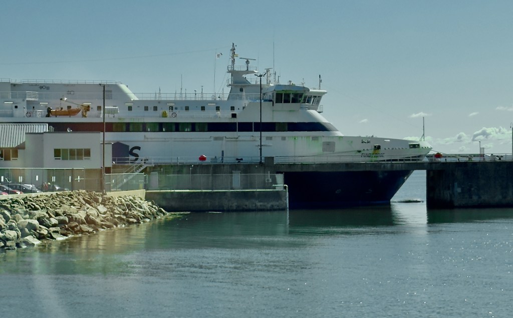
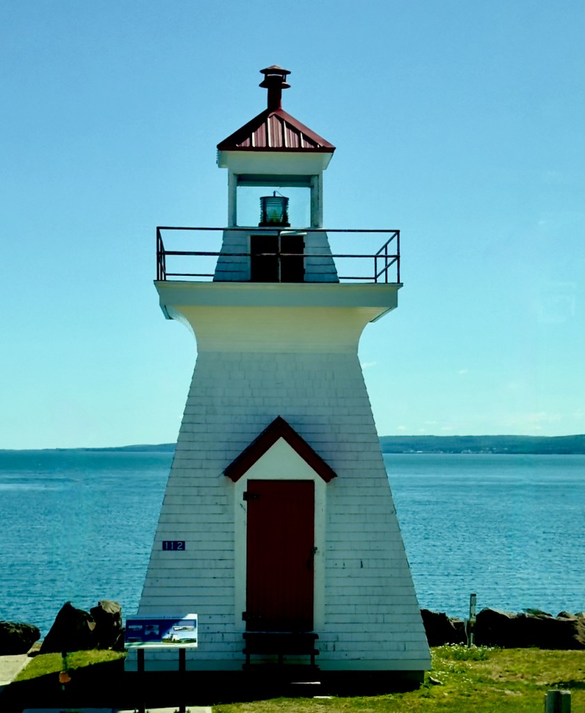
Day 9: We had to get up very early to catch the ferry from St. John to Digby, Nova Scotia. Of course I had to include the ubiquitous lighthouse. This was a very large ferry with lots of lounges for the 3 hour crossing.


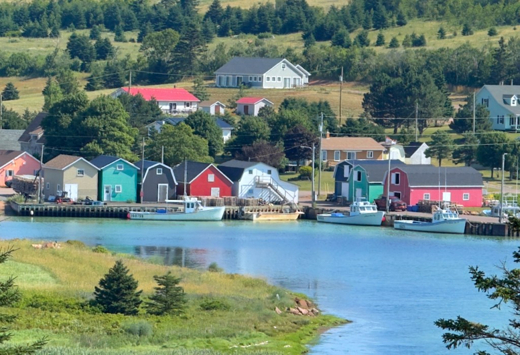
The town of Digby has a major harbor with lots of fishing boats, but we did not stop.


We had lunch at the town of Wolfville that had a lot of street side restaurants. I liked the Acadia theater old time neon sign.


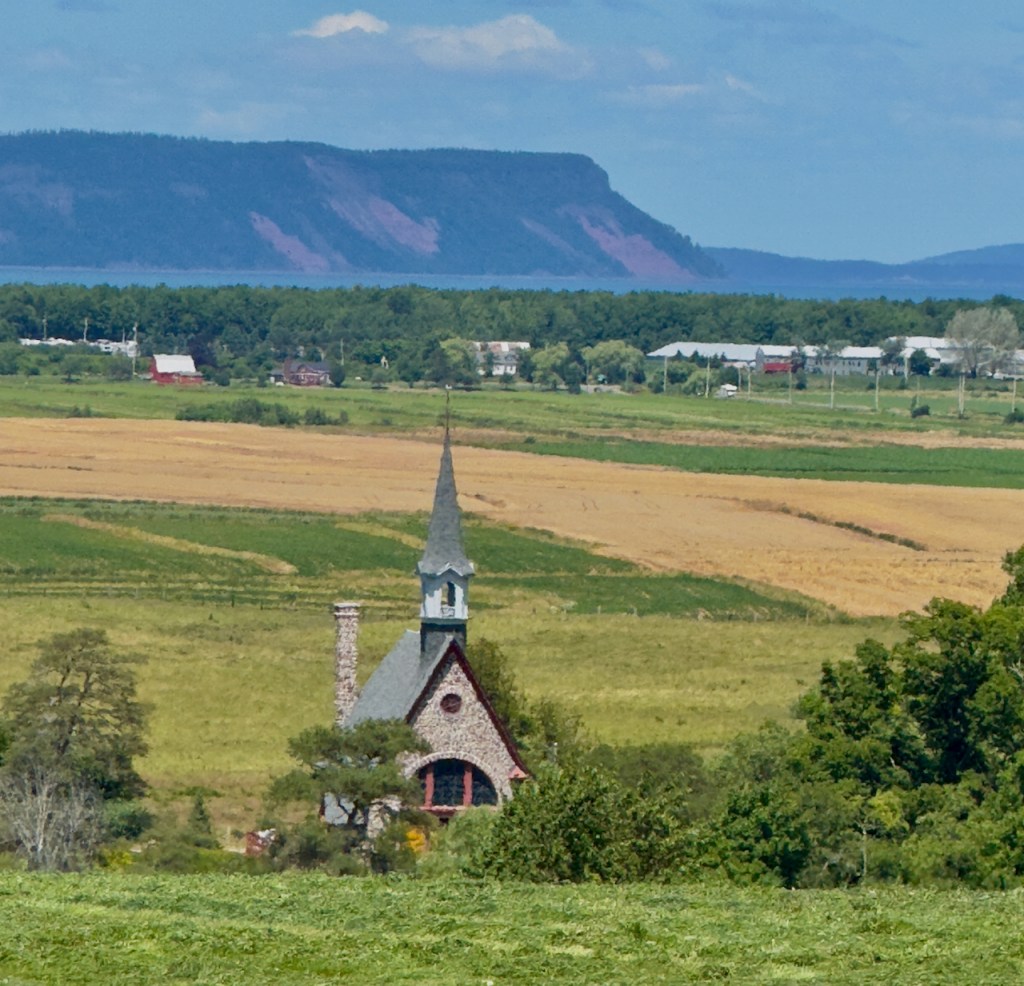
The next stop was at the Landscape of la Passage de Grand Pre’ which is a Unesco World Heritage site. “Situated in the southern Minas Basin of Nova Scotia, the Grand Pré marshland and archaeological sites constitute a cultural landscape bearing testimony to the development of agricultural farmland using dykes and the aboiteau wooden sluice system, started by the Acadians in the 17th century and further developed and maintained by the Planters and present-day inhabitants.” This was done to drain the swamps and control the tides.


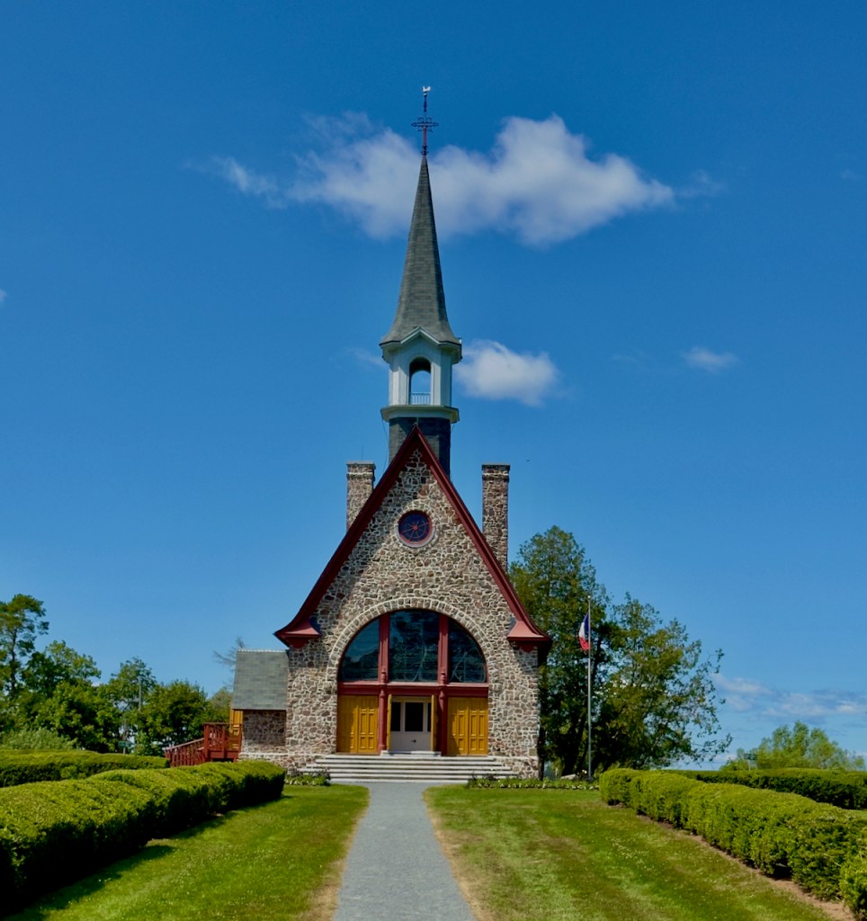
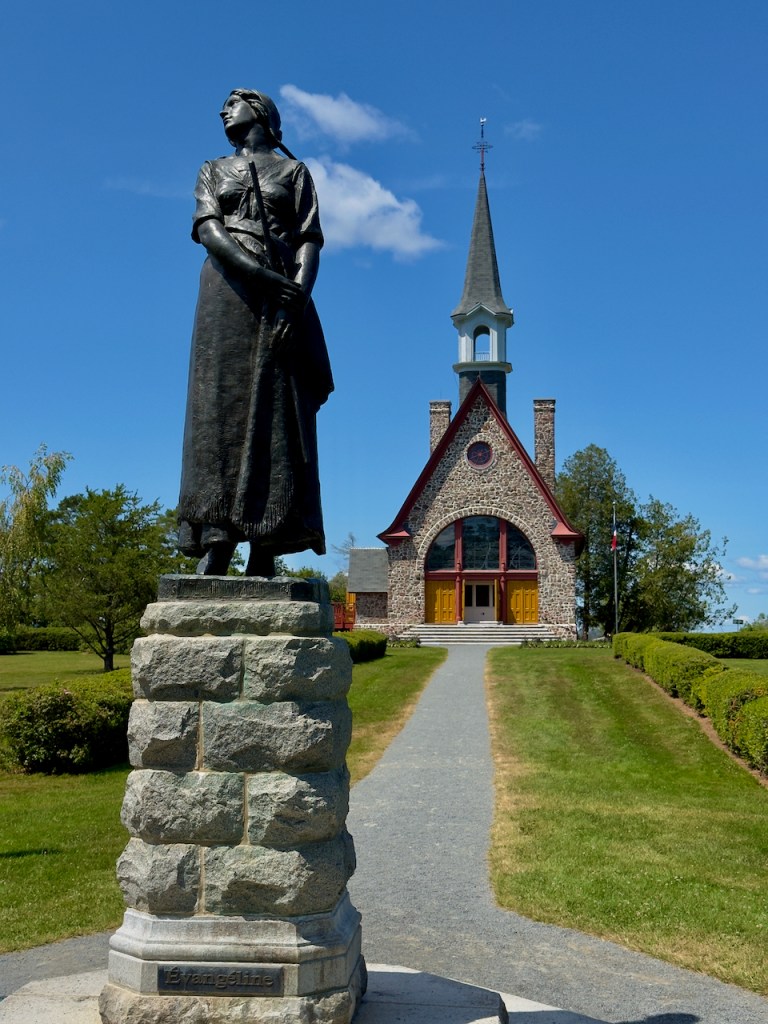
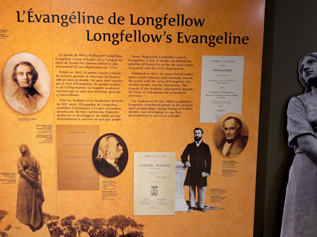
We visited the Grand Pre’ Historical Museum and encountered the story of the “Le Grand Dérangement: a tragic event in Acadian history”. This was the forceable removal of the French Acadians by the British starting in 1755 and continuing to 1762. They were forced to go to other places in the British Colonies, France, the Caribbean, and some to Louisiana (today known as Cajuns). This was after the French and Indian Wars against the British. That war ended with Britain in control of Nova Scotia, but the Acadians were allowed to stay on their land but they would not sign allegiance to Britain. After many skirmishes and wars with the Acadians and the Mi’kwah Indians against the British, eventually it was decided to expel them to remove the internal threat of the Acadians and their Indian allies. Wikipedia has an extensive history of these events.
At the museum there is the story of Henry Wadsworth Longfellow’s Poem of “Evangeline: A Tale of Acadie” which aroused widespread interest in the tragic deportation event and helped develop strong feelings of identity for the Acadians. The statue is of Evangeline at the Memorial Church built in 1921.
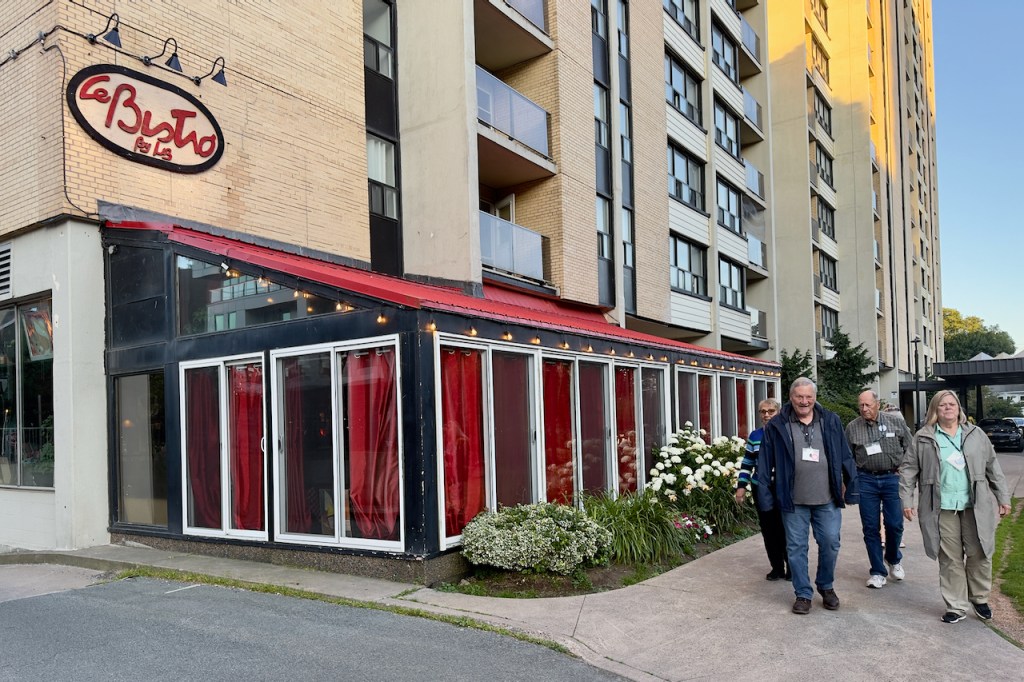
Our farewell dinner was at the le Bistro by Liz. Farewell to lots of new friends and farewell to the Maritimes.


Charles,
Amazing photos, as always! Looks like a wonderful trip. Thanks for sharing.
Diane & Dave
Thanks for sharing this beautiful photo essay. It looks like a very memorable adventure. Two favorites are the photo of lighthouse through the covered bridge and Evangeline with the church in the background. Amazing all.
Stunning pictures, as always!
Love all the pictures Charlie!! Looks like it was a fun and fascinating trip!!!Sent from my iPad
Thank you for creating a wonderful album of our trip. The photos are amazing!
I never made it to New England even though I have to gone coast to coast. Thank you for sharing.