May 30-June 5.
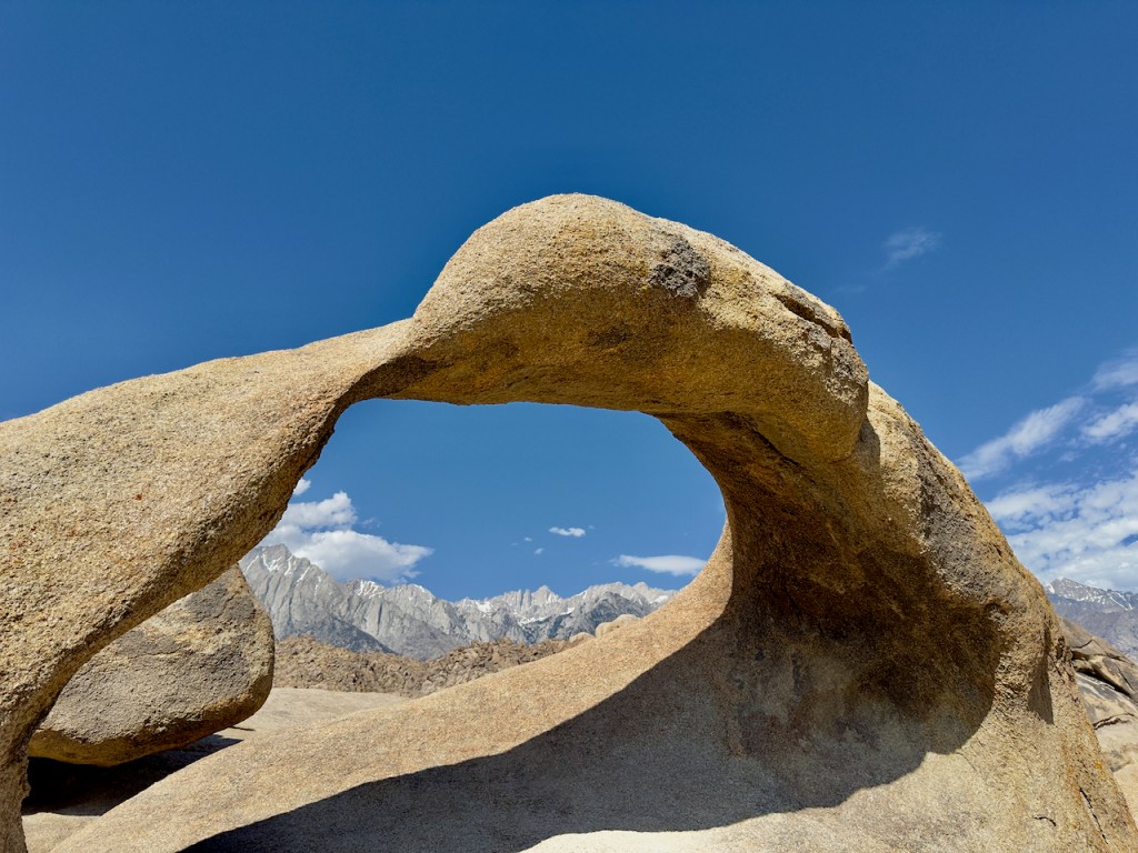
Traveling on route 395 on the east side of the Sierra’s, my first stop was in the Alabama Hills west of Lone Pine to finally see the Mobius Arch after a short hike. Mount Whitney, the tallest mountain in California can be seen through the arch.

Continuing north near Lee Vining is Mono Lake which is known for its Tufa Formations. These are formed in the ancient lake bed from underwater springs rich in calcium carbonate that form a type of limestone. The level of the lake has dropped from the time of their formation. California has mandated a certain level of water in the lake or water would have been diverted for agriculture and cities, and dried up long ago, such as happened to Owens Lake nearby. Mono Lake is very salty and alkaline since it has no drainage.


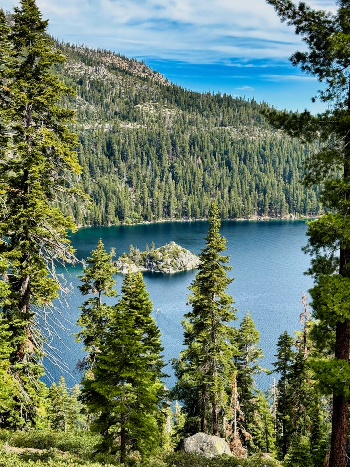
Continuing north, I traveled on the west side of Lake Tahoe and stoped to photograph the famous island at Inspiration Point in Emerald Bay.
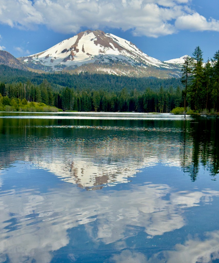
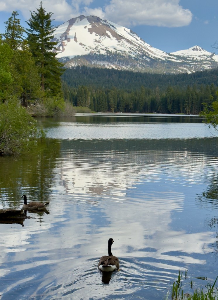
As I traveled further north I wanted to travel through Mount Lassen NP, but most of the roads were still closed with snow. But I did travel around it and found the northwest entrance open with Manzanita Lake right near the entrance. And what a treat it was because the water was relatively still and made for nice reflections of Mount Lassen.

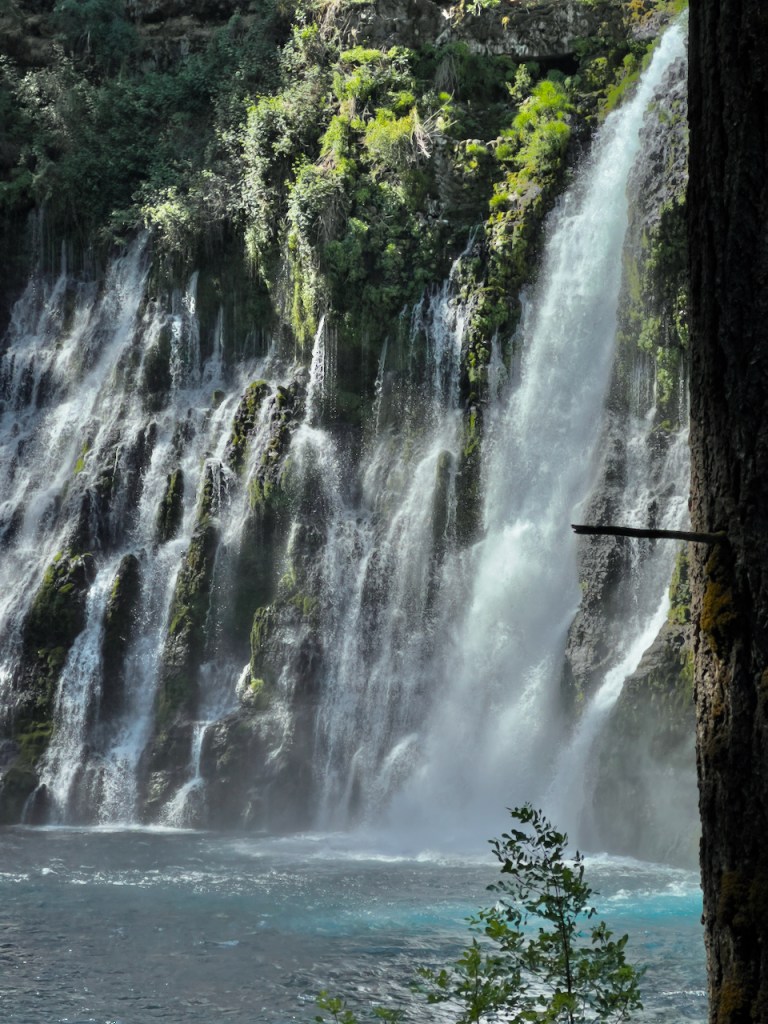
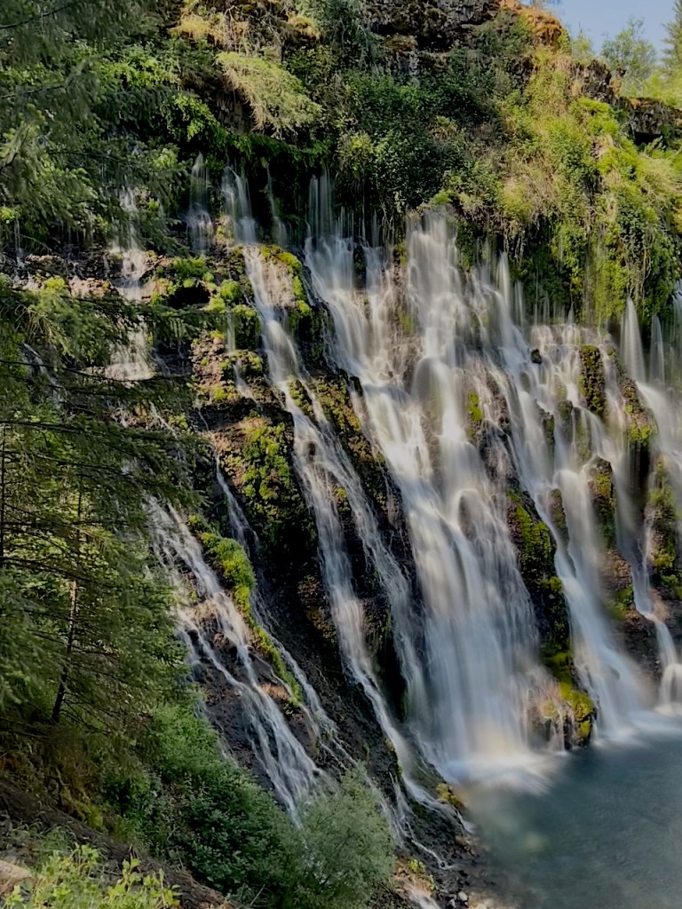
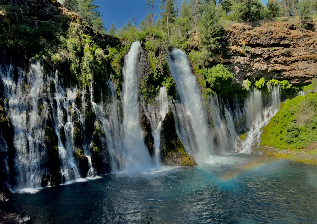
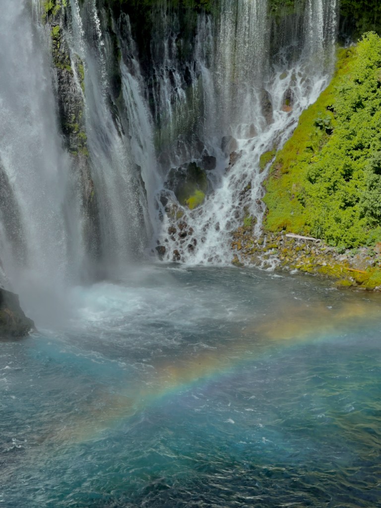
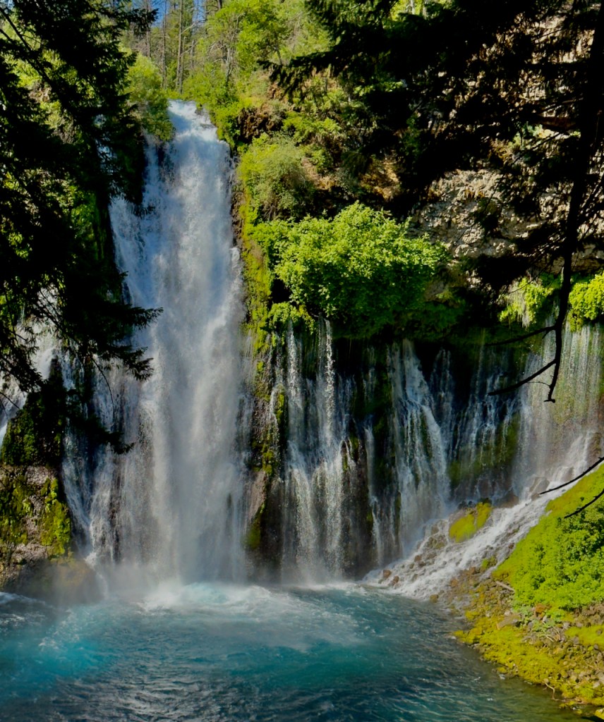
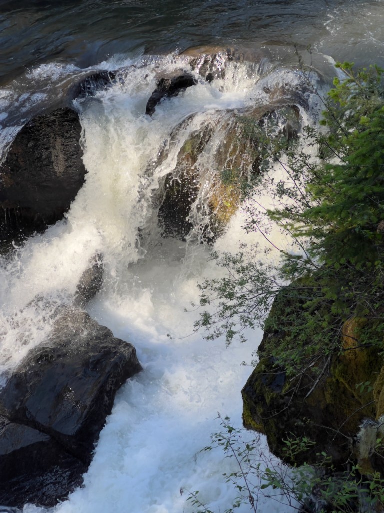
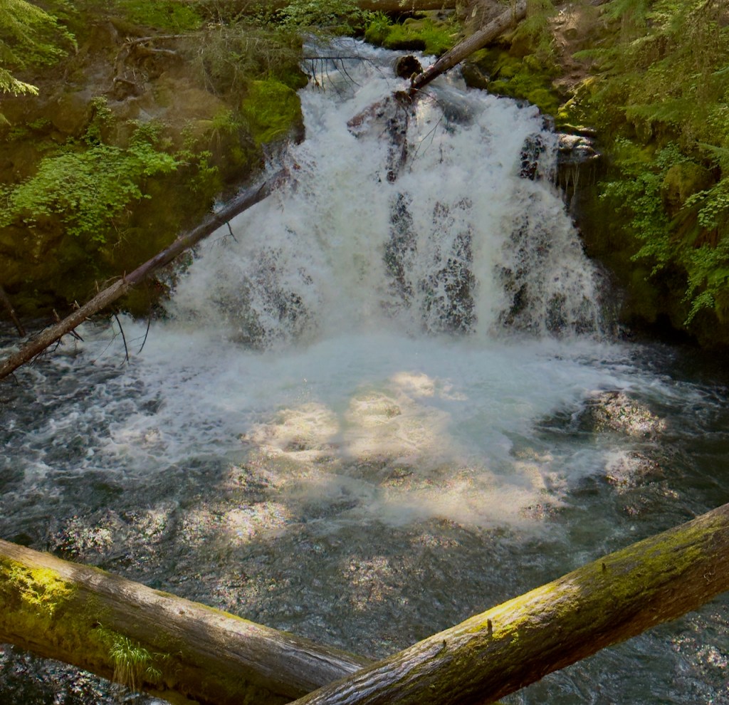
McArthur-Burney Falls or better know as just Burney Falls is 129 feet tall and is one of California’s most spectacular falls. The water (at a nearly constant 42 F) comes from underground springs both above and through the sides of the falls and the flow is nearly constant year around. You can see the water coming out of the layers of rock on the face of the falls.
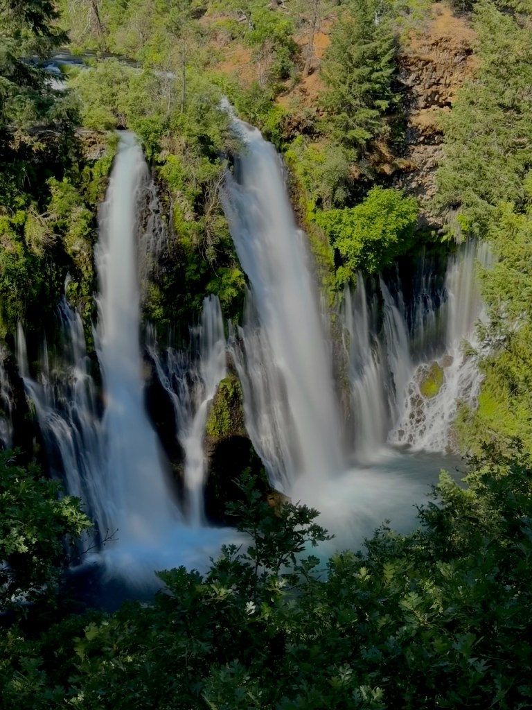

In the morning from the right spot on the walkway, the mist forms a rainbow.

As I leave Burney Falls there are views of Mount Shasta in various places. I stopped along the road to get this view.

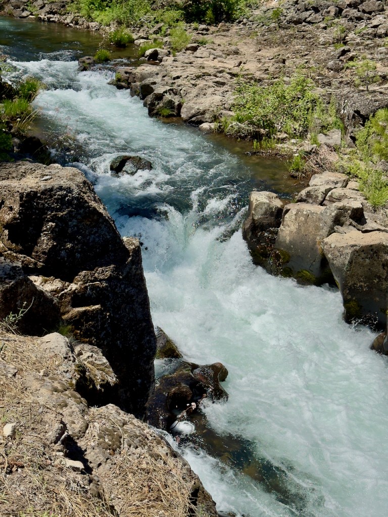
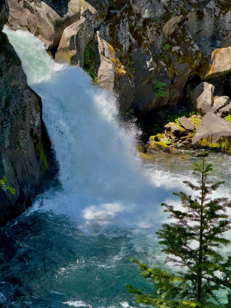
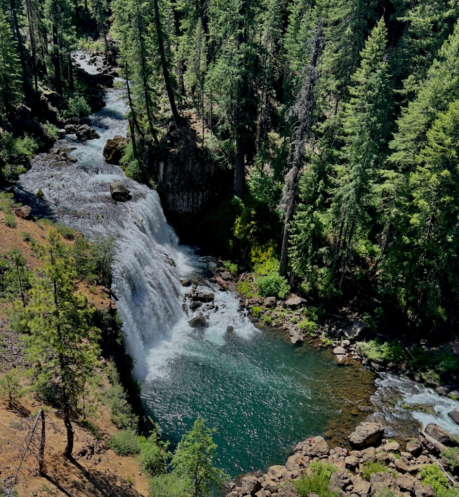
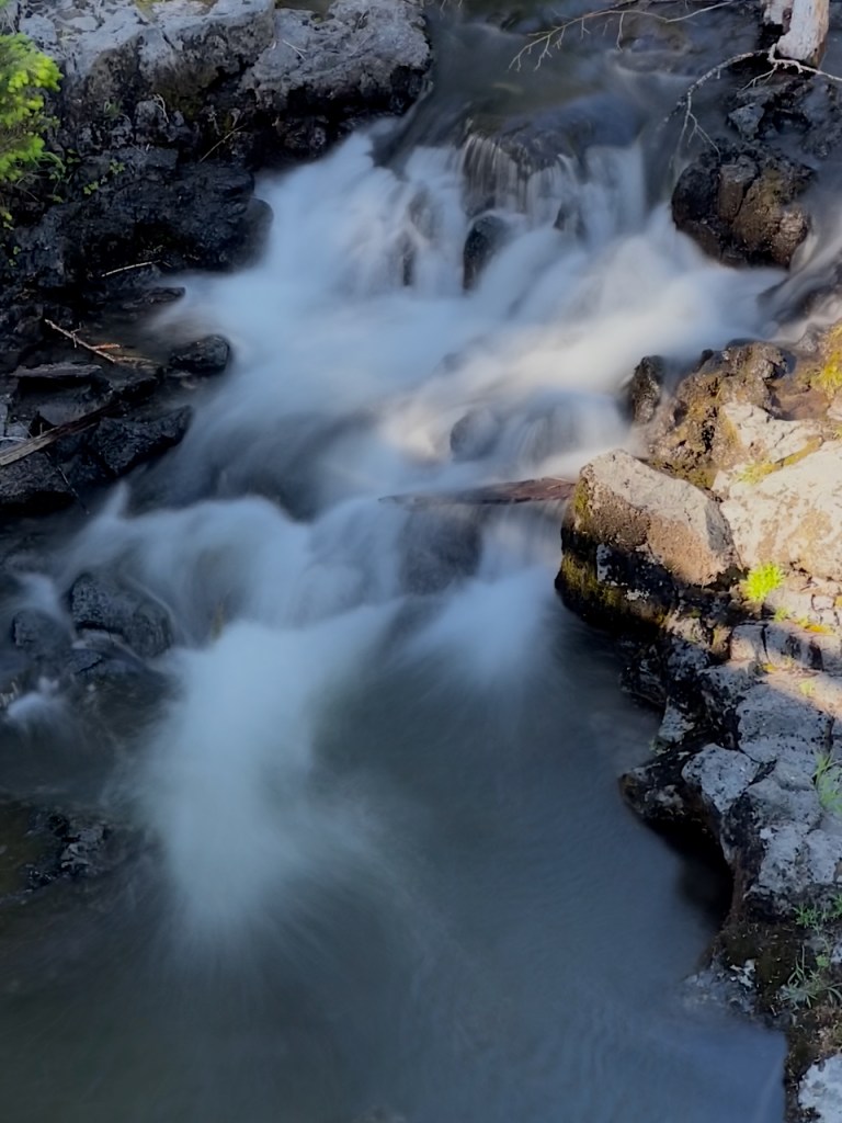
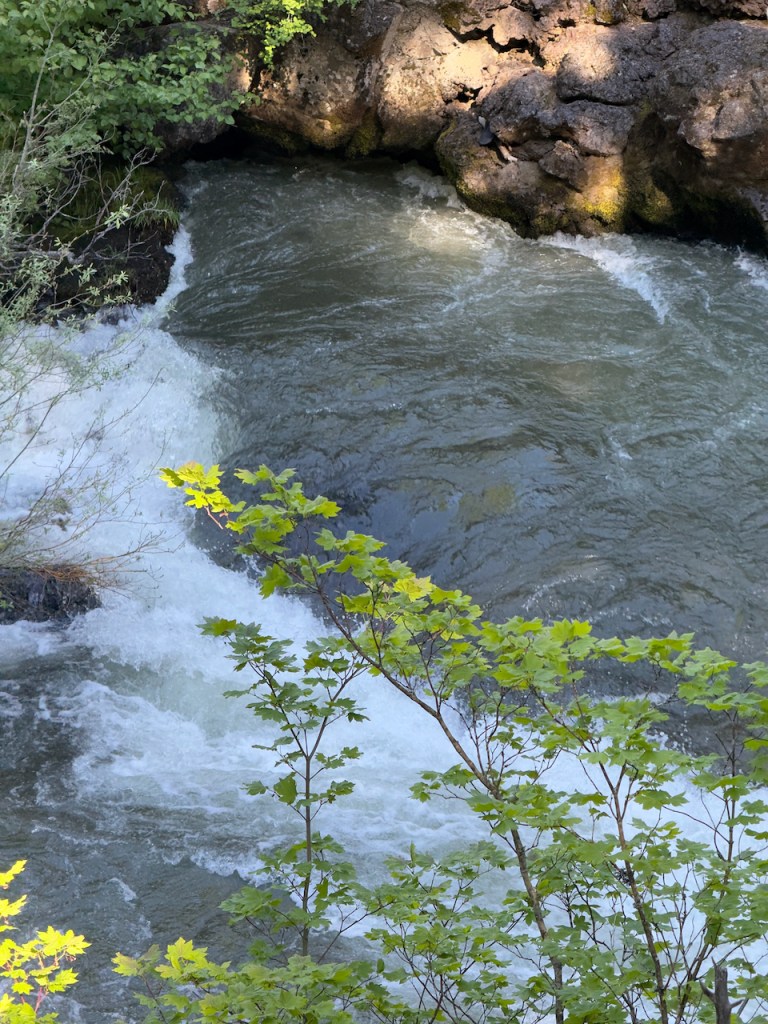
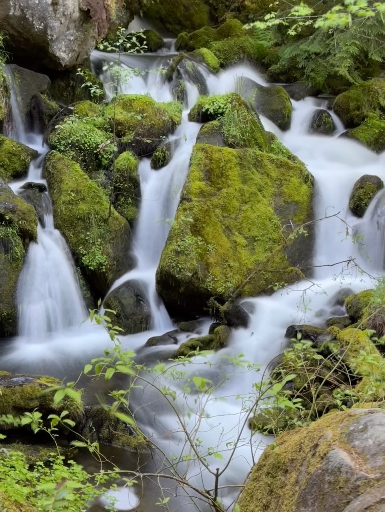
Further north near McCloud, CA is the McCloud River with three falls in close proximity. The first one is called the Upper Falls. The water is forced into a narrow gorge and makes a spectacular exit over the falls.

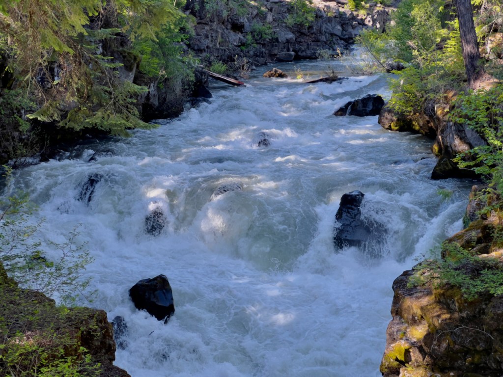
Next up is the Middle Falls which some say is the most impressive at 50 feet high.


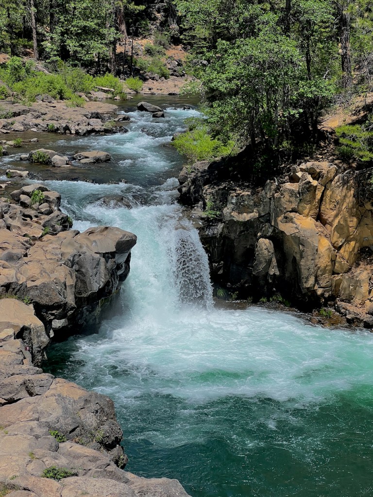
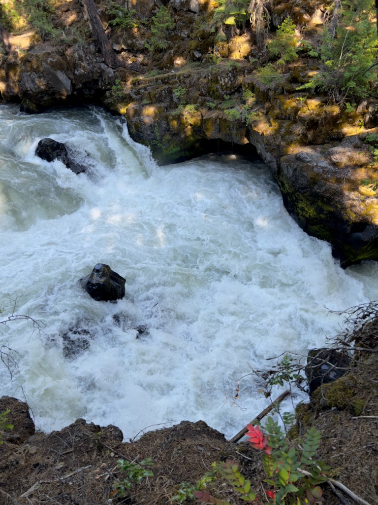
Finally there is the Lower Falls which falls over a 15 foot granite block.

Next I follow the scenic byway route alongside the Rougue River in Oregon which is a drainage for the Crater Lake volcano. There are quite a few small bridges with cataract waterfalls near the route.
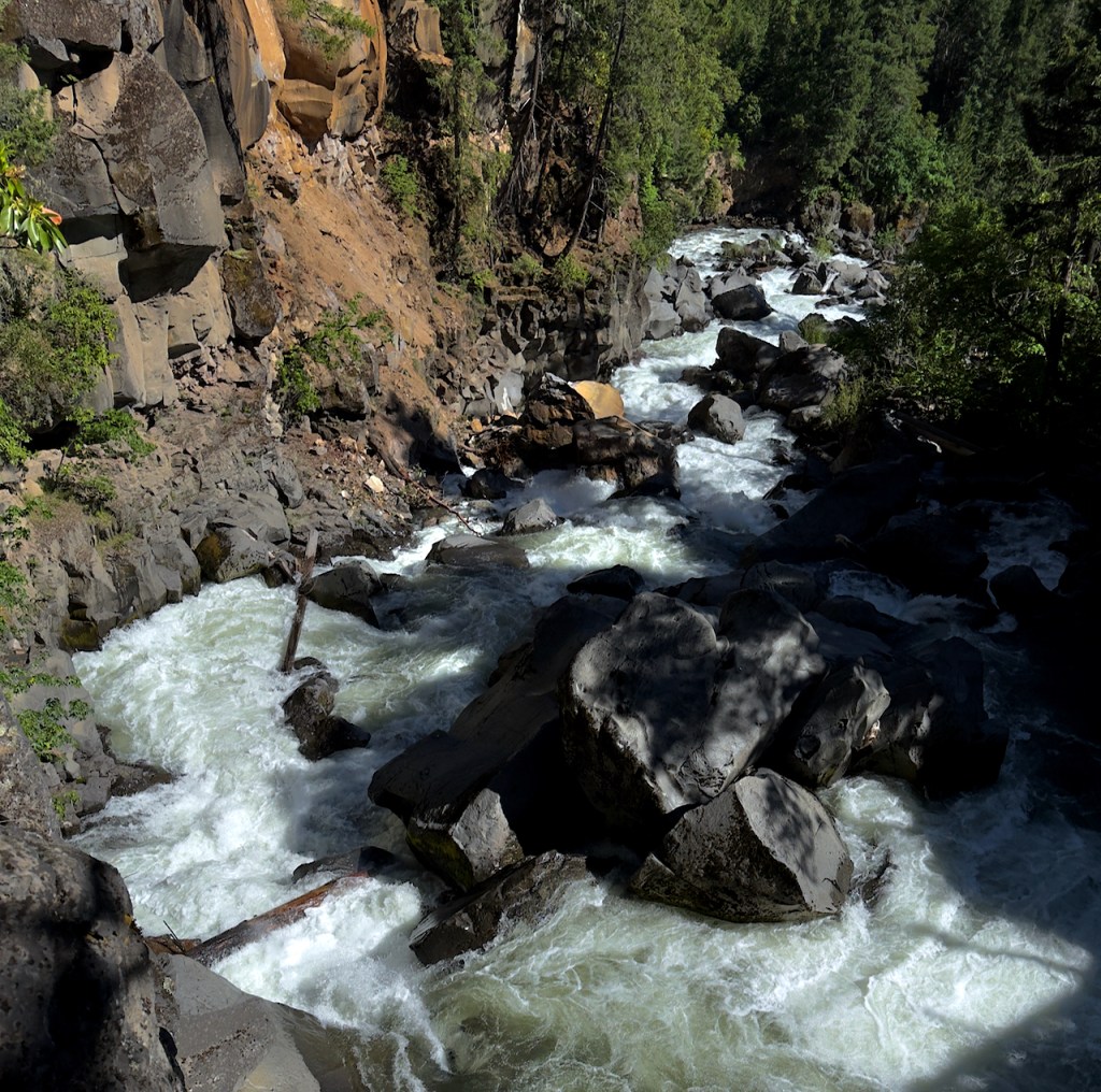

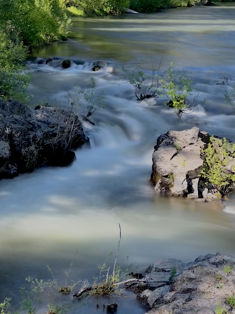
In one location named the Rogue River Gorge, the river is squeezed into a narrow gorge. The are many explanatory signs which describe how the river sometime goes under “ground” into lava tubes and then reemerges but these are hard to discern. The third and fourth photos show an entrance and an exit.


Near the source of the Rogue River is Crater Lake which I did not go to since I had been there in 2021. I stayed at Diamond Lake. This is a nice reflection view of Mount Bailey on Diamond Lake.

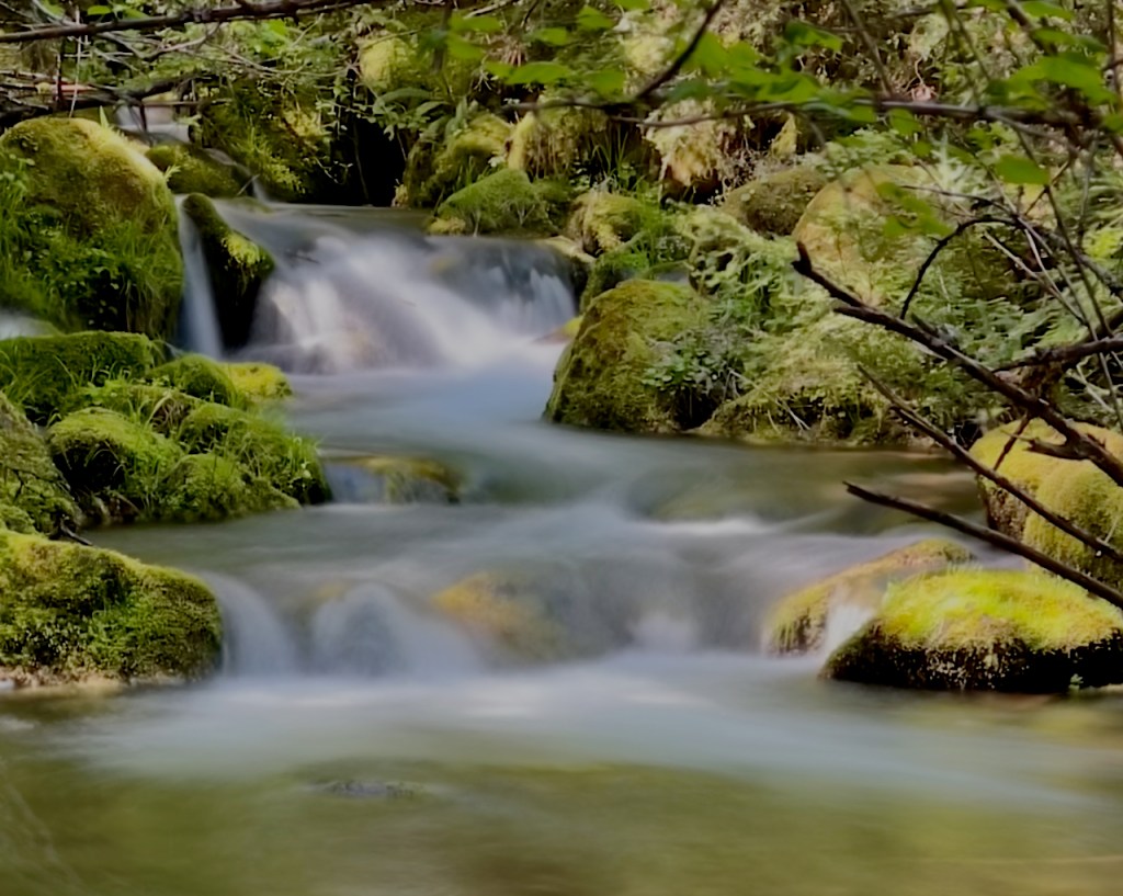
The next morning I visited four waterfalls along state route 138 part of the Rogue Rive scenic byway. The first is Clearwater Falls.


Below the falls there are a lot of green moss covered rocks which I think make interesting photos.
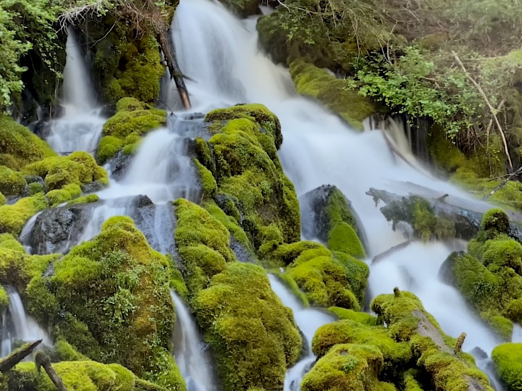
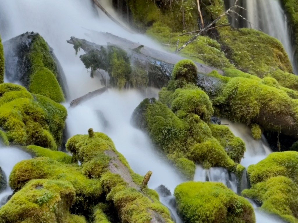
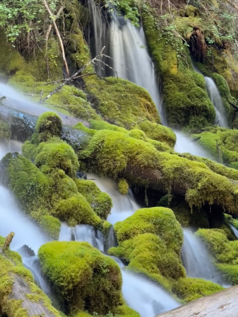

The next waterfall is Whitehorse Falls which also had nice moss covered rocks.


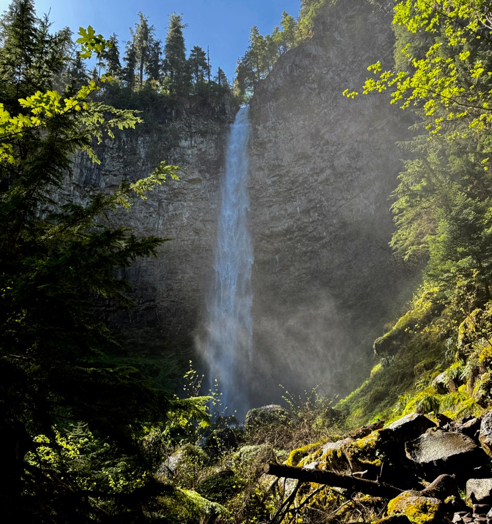
Watson falls had a long (difficult for me) mile long round trip trail (the guides said “easy” hike). It is the third tallest waterfall in Oregon at 272 feet.

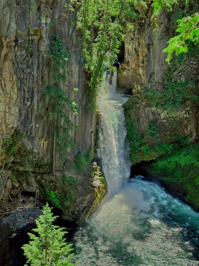
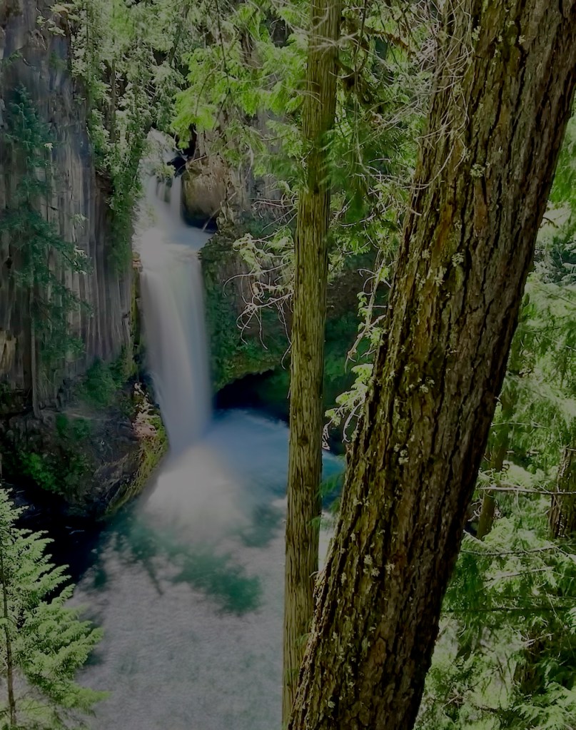
The final falls that I went to is Toketee Falls, with again a mile round trip hike that had nothing of interest, except trees, along the way since the trail was far away from the river. It had many up and down steps and stairs in both directions. Eventually you come to a viewing platform and that’s it!! There is a smaller falls upstream but you cannot get a good view of it. It does have interesting basalt volcanic columns along the sides.
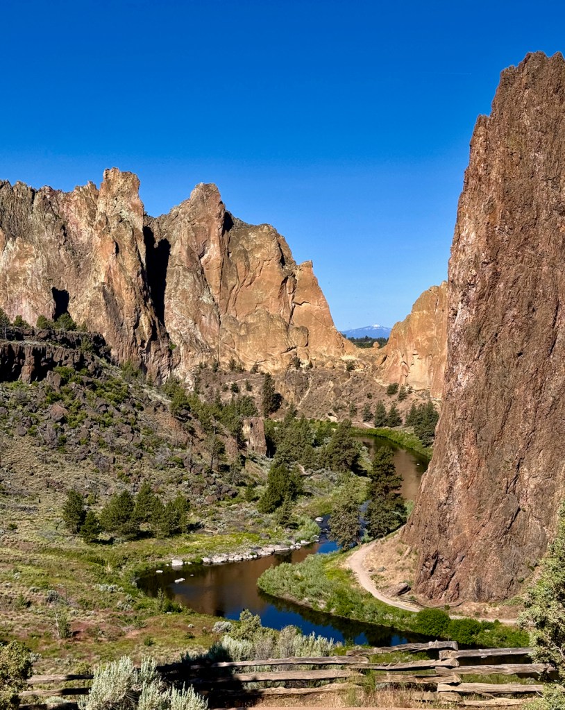
The next day I headed east in Oregon and visited Smith Rock State Park near Redmond. It is sort of an anomaly for these rocks to jut out of the plains. It is a good hiking and rock climbers area.


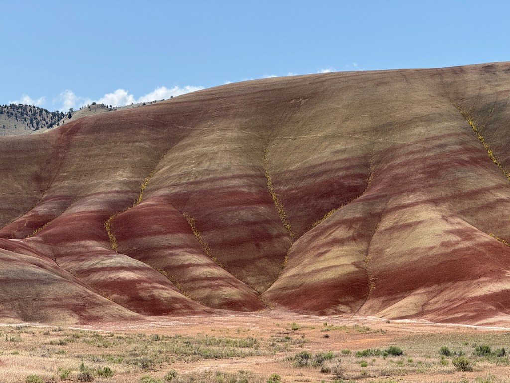
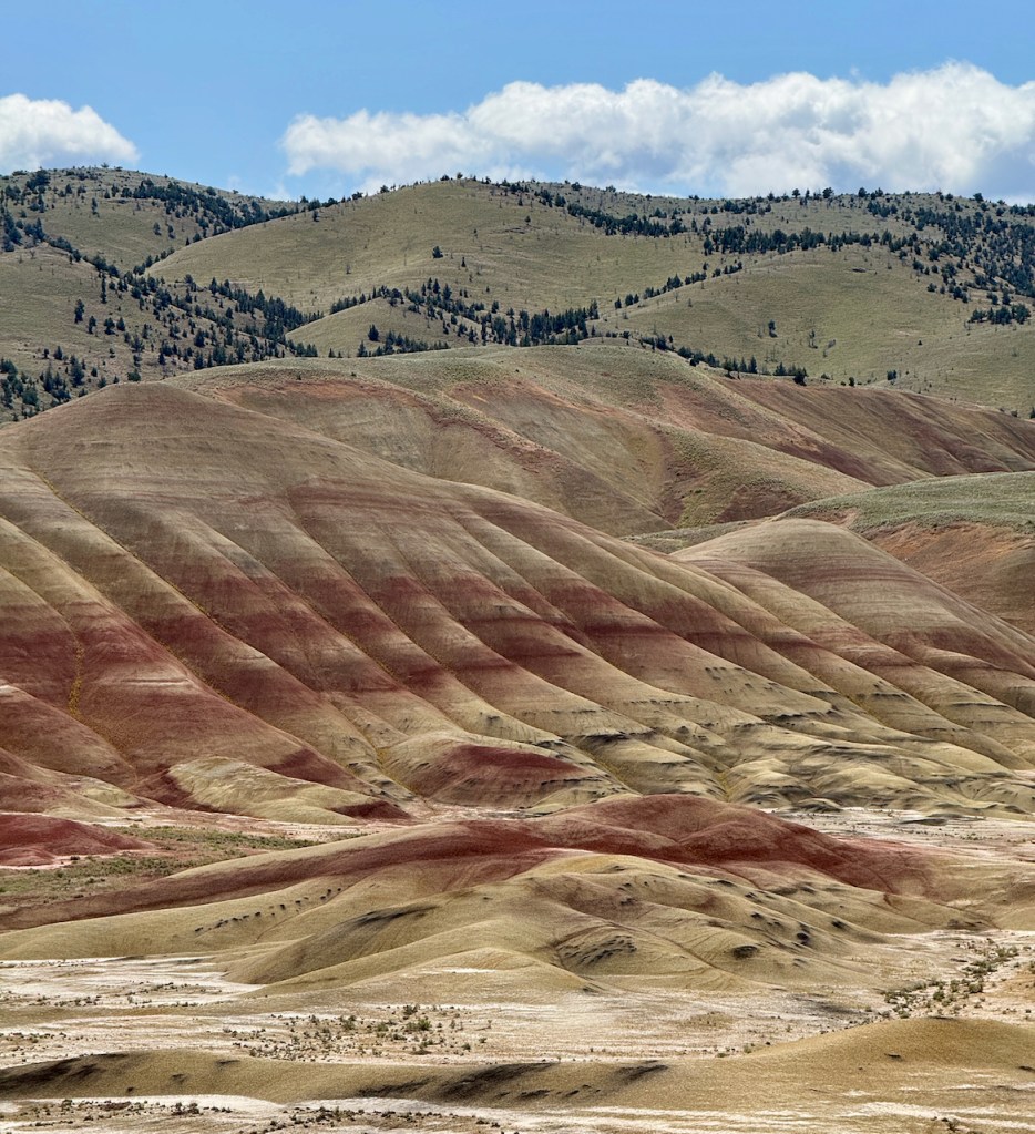
There are several areas in the John Day Fossil Bed NP. One of them is the Painted Hills and you can see why they are called that.
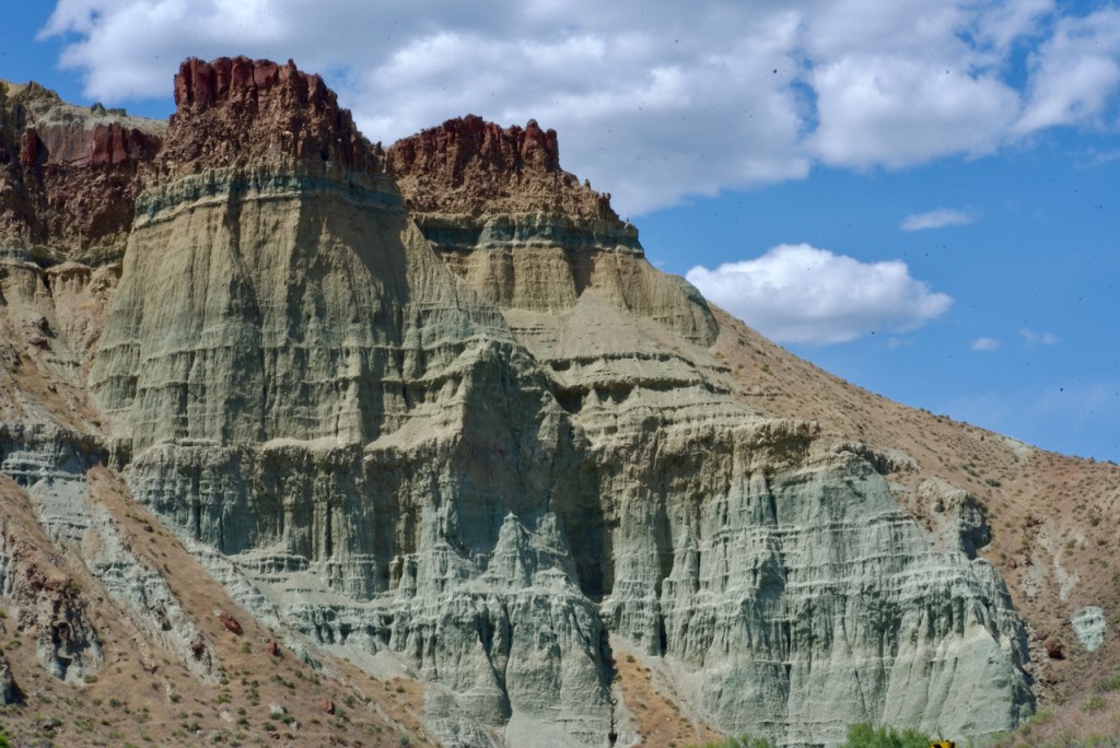
There is also a section called Castle Rock with multi colored sand stone.
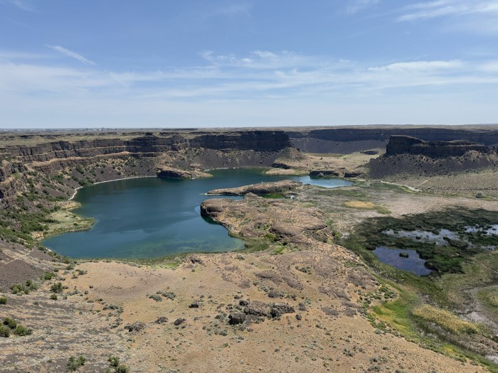
In eastern Washington there is an area called Dry Falls. Dry Falls in Washington is a geological wonder that was once the largest waterfall on Earth, but is now a dry, 3.5-mile-long cliff. It formed nearly twenty thousand years ago during a series of flooding events after the ice sheets melted. In Idaho massive ice dams formed with huge lakes behind them. When the ice dams broke there were tremendous floods. It is estimated that the amount of water was 10 times the flow of all the current rivers of the world. More in Wikipedia.
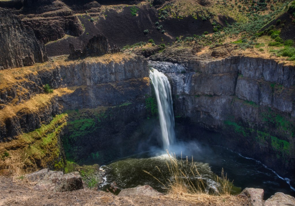
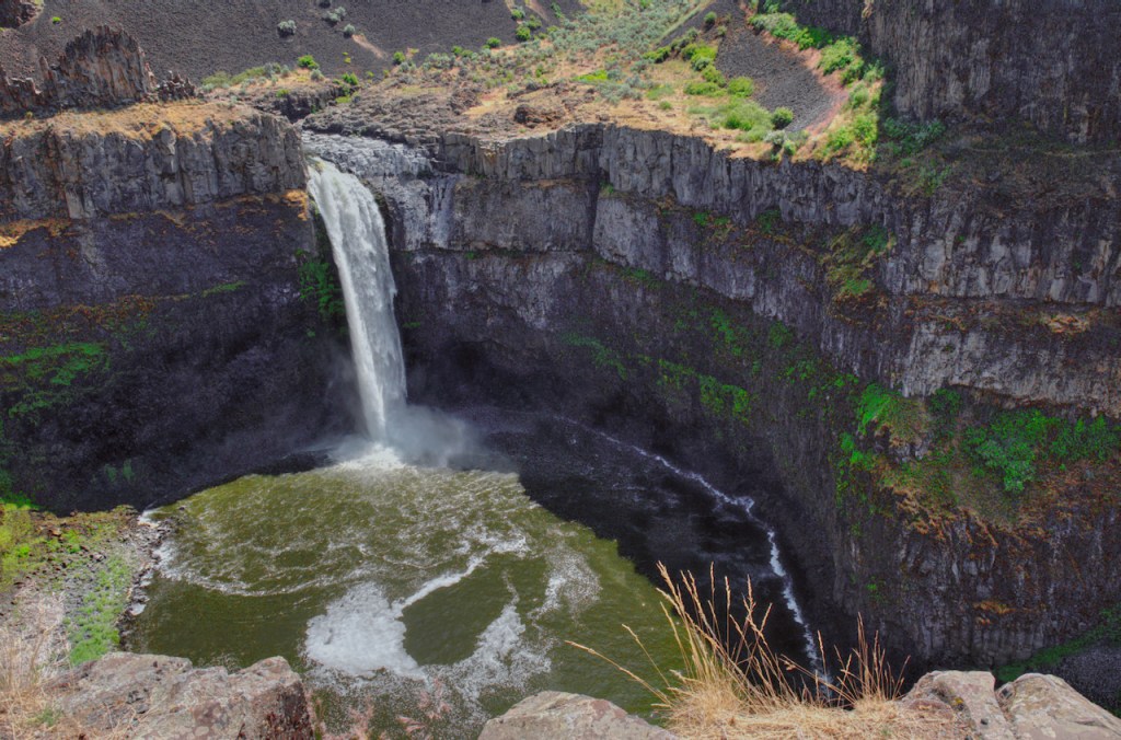
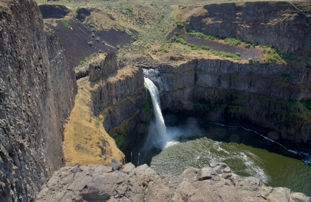
Further east as part of this system created at the same time as Dry Falls is the Palouse River Falls. I had to be very careful here as there is an 800 foot drop with no railings on the edge.


You took some amazing pictures of the lakes and waterfalls. I haven’t been to any of those despite residing in Oregon, someday we will make it there… But if not at least you showed us the beauty of each one of the amazing destinations in California and Oregon. Thank you!
Beautiful pictures Charles!
Absolutely spectacular photography! Well done!
stunning, as always !
Now there’s a batch that’s REALLY hard to choose from. I guess I’d have to go with the shots of Lassen and reflection – truly great. But … the “keyhole” photos are also wonderful. AND THEN, the waterfall pics with rainbow – wow!
You really need to submit some stuff to AZ Highways. The worse they can do is not use them, but you don’t know until you try. RIGHT?
Beautiful!
Wow! I really enjoyed all the photos of the waterfalls. Did not take any during my 10 years in CA.