March 5-12, 2025
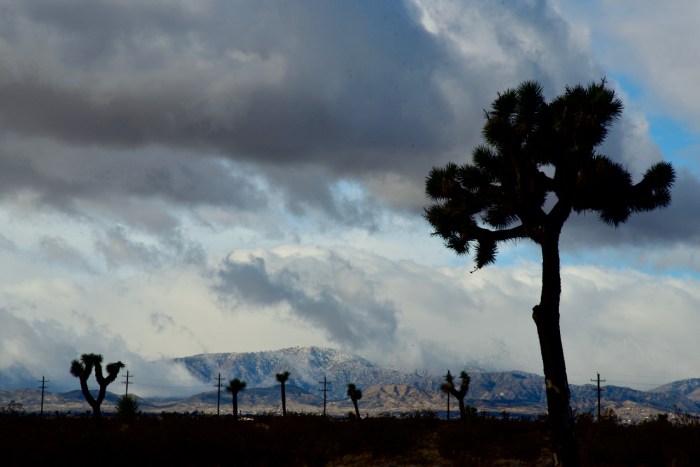
This is a trip to Santa Barbara and up the coast on Highway 1 as far as Ragged Point. The road is closed further north due to landslides. The first photo is of cloud formations on the north side of Joshua Tree National Park.
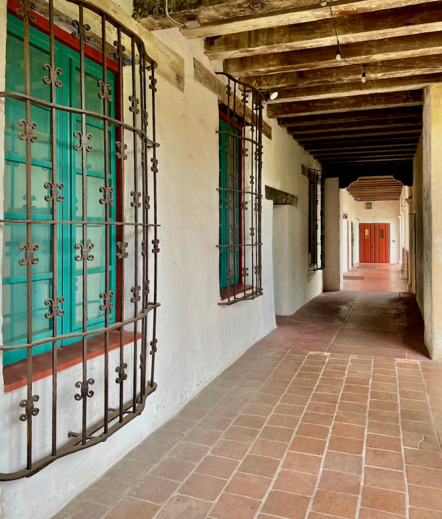
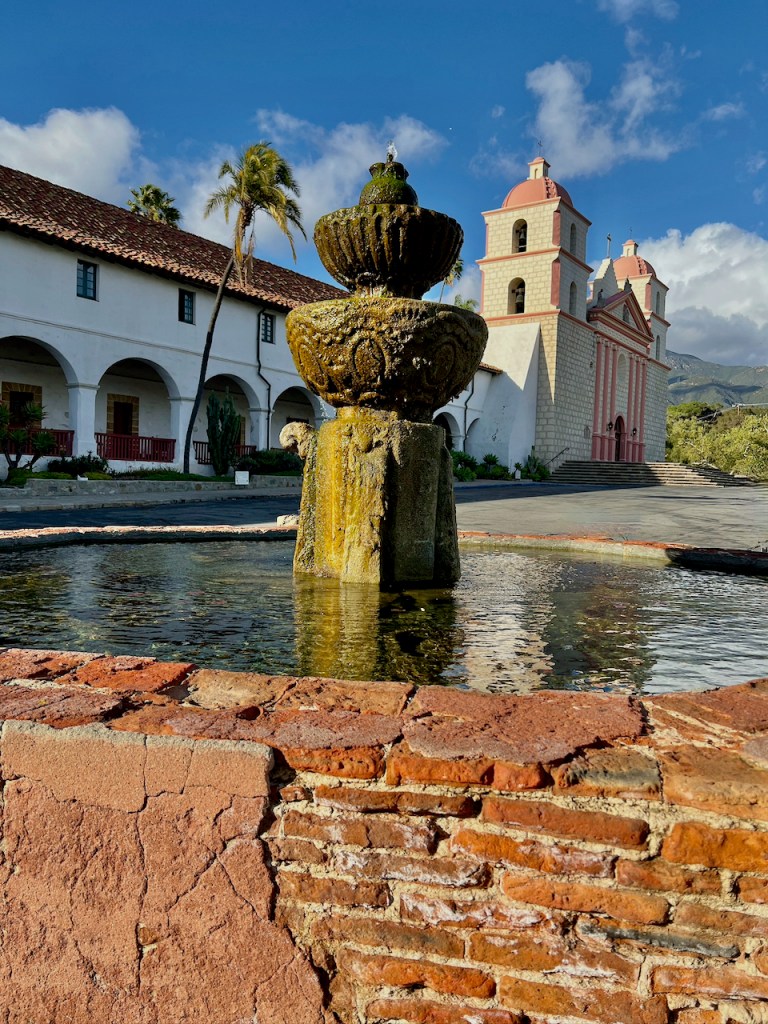
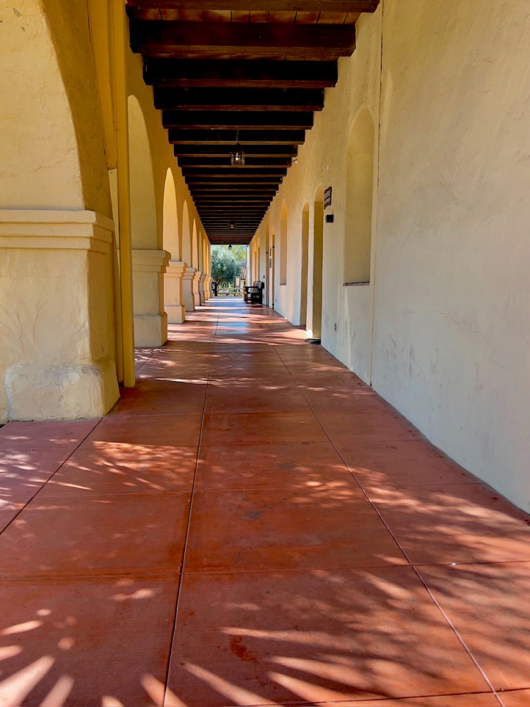
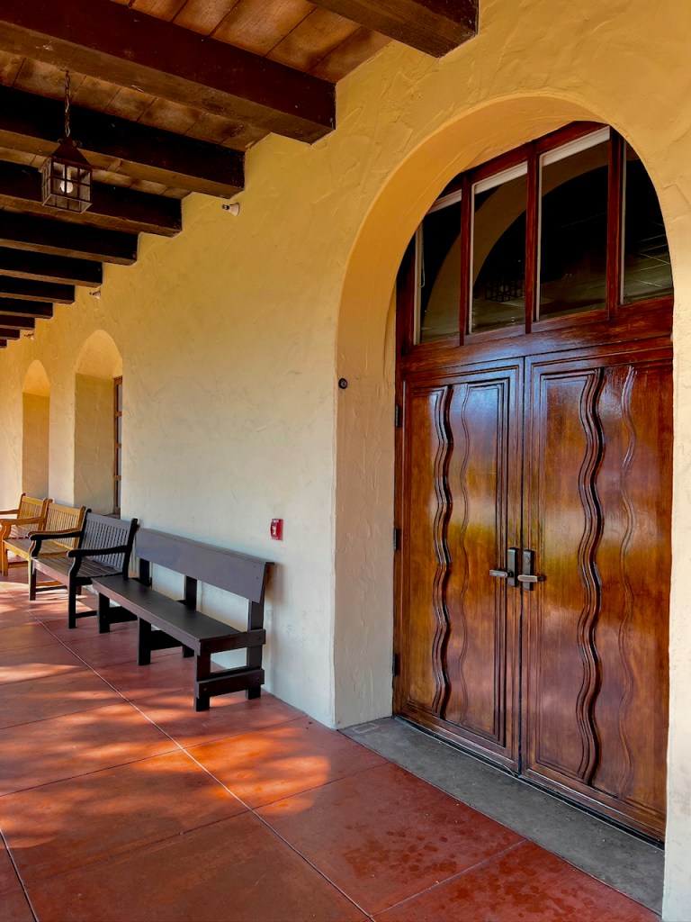
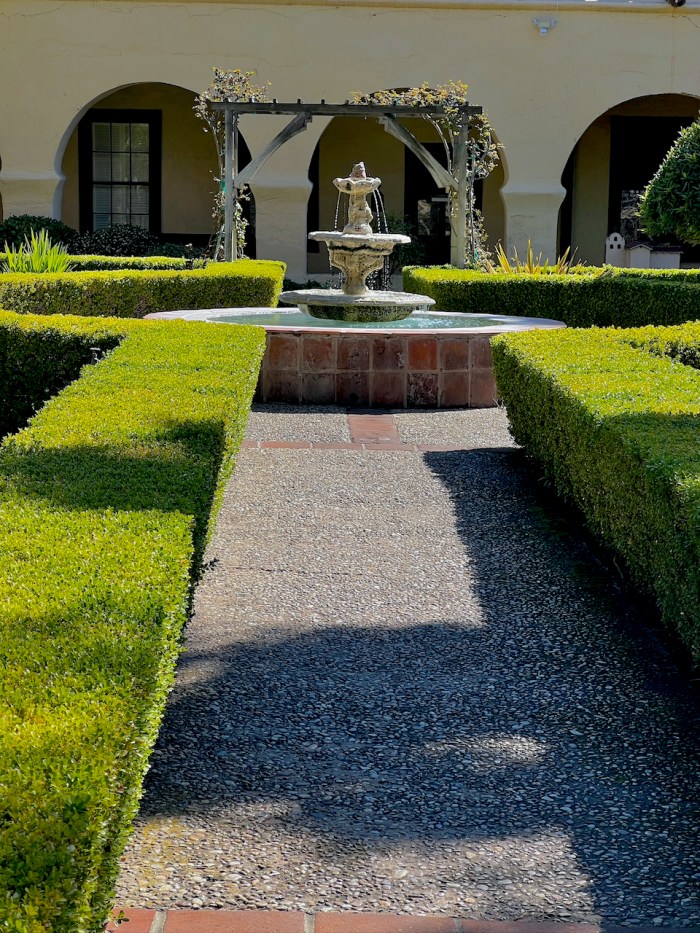
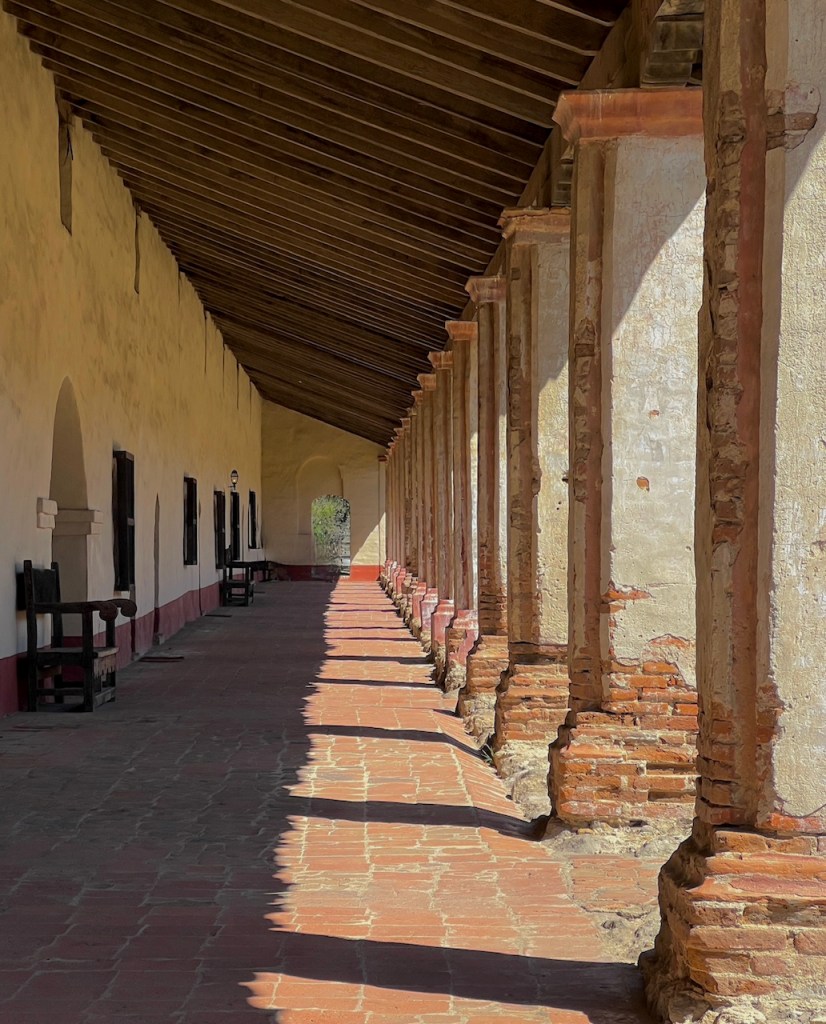
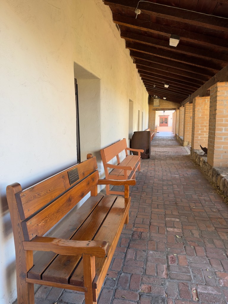
In Santa Barbara, I visited the old Spanish Mission. “Mission Santa Barbara (Spanish: Misión de Santa Bárbara) is a Spanish mission in Santa Barbara, California, United States. Often referred to as the ‘Queen of the Missions’, it was founded by Padre Fermín Lasuén for the Franciscan order on December 4, 1786, the feast day of Saint Barbara, as the tenth mission of what would later become 21 missions in Alta California.” Wikipedia. More information is in Wikipedia. I will visit four missions on this trip. The Spanish established the string of missions to support their claim for the territory of California. They tried to Christianize the natives, but also enslaved them to build the missions and to take care of large herds of cattle, horses and sheep.
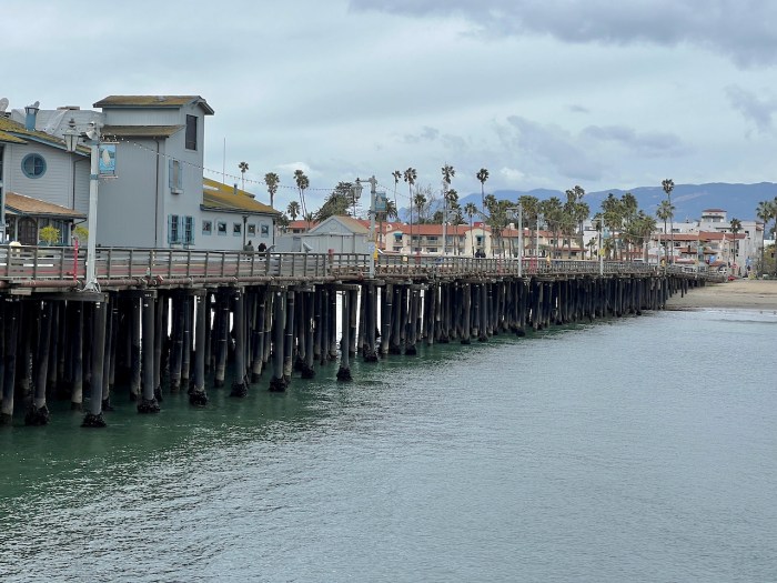
Santa Barbara has Stearns Wharf that you can drive onto with many restaurants, shops and an aquarium which I visited.
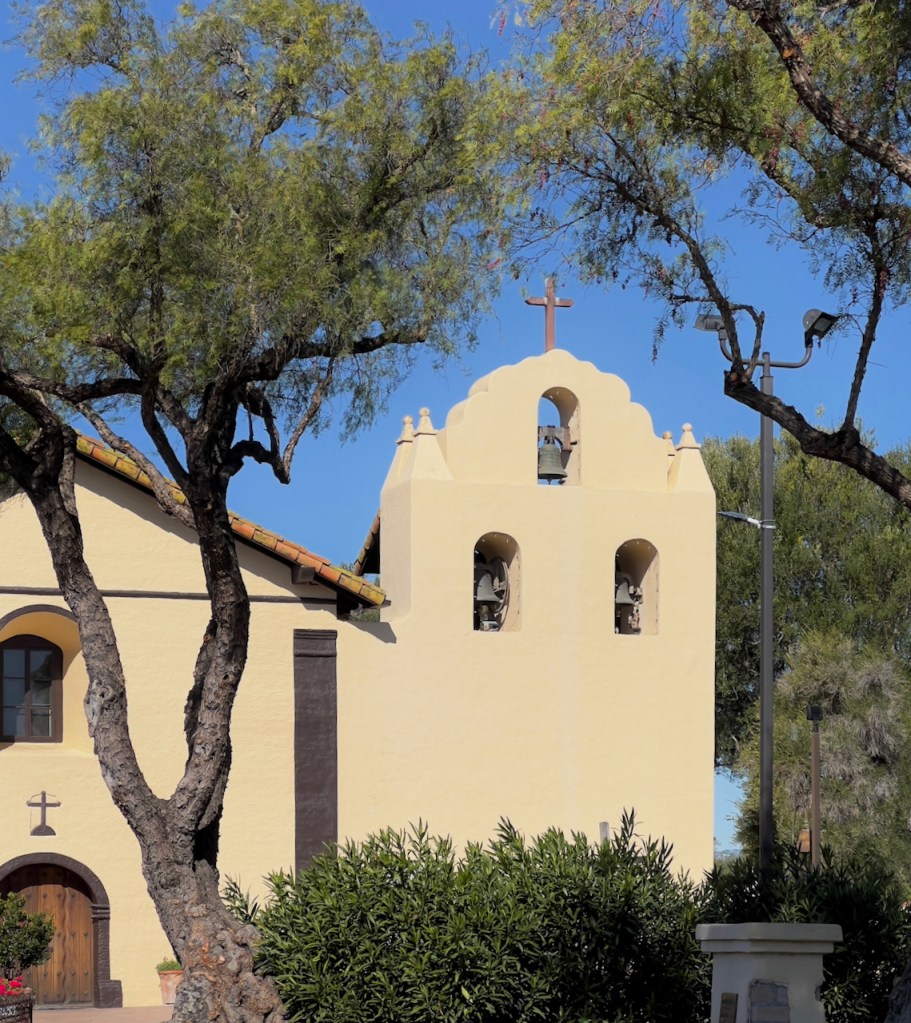
The next stop was at the Santa Ines Mission in Solvang.
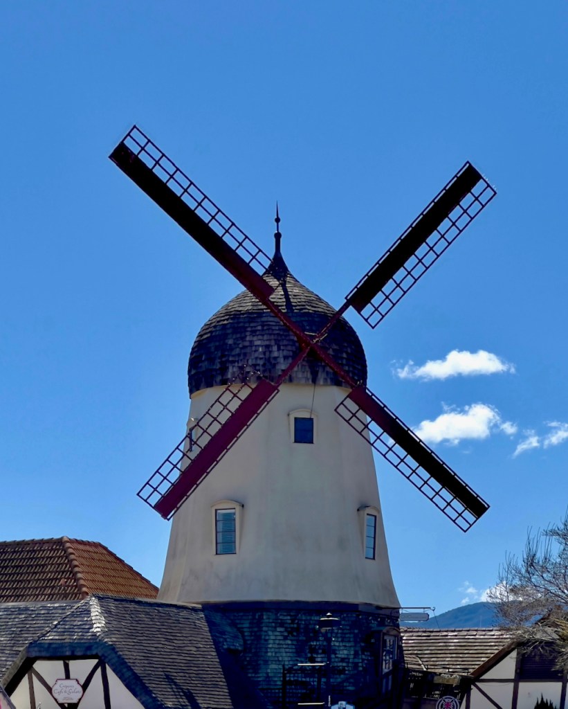
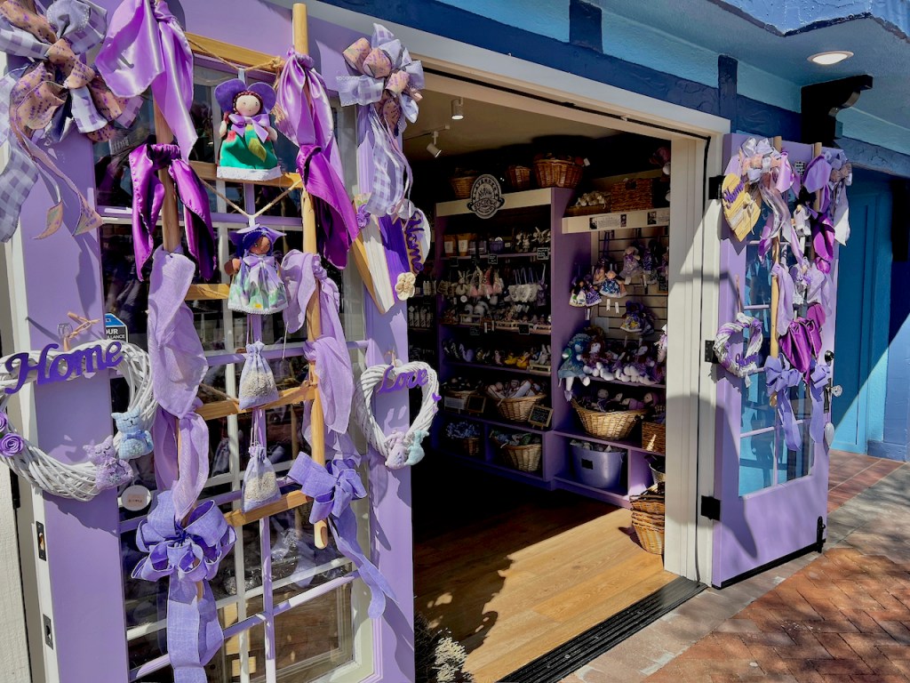
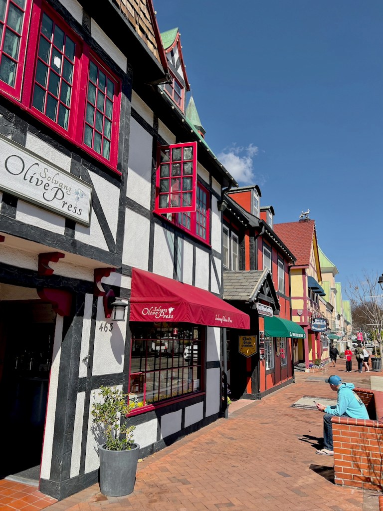
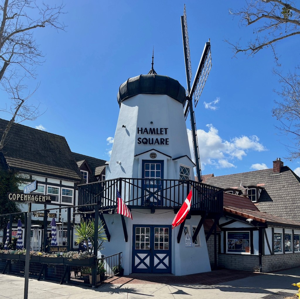
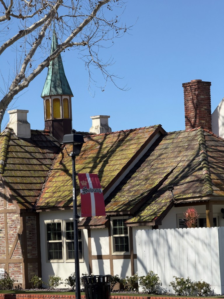
Solvang is a fairly large tourist town with Danish decor and architecture. It has many restaurants, bakeries, chocolate stores, and of course lots of tourist gift shops on 10-12 square blocks.
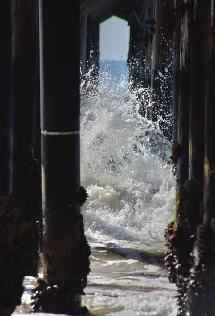
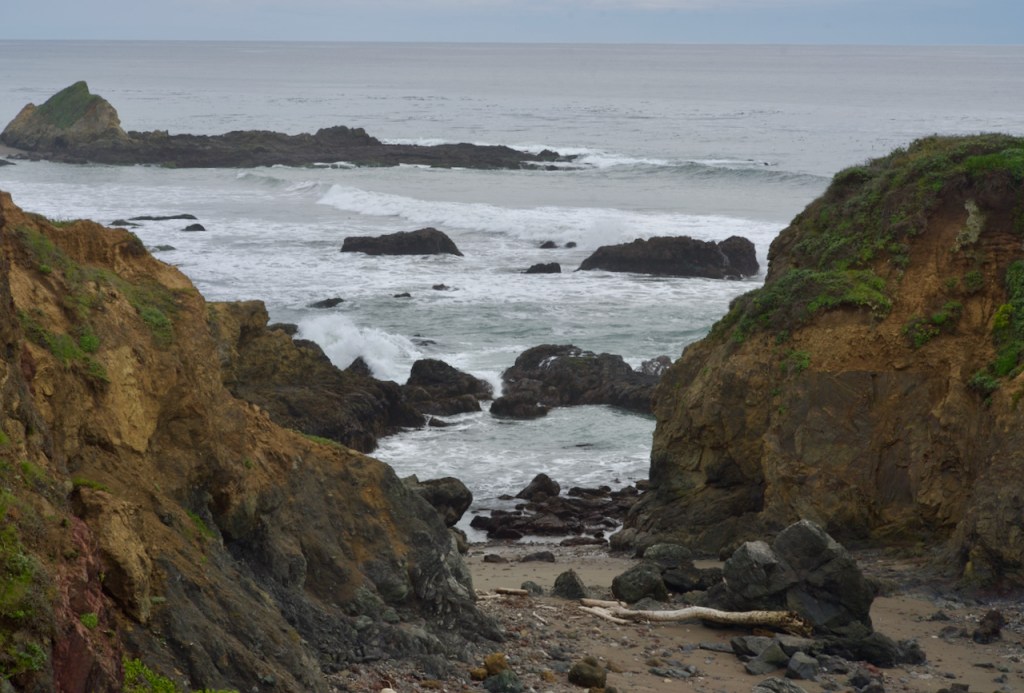
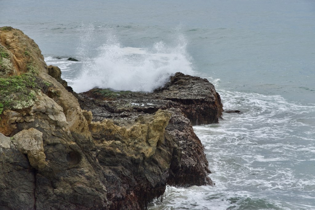
At the pier at Gaviota Beach, it was fun to see the waves crashing into the pilings.
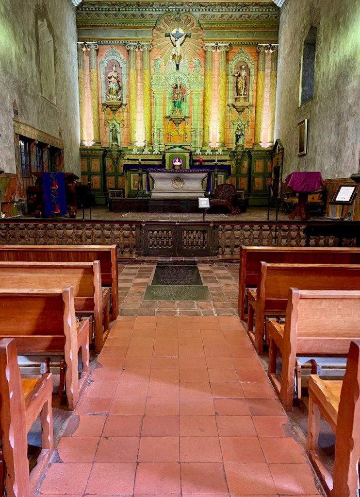
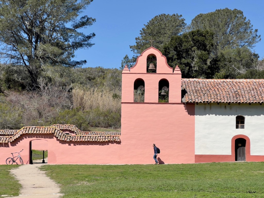
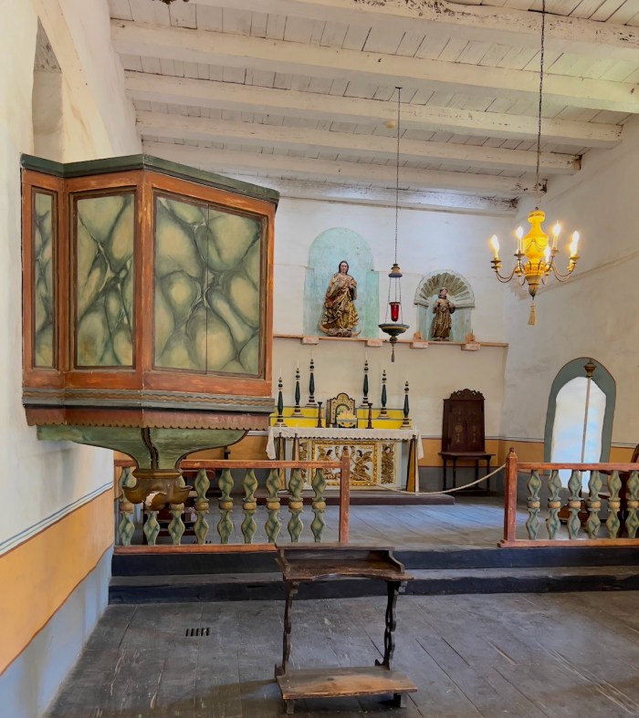
Close to Lompoc is the best preserved and rebuilt mission that is a state park. They started restorations in the 1930s and continued into the 1950s. Many rooms were open which showed various aspects of life and workings of the mission. Founded in 1787, the La Purisima Mission land holdings once covered nearly 470 square miles. Bordered by the Santa Maria River in the North and the Gaviota coastline in the South, the land was home to the Chumash people and Spanish settlers. The mission was best known for its hides and blankets, and at its peak inhabitants herded as many as 24,000 cattle and sheep.
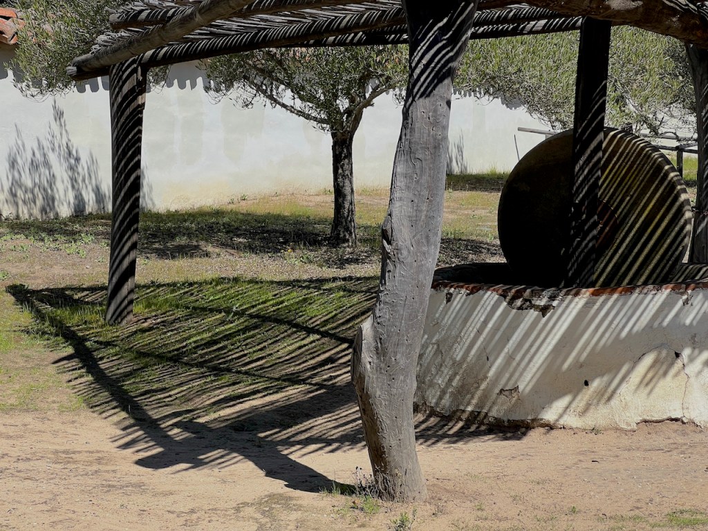
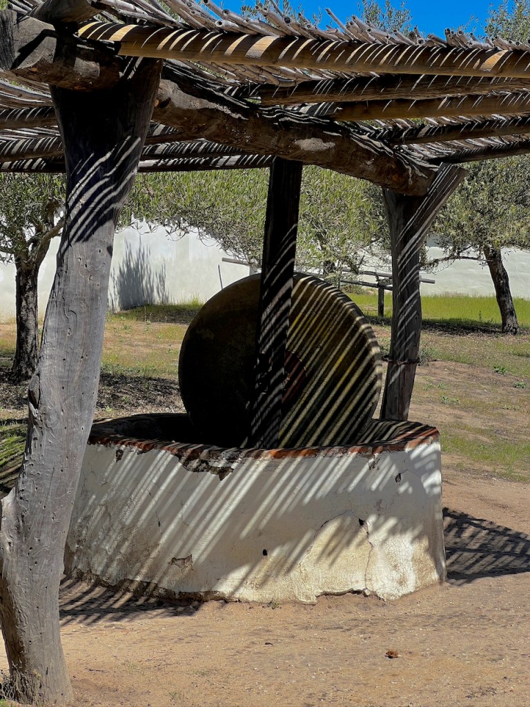
I was especially intrigued by the shadows cast on a large grinding stone under a lattice shelter.
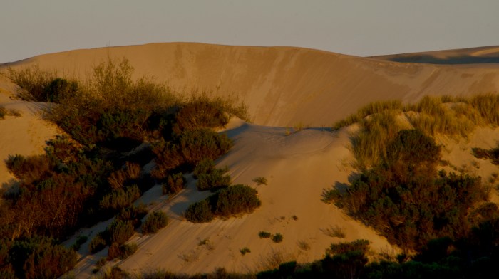
I stayed at a RV park very close to the beach with sand dunes. This is an early morning photo with nice golden light.
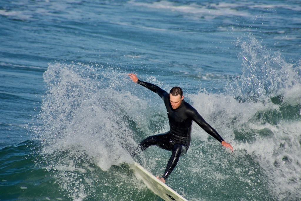
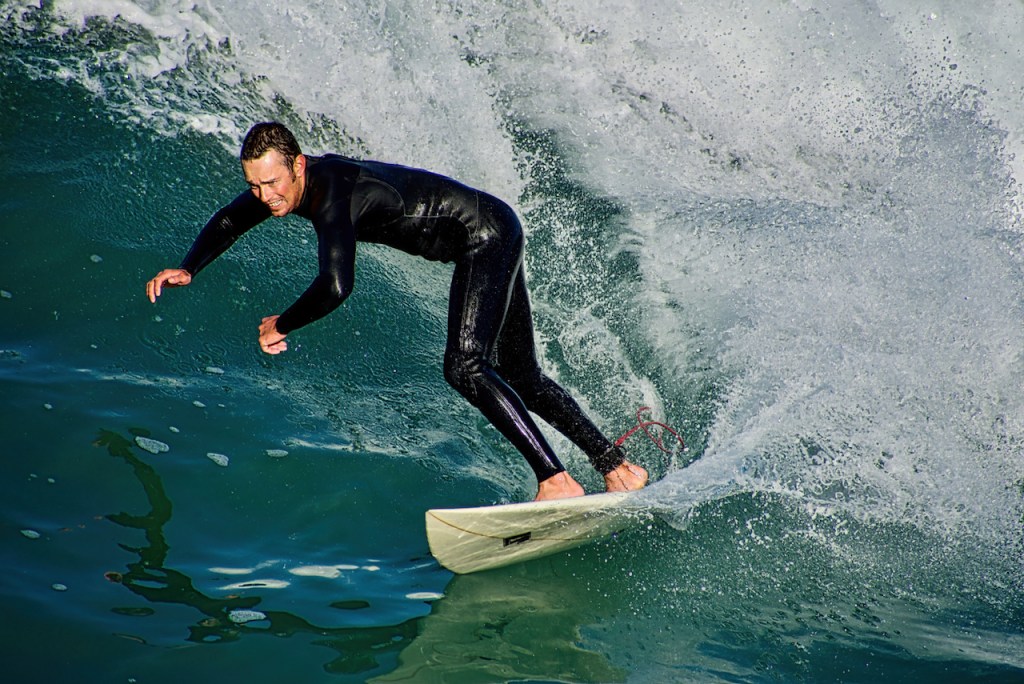
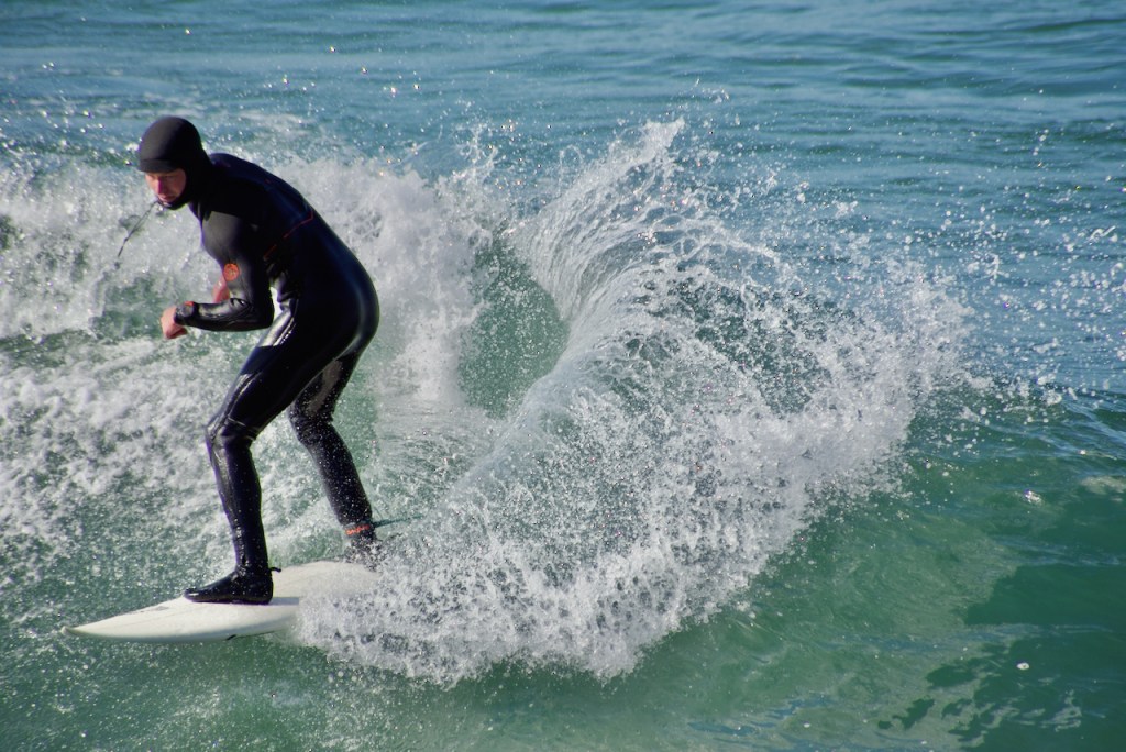
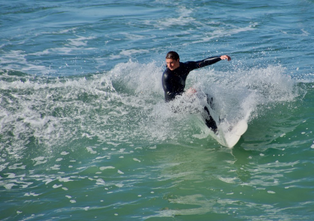
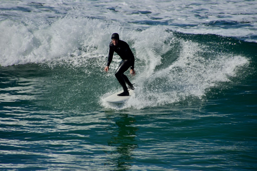
The following morning I went to the Pismo Beach Pier where many guys were surfing in wet suits. Many photos later, this is just a sample.
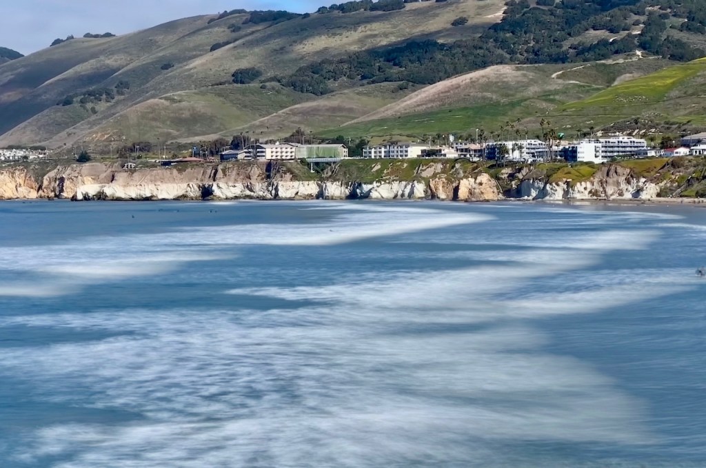
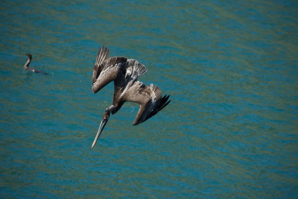
Then up the coast a little further is Avila Beach. Here, rather than surfers, I was pleasantly surprised to find 50-60 brown pelicans circling and then diving into the ocean to catch fish.
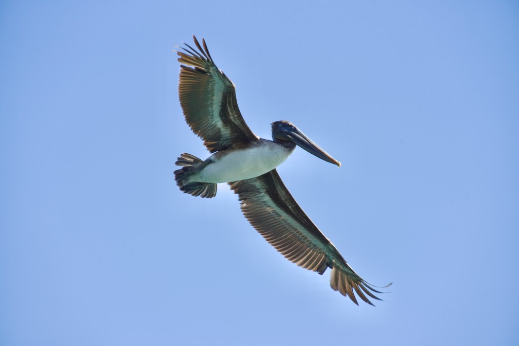
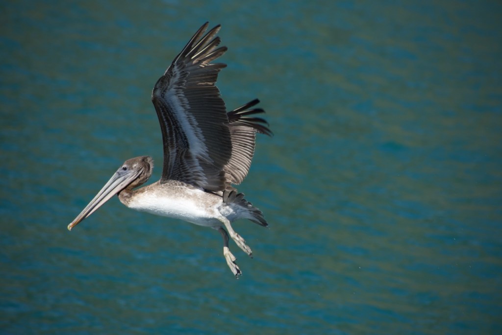
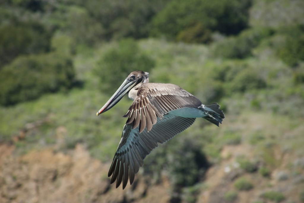
It took me quite a few attempts to try to track the fast diving birds to take photos, but I finally managed to get quite a few shots.
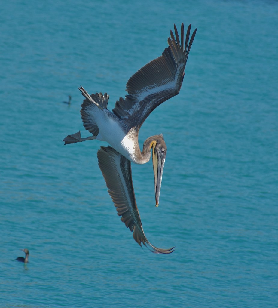
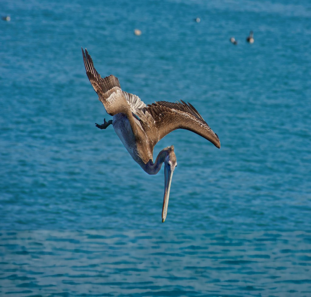
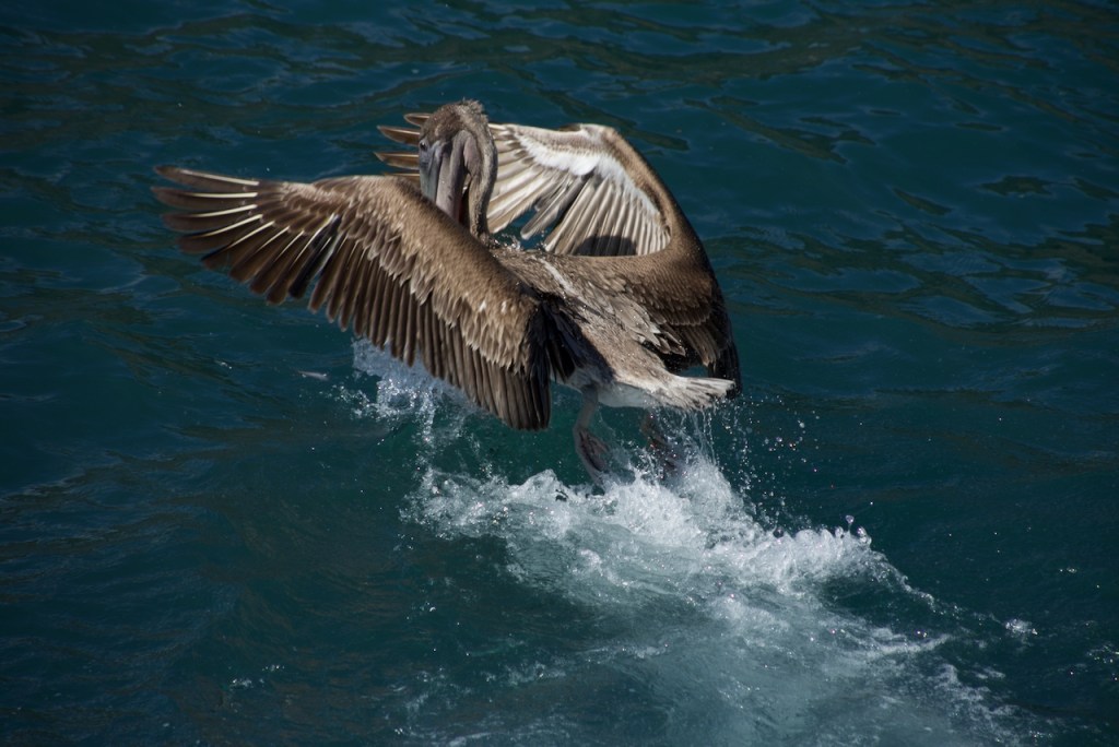
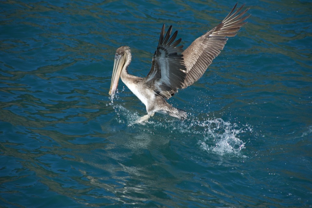
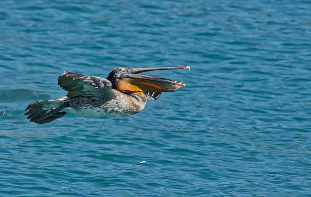
After the dives they came up with their pouches full of water and maybe some small fish. At any rate I did not see any large fish in their pouches.

The final mission that I saw is in San Luis Obispo, but they were having a service, so I did not see much of it.
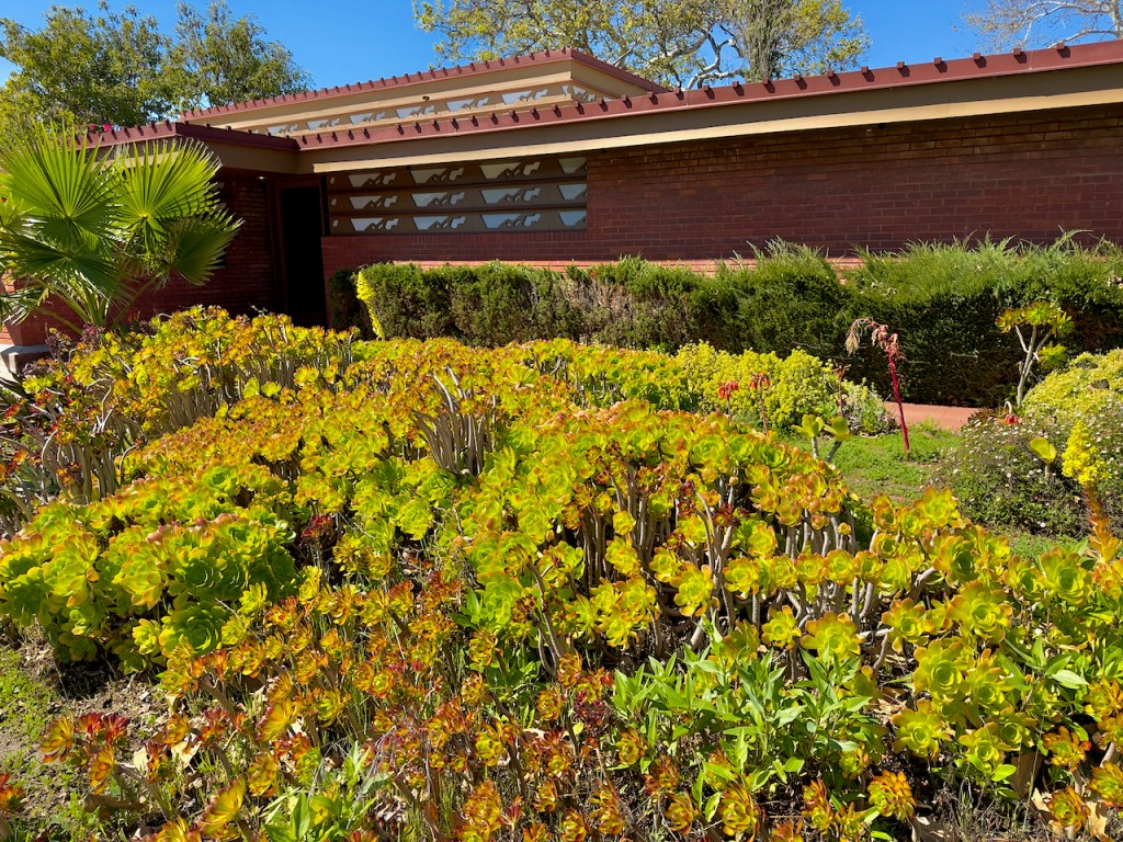
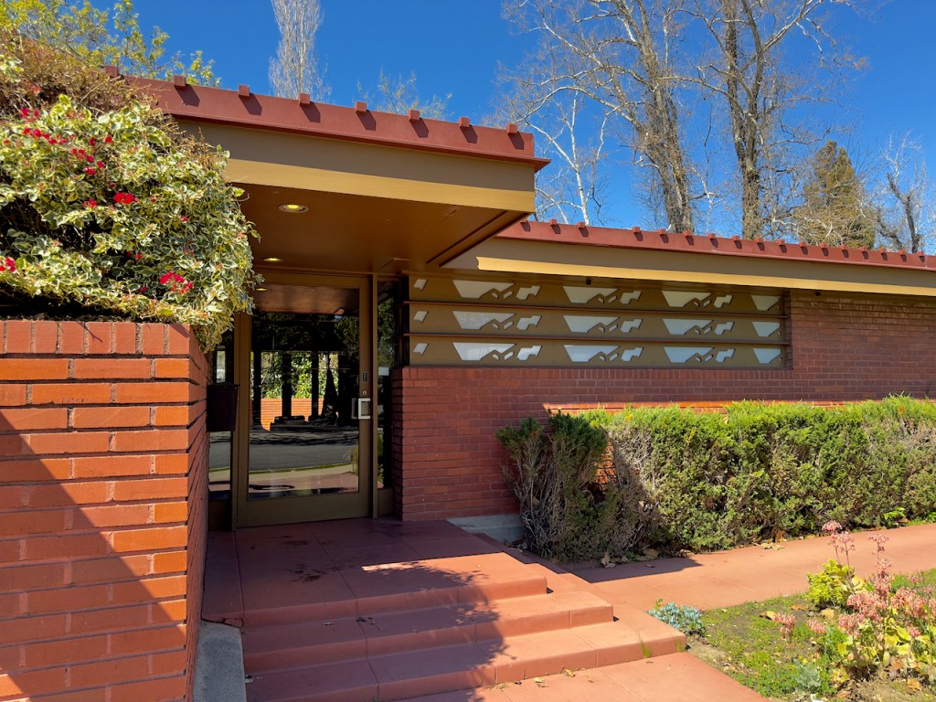
But I did find a Frank Lloyd Wright office building – the Kundert Medical Clinic. The shapes in the windows evoke repeating squiggles that are actually the outlines of the Seven Sisters, the craggy volcanic peaks that define the San Luis Obispo County skyline.

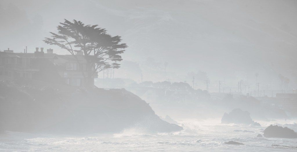
Early morning fog along the coast near Morro Bay.
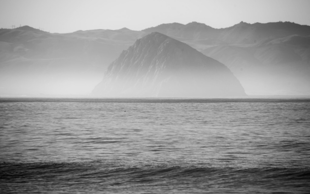
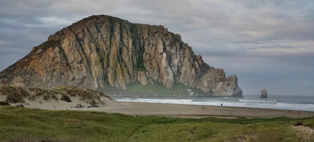
Of course this would not be complete if I didn’t have a photo of Morro Rock.
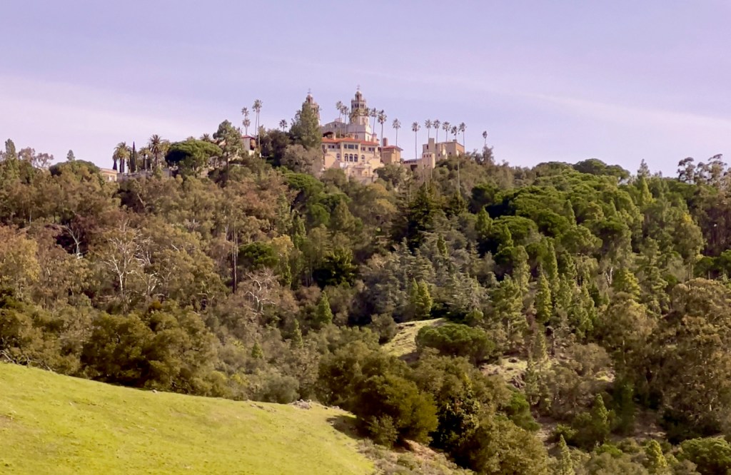
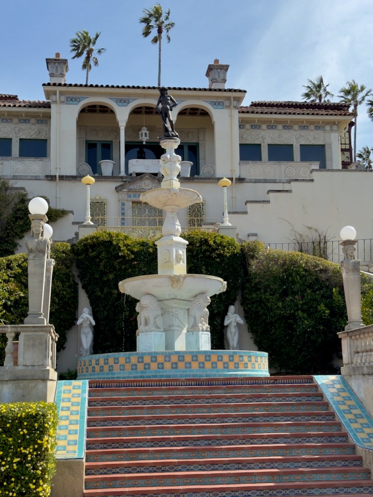
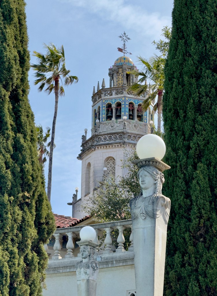
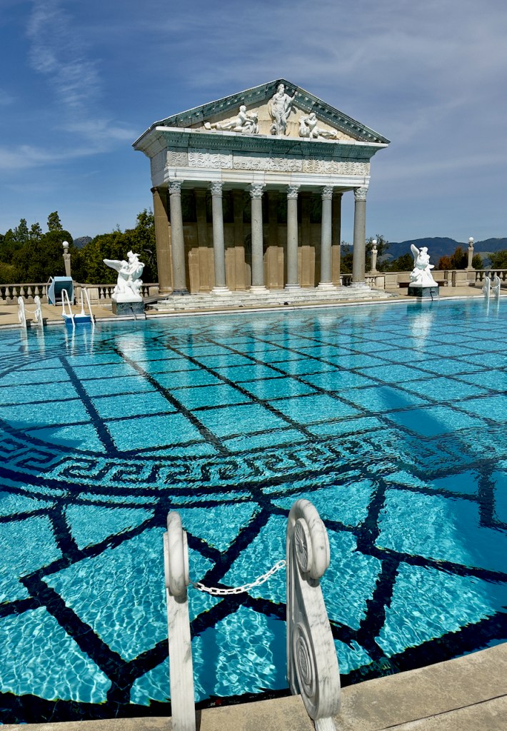
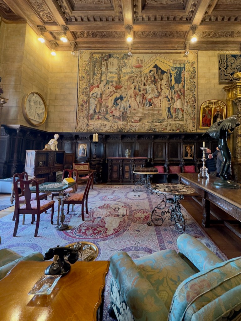
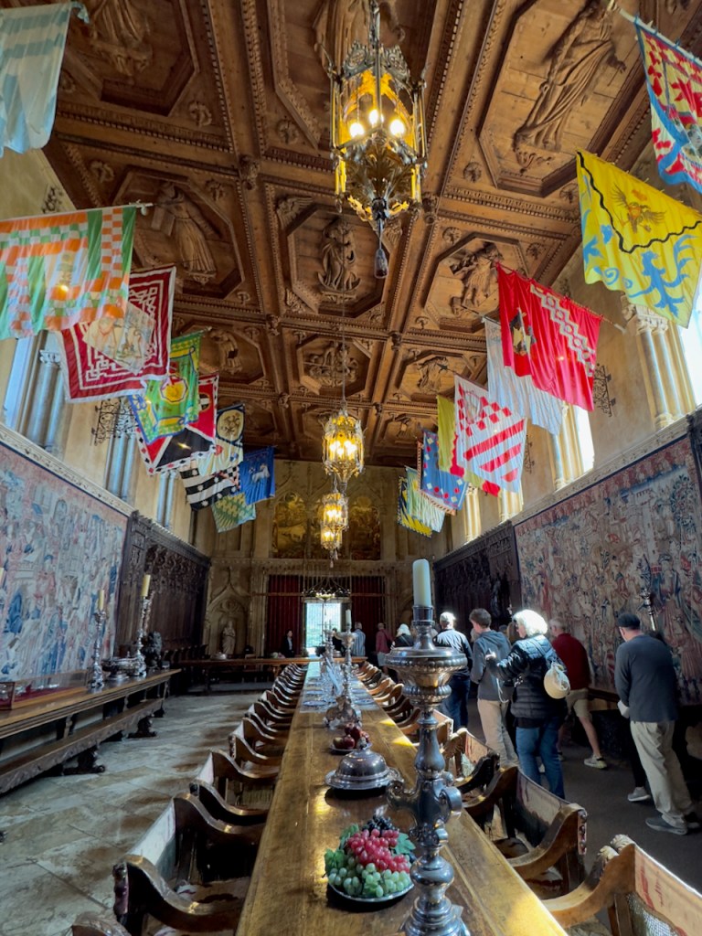
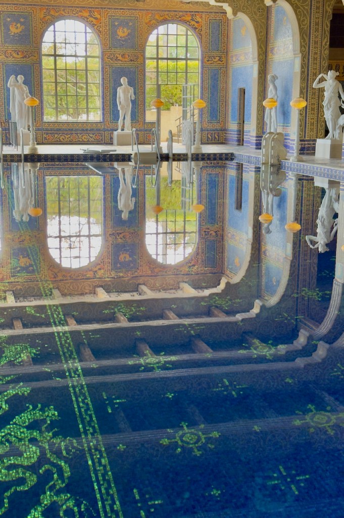
The Hearst Castle was built by William Randolph Hearst, the publishing tycoon and his architect, Julia Morgan between 1919 and 1947. There is a very long article in Wikipedia giving the history of the castle. The castle is on a very high hill overlooking the Pacific Ocean on a 64 square mile estate. Today it is accessed by a fleet of buses which take you up the winding road from the visitor center. The castle has many Greek and European influences in the construction of the buildings and also the furnishings in the rooms. It was a very famous destination for the rich, famous, and Hollywood stars in the 30s, 40s, and 50s. It had a large outdoor heated pool and also a heated indoor pool. A highlight for the guests was cocktail hour and then a communal dinner with seating arrangements changed every night.
After the tour, I continued north to Ragged Point where there are hotel accommodations and a very fine restaurant.
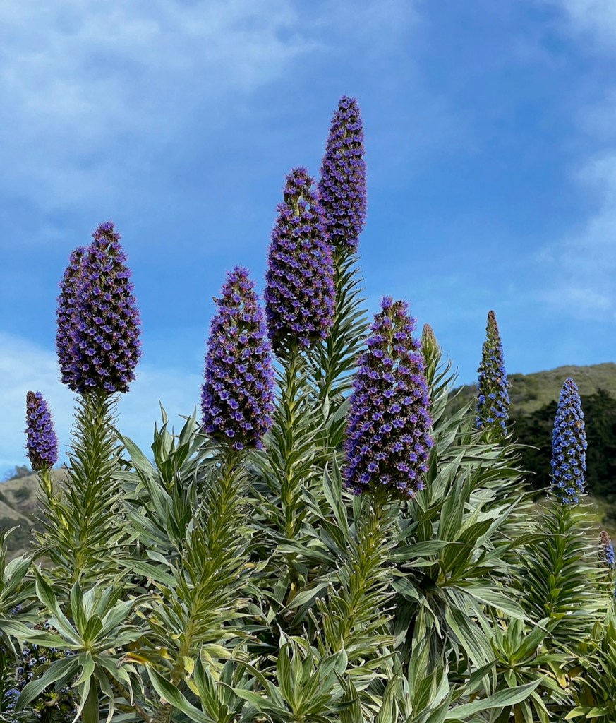
Above flower is called the Pride of Madeira.
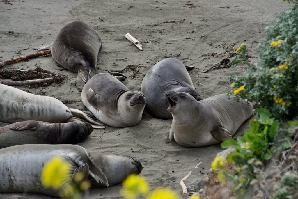
On the way back south to Morro Bay, I stopped to see the sea lions all asleep on the beach.
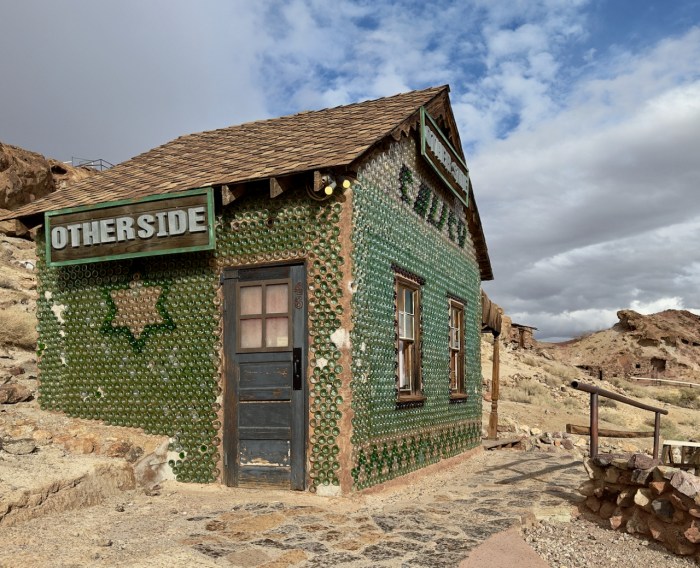
On the way home I over nighted in Barstow, CA. Nearby is the Calico ghost town famous for silver and borax mining with many original buildings. The bottle house caught my eye.
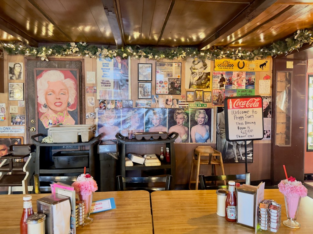
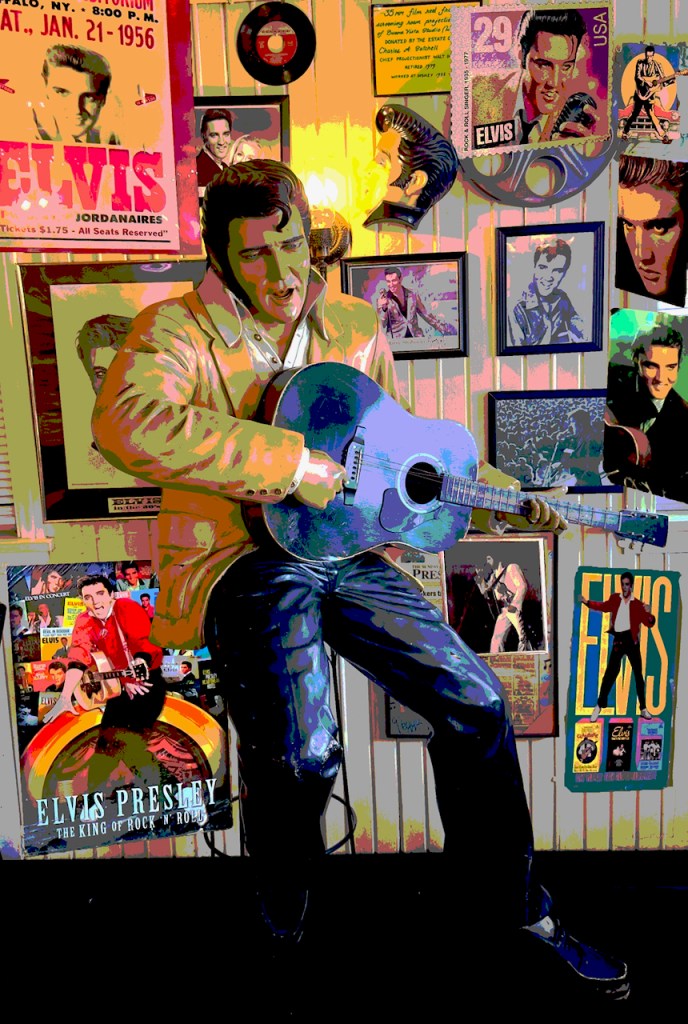
Finally I had dinner at Peggy Sue’s, a 1950s diner with all the photos and even a statue of Elvis Presley in the restaurant and memorabilia in an adjoining shop. If you are ever in the area it is worth a lunch or dinner stop right off I-15 about five miles east of Barstow. Marilyn Monroe is featured along with Elvis. The photo is a creative collage I will use in camera club competition.


Nice, Charles. Those should get you atleast a few winners at PCC!
Did you send this to Barbara?
Thx,
Gary
Thx,
Gary Vargo
gsvargo@hotmail.com
814-434-9331
All spectacular, but 4 favorites – 1.SB mission with fountain. 2. second grinding stone shot, 3. always a fan of Frank Lloyd Wright architecture, 4. Hearst castle pool with reflection.
Oh WOW Charlie! These pictures are fantastic! I LOVE all of them! You saw quite a lot! Loved the surfers, the pelicans, the sea lions, the Elvis and Marilyn Monroe pictures! And the Hearst Castle! WOW!!! And all the scenic pictures! Thank you for sharing! Hope to talk to you soon!
Deb
>