The photos will look much better on a computer so I encourage you to go to the blog web site by clicking the blue section at the top of the email.
Spring in Death Valley with flowers Archive Death Valley March 2016.
March 16, 2024
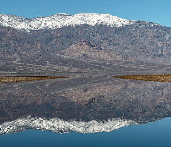
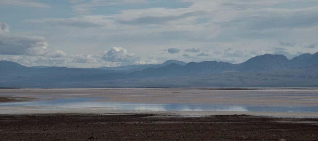
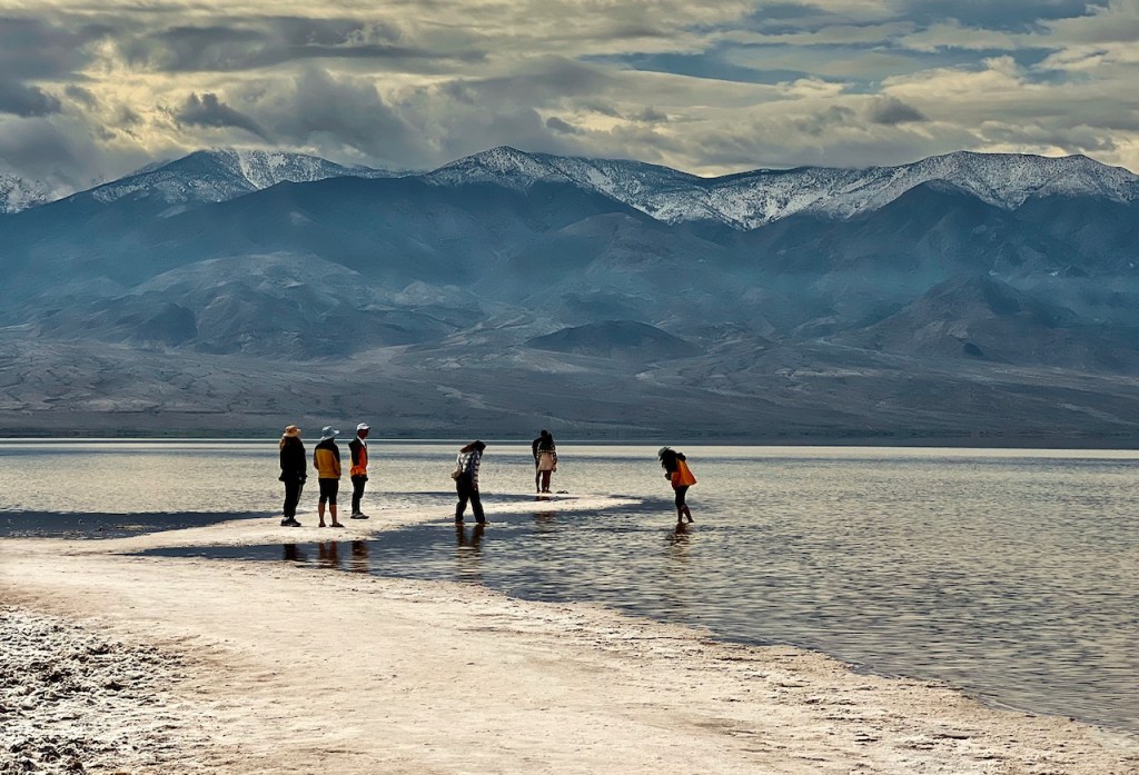
From news reports, I learned that the usual salt flats in Death Valley were covered by water in the form of “Lake Manly”, a lake 6 miles by 3 miles by 1-2 feet deep at 288 feet below sea level. This happened because of a large amount of rainfall (2.2 inches on August 20, 2023) from Hurricane Hilary remnants coming up from Mexico. A second large rainfall of 1.5 inches occurred on February 20 to add to that initial water. The lakes that form after rainfall usually do not last long as the water quickly evaporates leaving the salt behind. After the August deluge many of the roads were washed out and led to partial closure of the National Park. After the February rainfall many people flocked to Badwater in Death Valley and were able to kayak in the lake.. This was discontinued on by the end of February due to damage from walking far into the lake to launch the kayaks. The first image is what I was hoping for but the slight wind created ripples in the lake for me, so this is NOT my image. Credit below.

Photos in order: July 5, 2023, August 30, 2023. and February 14, 2024.
The above two images are from the Earth Observatory is part of the EOS Project Science Office at NASA Goddard Space Flight
The day started with rain in the nearby RV Park where we were staying but there was promise of sunshine latter in the day. So many photos actually are pretty good with the low cloud cover in the morning.
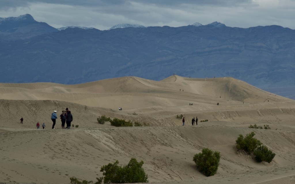
Death Valley has quite a few notable features other than the usual salt flats at Badwater at 280 feet below sea level. There are several areas with sand dunes and of course the surrounding mountains which rise 8000 feet or more. The first sand dunes are at Stove Pipe Wells which is very accessible and hence the dunes attract large numbers of people and leave footprints all over the place. I sought out a few smaller dunes off to the side for some of my photos.


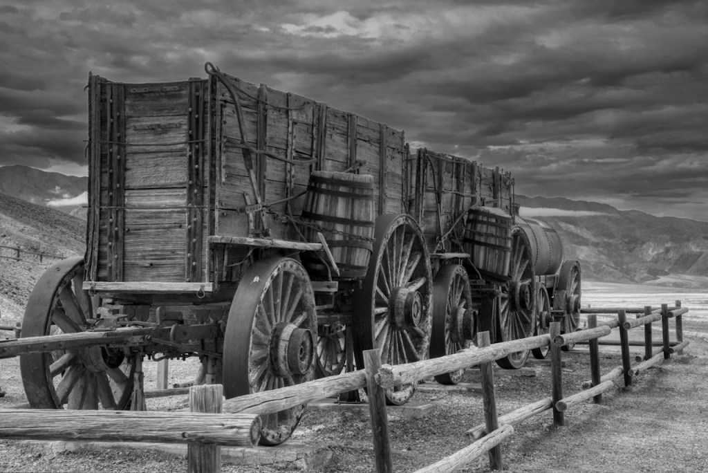
Another stopping point is the 20 Mule Team Borax works. This site has been preserved and features the incredible story of the production of borax and the 20 mule teams hauling the borax. The Harmony Borax Works was started in 1883 and went out of business by 1889. The mules hauled up to 36 tons of borax and a water wagon with 1,200 gallons for 10 days, across a distance of 165 miles of forbidding desert and mountain terrain to a rail road in Mojave, CA. I will let the National Park information boards tell the story. In the beginning borax was used in soap/detergent products, and was also used in various medicinal products.
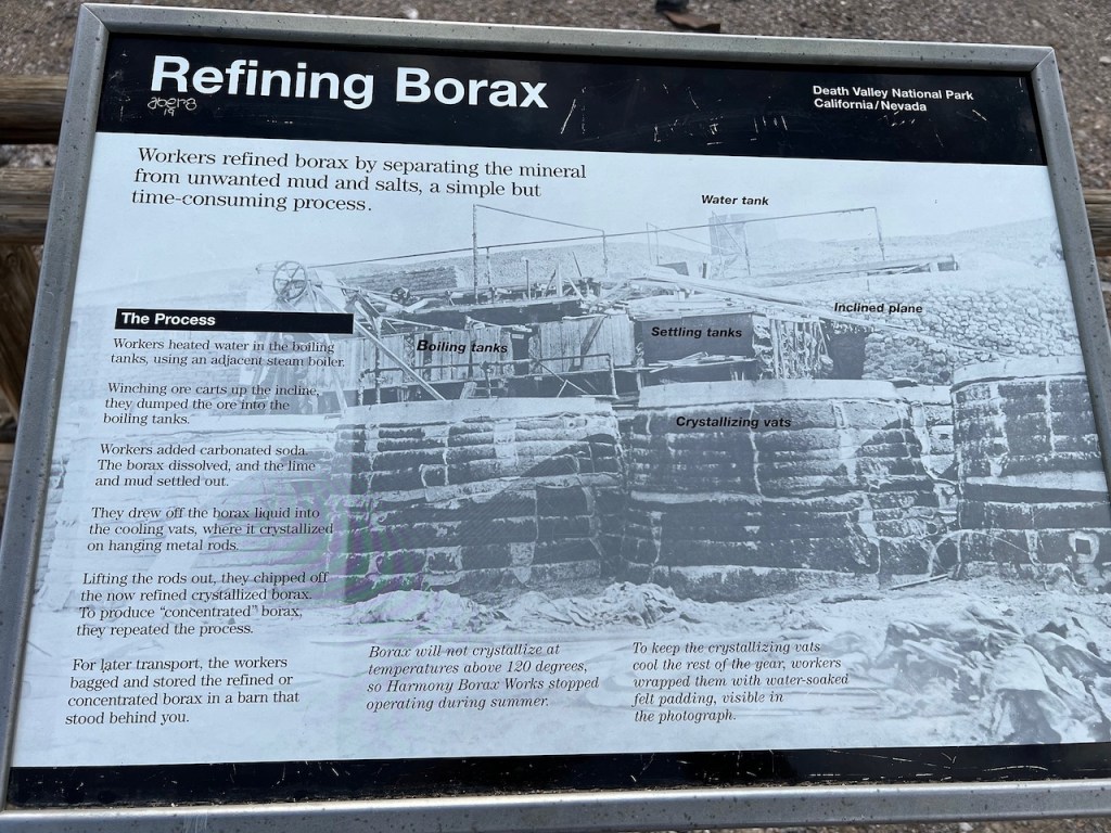
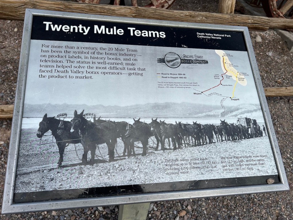
The site is on the National Register of Historic Places. The 20 Mule Team is an iconic famous trademark and company, made famous as a sponsor of a Radio show (started in 1930). The TV series called “Death Valley Days” started in 1952-1970 with the most famous host and actor as Ronald Reagan (1964-1966).

Currently there is still a 20 Mule Team Borax Company. They have a very large open pit mine near Boron, CA. They currently mine one third of the world supply of boron and borax products.
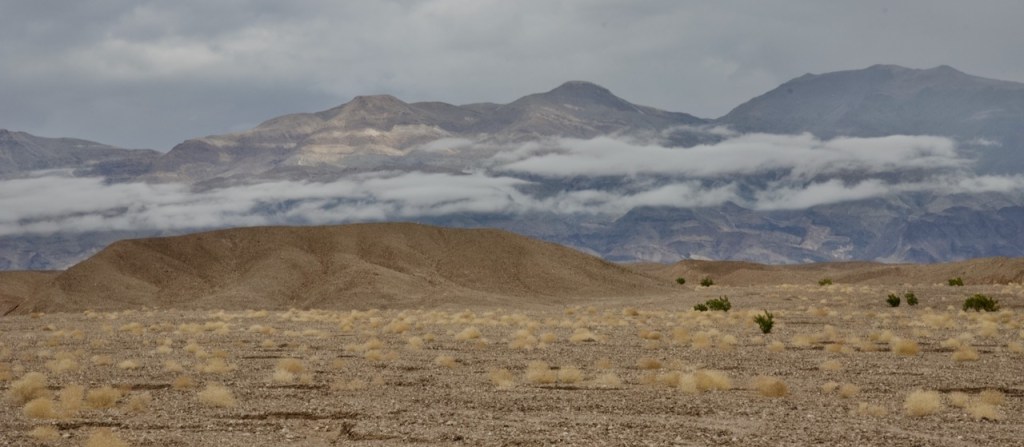
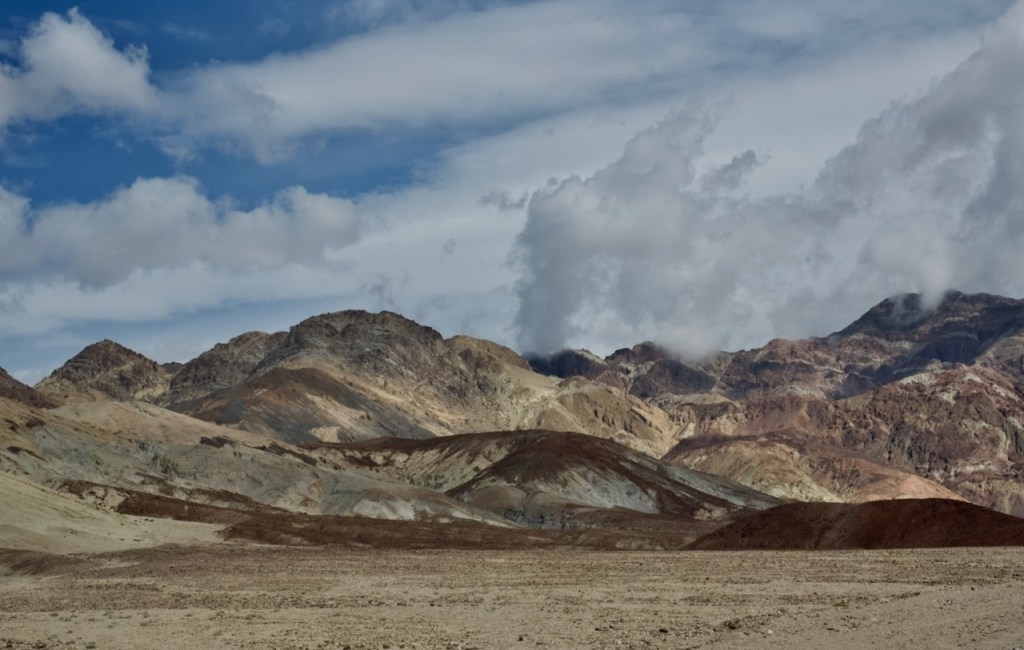
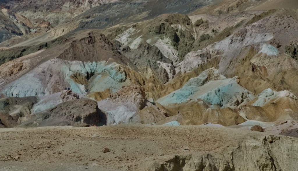
When you start driving in Death Valley, it is not immediately apparent how large it is in terms of miles. We only did a fraction of the places as many require 4 Wheel drive which I did many years ago. We were Able to do the Artist Point Drive, where I found many examples of colored minerals in the rocks. In looking to the east as the sunshine and the clouds produce great photos.


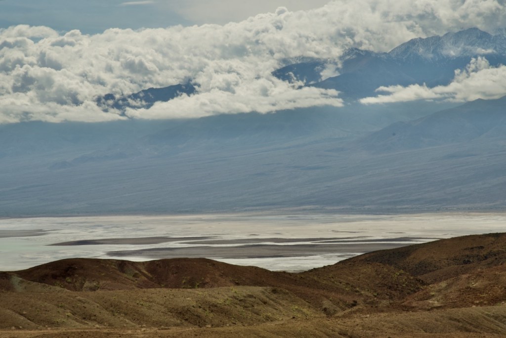
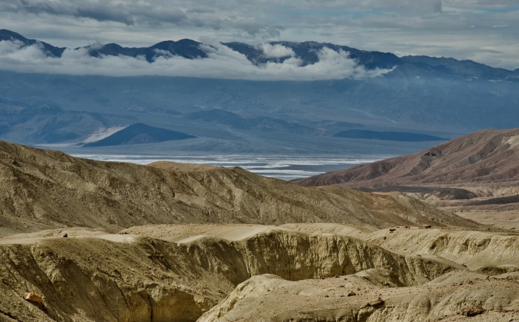
In the above photos, you begin to get glimpses of the salt flats and lake. I like the low clouds on the mountains to the west. Finally we are approaching the place called Badwater as this is the closest point to the main salt flats and at this time to the lake.
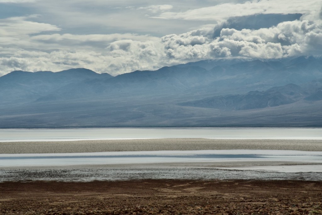

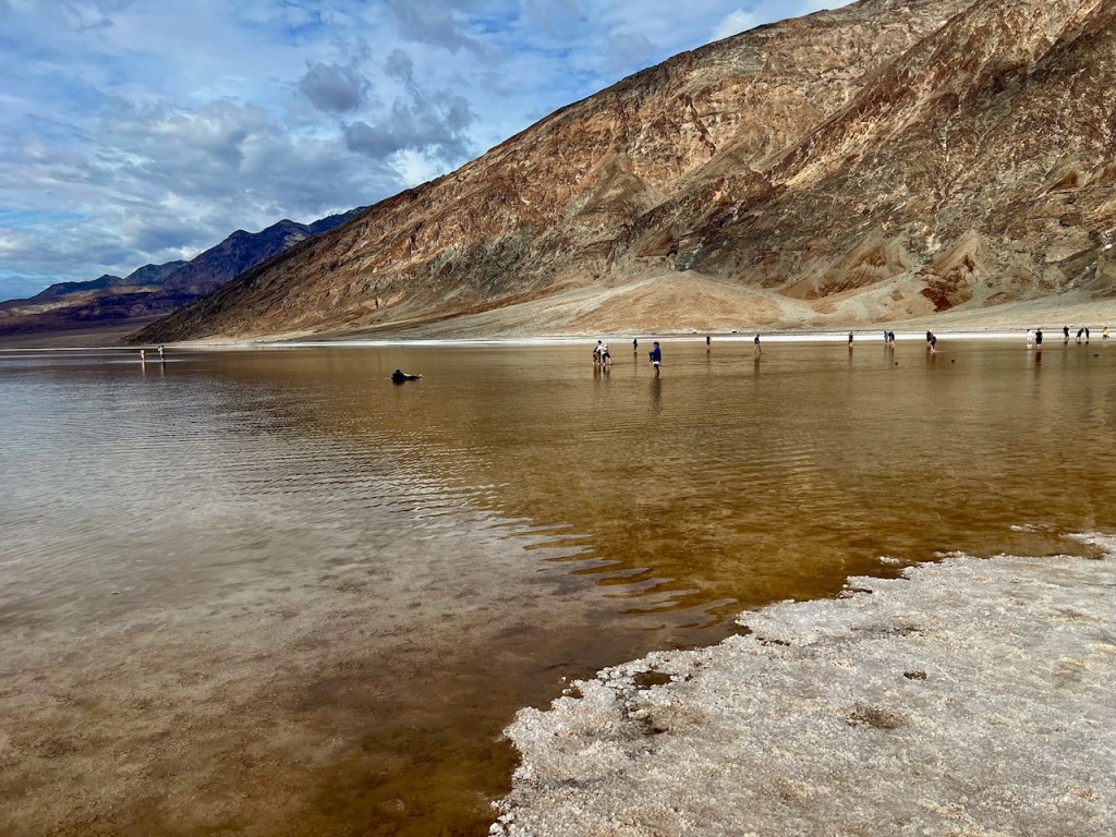
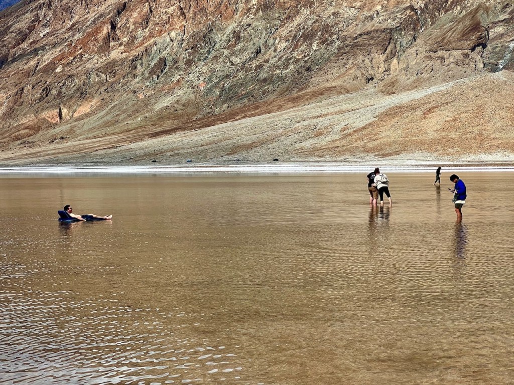
At Badwater the parking lot was full so I went up the road a little further to park on the shoulder. There were lots of people walking in the water. Even a guy in some type of low profile floater (second photo).

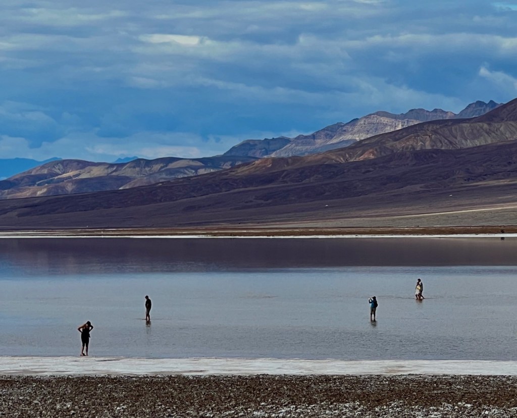


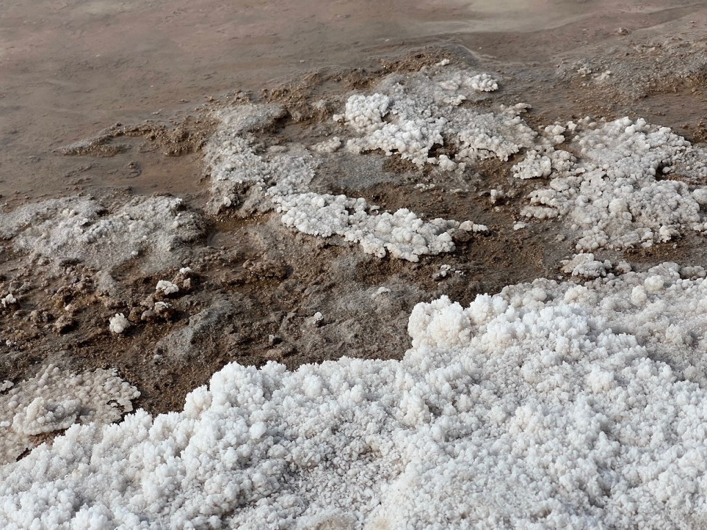
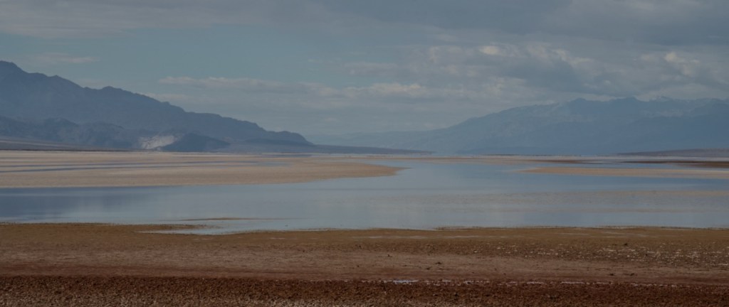
The next few photos are from when we were driving south away from Badwater. The above photo shows how the salt crystalizes upon evaporation.
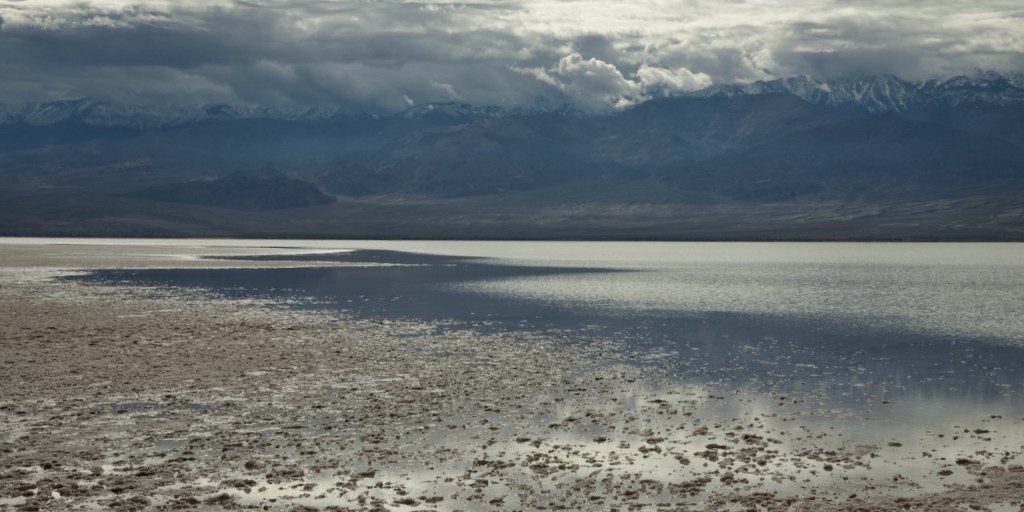
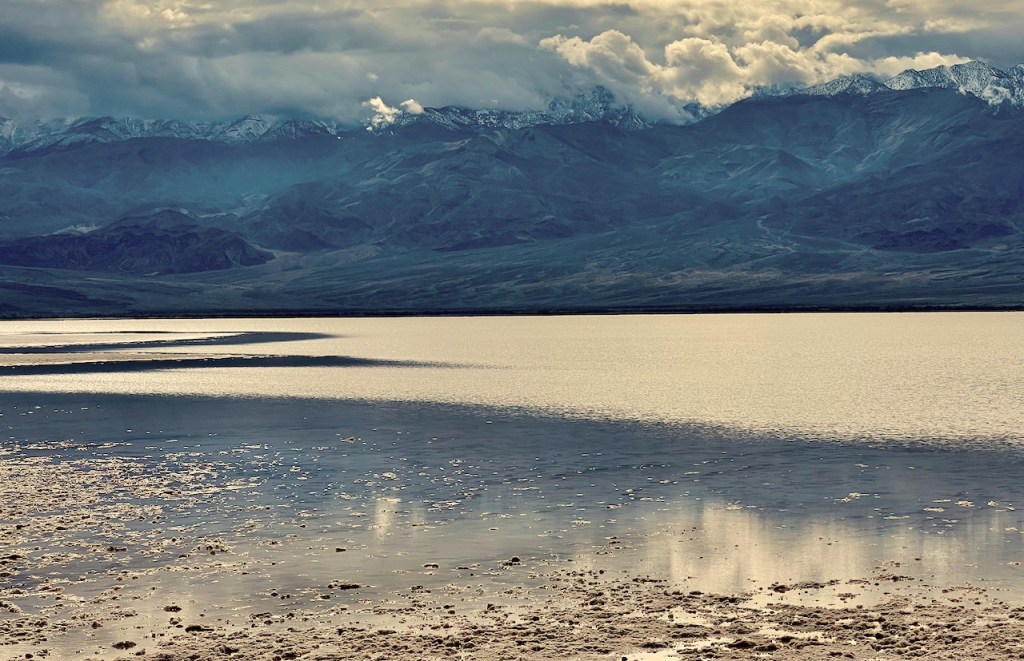
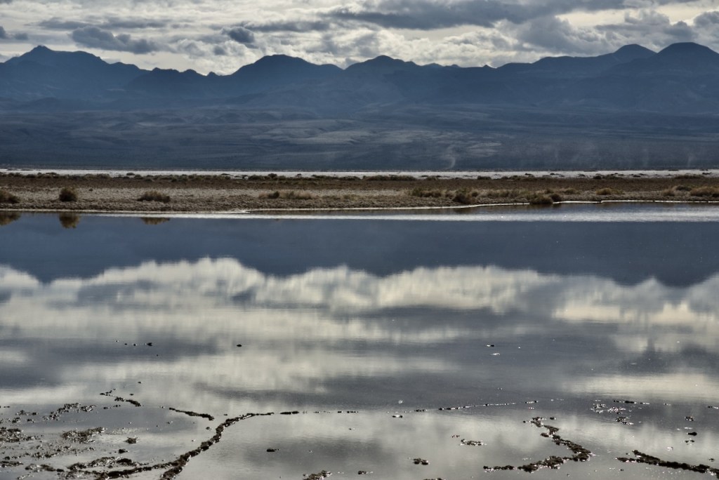
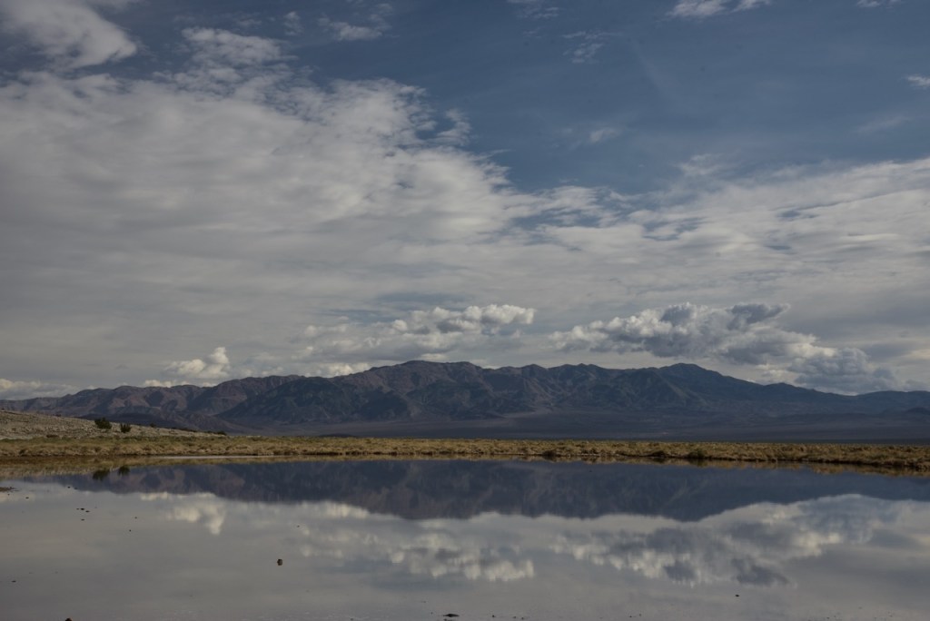
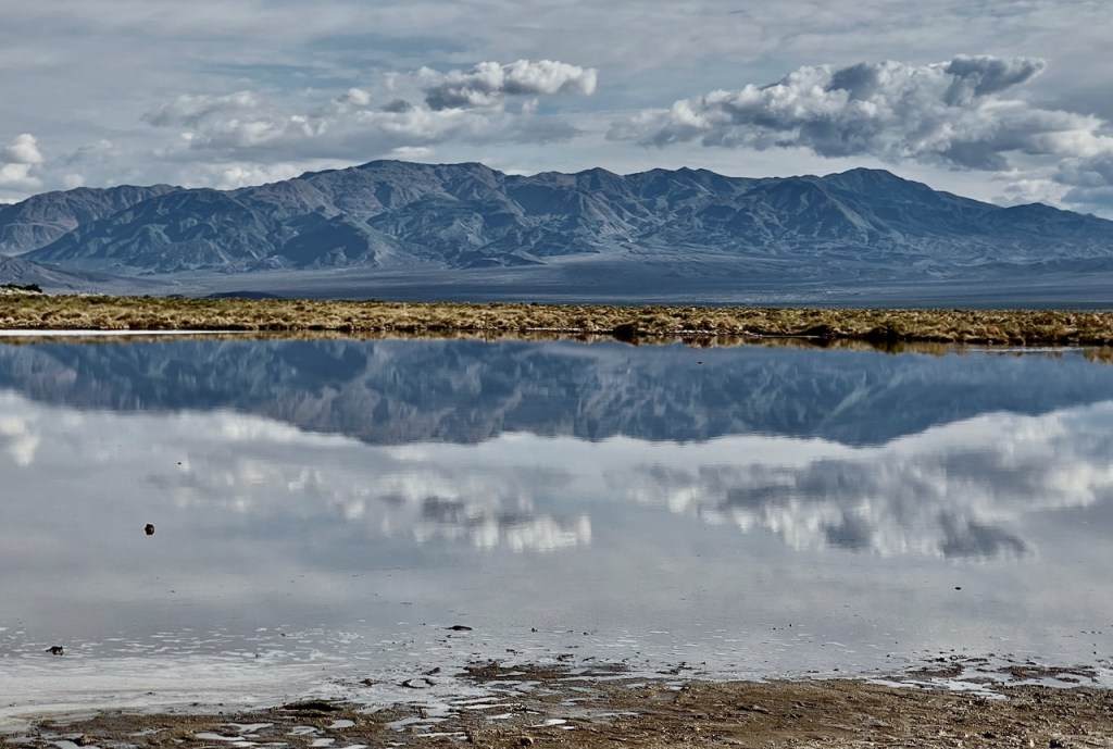
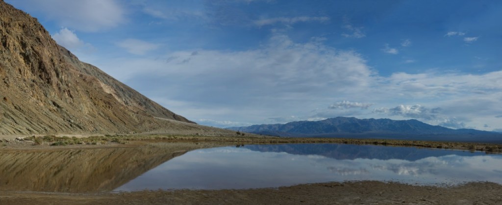
At the final stopping point, I found a smaller pond with the reflections that I was looking for. What a find!
The difference in the colors are from using my Nikon and the iPhone which gives different results.

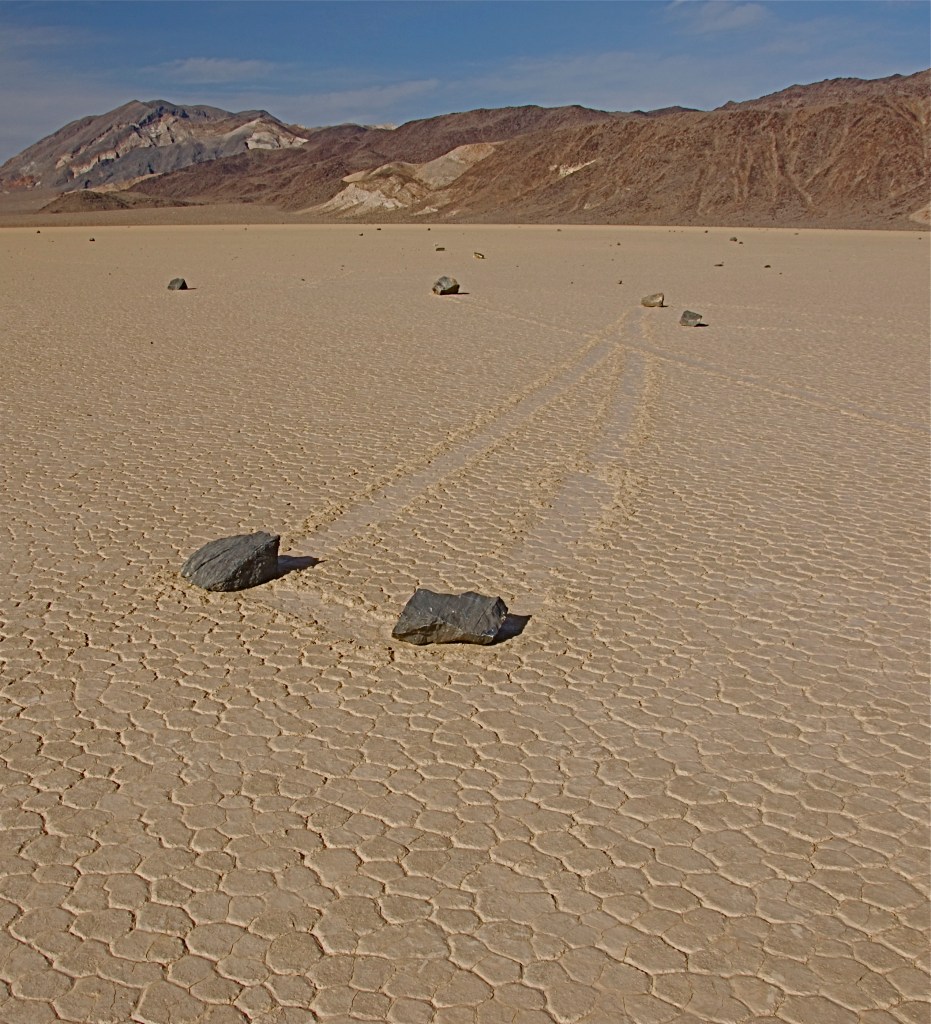
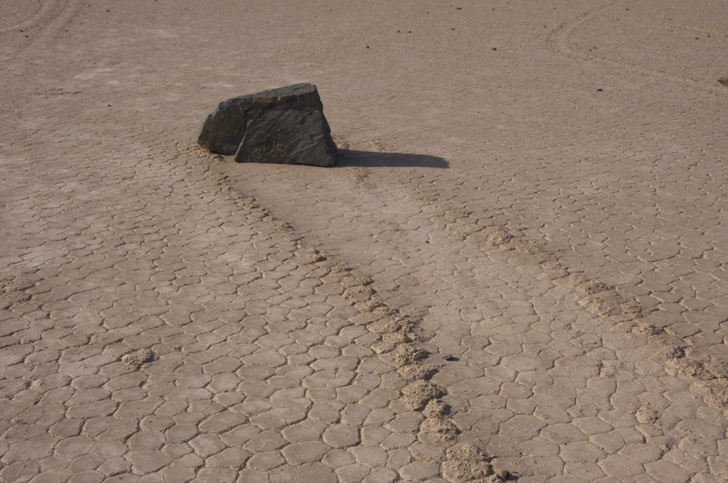
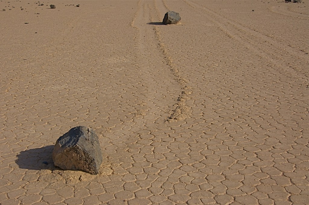
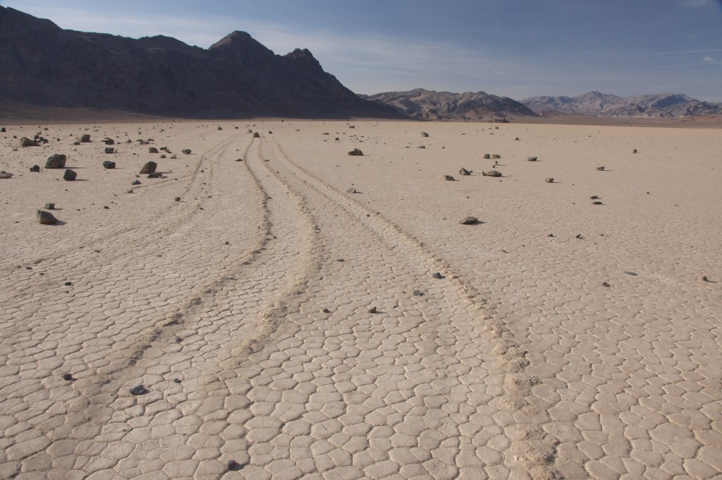
The following photos are from a trip in March 2012 with a group of guys in a 4W Drive vehicle. We went to a place called “Racetrack Playa”. “Its strangest feature of all is the mysterious Racetrack Playa. Here, rocks drift across the flat desert landscape, seemingly propelled by no power other than their own! In 2014, scientists were able to capture the movement of the stones for the first time using time-lapse photography. The sailing stones are the result of a perfect balance of ice, water, and wind. In the winter of 2014, rain formed a small pond that froze overnight and thawed the next day, creating a vast sheet of ice that was reduced by midday to only a few millimeters thick.” National Park.


Nice, different shots Charles! I can’t believe there is that much water there! I love the clouds. I’m at World Wildlife Zoo again today getting animals in different weather conditions!
Gary
Thx,
Gary Vargo gsvargo@hotmail.com 814-434-9331 ________________________________
That was my comment (Dr Click). Dawn Stump. Great photos. We hope you are both doing okay.❤️❤️
Did Joanne go with you? Thank you Dolores